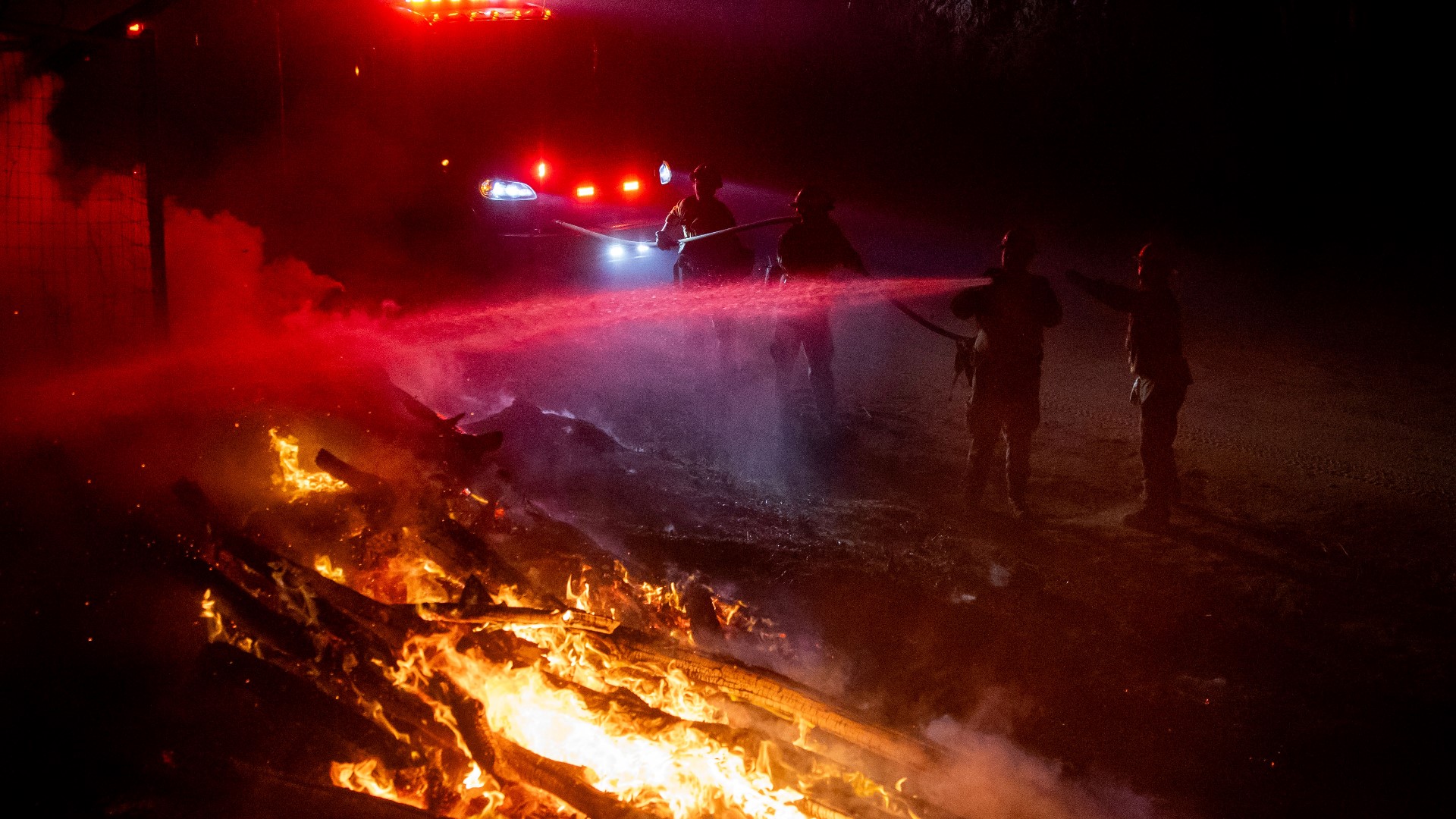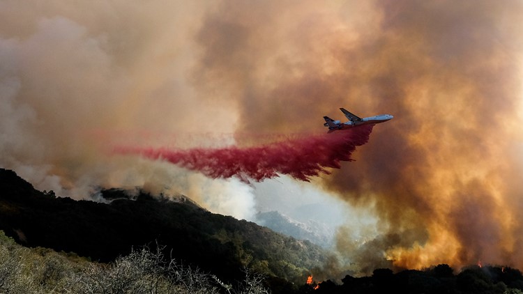
SANTA BARBARA, Calif. — Shifting winds posed new challenges for firefighters battling a blaze in Southern California coastal mountains.
The Alisal Fire is covering more than 24 square miles in the Santa Ynez Mountains west of Santa Barbara. Containment remains at just 5% as the fire threatens ranches and rural homes while a major highway will stay shut down for days.
The cause of the fire is still under investigation, according to Mike Eliason, the public information officer for Santa Baraba County Fire. The properties being protected include Rancho del Cielo, which was once owned by Ronald and Nancy Reagan and was known as the Western White House during his presidency.
An official says U.S. 101 could remain shut until the weekend.
The fire is located near Refugio Canyon along the Gaviota Coast, along the coast in Santa Barbara County since it broke out on Monday, Oct. 11.
A video update from the U.S. Forest Service is available below.
► GET THE LATEST NEWS: Get news updates in your email with the Daily Blend newsletter. Sign up at www.abc10.com/email
Key Figures
- Acres burned: 16,801
- Containment: 5%
- Structures threatened: 100-120
- 1,306 personnel
Evacuations and Road Closures
Click HERE for in-depth evacuation orders and warnings in Santa Barbara County.
Highway 101 is closed at Las Cruces and Winchester Canyon/Cathedral Oaks Road in Goleta. Pacific Railroad and Amtrak lines are closed from Gaviota to Goleta. For current state highway/route information visit roads.dot.ca.gov.
Accounts to follow
Evacuation Maps
A map of evacuations from the Santa Barbara Office of Emergency Management is available below.
Wildfire map
Click here for a map of the Alisal Fire.
Wildfire Preps
If you live in a wildfire-prone zone, Cal Fire suggests creating a defensible space around your home. Defensible space is an area around a building in which vegetation and other debris are completely cleared. At least 100 feet is recommended.
The Department of Homeland Security suggests assembling an emergency kit that has important documents, N95 respirator masks, supplies to grab with you if you’re forced to leave at a moment’s notice. The agency also suggests signing up for local warning system notifications and know your community’s evacuation plans best to prepare yourself and your family in cases of wildfires.
Some counties use Nixle alerts to update residents on severe weather, wildfires, and other news. To sign up, visit www.nixle.com or text your zip code to 888777 to start receiving alerts.
PG&E customers can also subscribe to alerts via text, email, or phone call. If you're a PG&E customer, visit the Profile & Alerts section of your account to register.
ABC10: Watch, Download, Read


WATCH MORE:
Scorched Earth | Drought and water conservation, what can you do to help right now?