
PLACER COUNTY, Calif. — Find the latest updates on the Mosquito Fire HERE.
Fire crews are expecting some welcome relief from the dry, hot and windy weather while battling the Mosquito Fire. Beginning Saturday, cooler temperatures, higher humidity, rain and more wind are forecast by the National Weather Service.
Cal Fire says firefighters will strengthen and secure all control lines in preparation for these changing conditions.
The wildfire is burning in both El Dorado and Placer counties and has grown to nearly 68,000 acres in 9 days, officials said Thursday night. Containment of the blaze is still at 20%.
Critically dry fuels continue to fuel the Mosquito Fire’s steady growth to the east, according to Cal Fire.
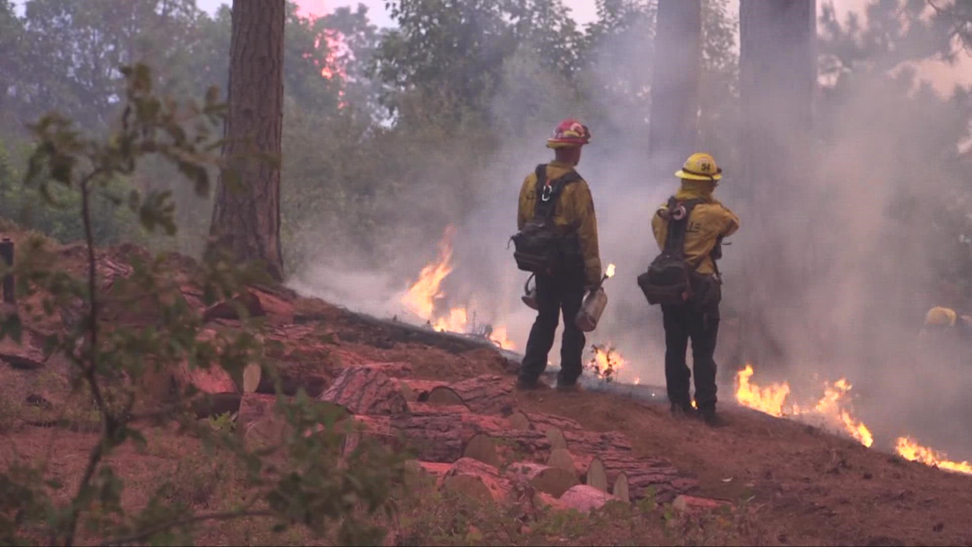
Ground crews are focused on securing the west corner of the fire below the communities of Todd Valley and Foresthill, while aerial units assist in strategic burns. In order to keep the fire south of Westville crews spent time securing the control lines along the Foresthill Divide and Deadwood roads.
No new evacuation warnings or orders have been issued.
► Scroll down for evacuation maps and other fire resources.
PHOTOS: Scenes from the Mosquito Fire
RELATED: Pyrocumulus: What is it and how does it form?
RELATED: How to check the air quality where you live
The Mosquito Fire’s cause is under investigation. Pacific Gas & Electric said unspecified “electrical activity” occurred close in time to the report of the fire on Tuesday.
Stay Informed
Live Evacuation Maps
Placer County Sheriff's Office evacuation map (You need to click the "I Understand" box to use the map):
El Dorado County Sheriff's Office evacuation map (You need to click the "I Understand" box to use the map):
STAY INFORMED WITH ABC10:
► ABC10 In Your Inbox: Sign up now for our daily newsletter for local headlines, weather, tips and even something to make you smile.
► ABC10 On Demand: Get access to our local news, live programming and weather with the free ABC10 app for Roku and Amazon Fire TV.
Evacuation Centers
Evacuation centers:
- Rocklin: Sierra College at 5100 Sierra College Blvd
- Cameron Park: Cameron Park Services District at 2502 Country Club Drive
- Overnight shelter, meals, showers, limited health services, and parking for trailers will be provided. Animals in crates and carriers will be accepted.
- Placerville: Green Valley Community Church at 3500 Missouri Flat Rd.
- No Large animals or no birds. Limited RV parking and no hookups
For large and small animals:
- Nevada County Fairgrounds on 11228 McCourtney Road, in Grass Valley Check-in at Gate 8
- Placer County Animal Services Center at 11232 B Avenue in Auburn
- No birds/chickens due to avian flu
- Gold Country Fairgrounds, 209 Fairgate Road, Auburn, California is opening on September 14
Fire Map
This map from the National Interagency Fire Center shows fire activity (this may take a few seconds to load):
Road Closures
For a Waze map with current road closures, click here.
Watch more on ABC10


