
PLUMAS COUNTY, Calif. — Thick smoke that held down winds and temperatures began to clear Sunday from the scenic forestlands of Northern California as firefighters battling the largest single wildfire in state history braced for a return of fire-friendly weather.
The winds weren’t expected to reach the ferocious speeds that helped the Dixie Fire explode in size last week. But they were nonetheless concerning for firefighters working in unprecedented conditions to protect thousands of threatened homes and buildings. The clear marked a return of firefighting-friendly weather and allowed helicopters and air tankers that had been grounded to rejoin the fight against the massive Dixie Fire.
Many families are staying in tents and trailers at Lassen Community College in Susanville, an evacuation site for people from Greenville and surrounding communities. Lisa Phillips is a former firefighter who lives in Chester. She was issued a mandatory evacuation order and has been there a week with their dogs and birds. She says thankfully, her house is still intact.
“It's hard having a beautiful home and bed to sleep in and being told you have to leave and then finding yourself like this," Phillips said. "I’m single and that's very terrifying for me. I’m thankful I have my home and I’m alive. I’m hoping my business will survive. I’m definitely looking forward to being back home, back to the norm."
Plumas County Sheriff Todd Johns said all the reports for missing people were cleared, noting that 31 people had been safely located. A portion of Highway 70 was also reopened, but Sheriff Johns asked that the thoroughfare be used for essential travel only due to firefighter work and potential danger on the roadway.
"We felt that it was critically important to the county to get that thoroughfare open," Johns said.
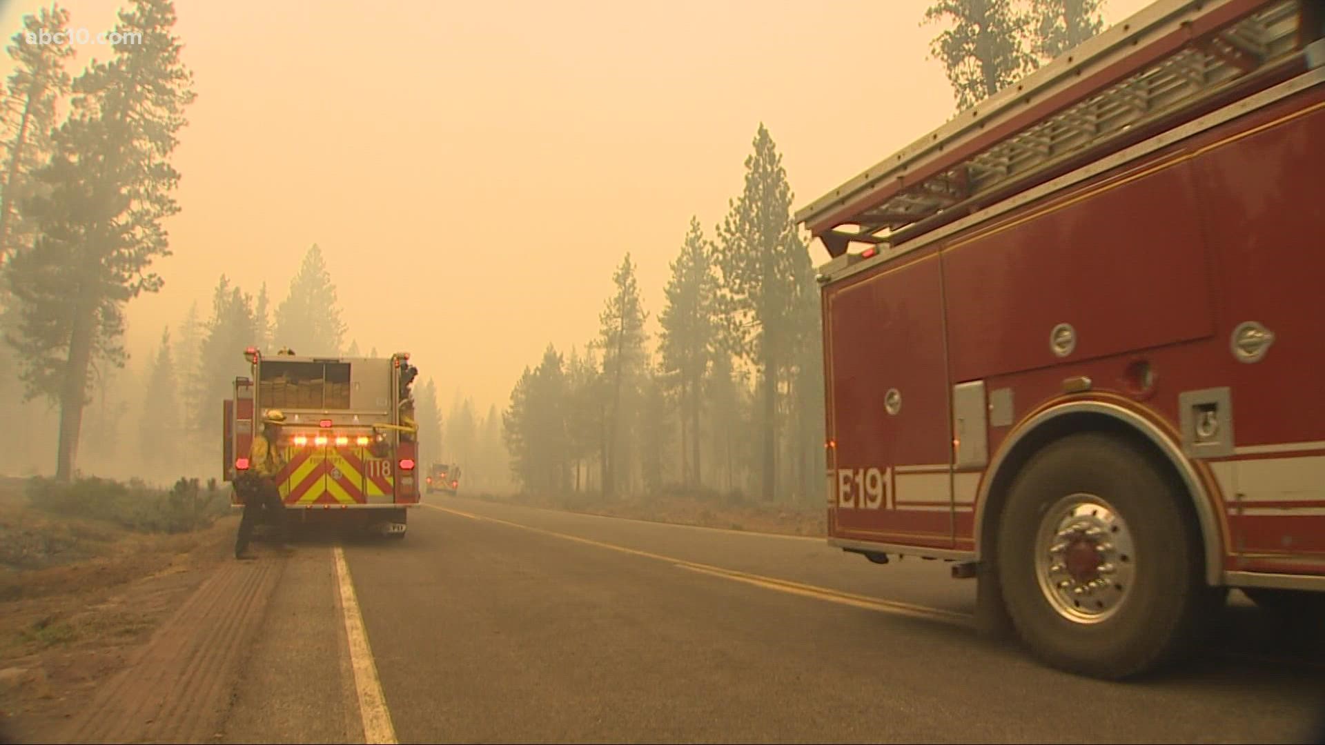
Diamond Mountain Road continues to see work from fire crews as they try to hold the area from the fire, according to Operations Section Chief Kyle Jacobson. In the Lone Rock area, the fire progressed into the Bear Valley area, but crews have been able to get around the fire's edge on the north side to the east. Due to better conditions, Jacobson said crews were able to make use of helicopters as they fought the fire.
"All in all, it's been productive these last few days. It's still a very difficult firefight. The weather, the fuels conditions can create extreme fire behavior but they're in there doing everything they can," Jacobson said.
Hot and dry conditions are expected later this week and will create potential for more active and extreme fire behavior.
The Dixie Fire, burning in Butte, Plumas, Lassen, and Tehama counties, has grown to 482,047 by Monday night and was just 22% contained. The Dixie Fire surpassed the Mendocino Complex, which burned 446,723 acres in 2018. The August Complex remains the largest wildfire in California history, which burned 1,032,648 acres.
Over 400 structures have been destroyed, with an additional 16,000 still threatened. Three firefighters have been injured.
For this weekend's updates, click HERE.
Accounts to follow:
Evacuations and road closures
Click HERE for in-depth evacuation orders and warnings in Plumas, Butte, Tehama, and Lassen Counties. For current state highway/route information visit roads.dot.ca.gov.
Evacuation centers
- Spring of Hope Church, 59 Belle Lane Quincy, CA 95971
- run by the American Red Cross California Gold Country Region
- Plumas County Animal Services, 201 N Mill Creek Rd Quincy, CA 95971
- Veterans Memorial Hall at 180 Gay St. in Chester, CA
- Lassen Community College at 478-200 CA-139 Susanville
- Plumas County Fairgrounds 204 Fairground Road, Quincy (large animals)
- Recreation Center 101 Meadowview Lane, Chester
- Tehama County Complex 1830 Walnut Street, Red Bluff (large and small animals)
Dixie Fire Structure Status Map
A live map showing which structures have been destroyed or at risk is available below.
Butte County Evacuation Map
A live evacuation map from Butte County is available below.
Wildfire Map
An updated map of the acreage of the Dixie Fire
WILDFIRE PREPS
According to Cal Fire, 2020 was one of the most severe fire seasons on record as 9,917 wildfires burned 4.2 million acres. Over 9,000 structures were destroyed, and 31 people (civilians and firefighters) were killed.
California also experienced its first "Gigafire" because of the August Complex Fire, burning over 1 million acres by itself. Four of California's top five largest wildfires in state history happened in 2020.
If you live in a wildfire-prone zone, Cal Fire suggests creating a defensible space around your home. Defensible space is an area around a building in which vegetation and other debris are completely cleared. At least 100 feet is recommended.
The Department of Homeland Security suggests assembling an emergency kit that has important documents, N95 respirator masks, supplies to grab with you if you’re forced to leave at a moment’s notice. The agency also suggests signing up for local warning system notifications and know your community’s evacuation plans best to prepare yourself and your family in cases of wildfires.
Some counties use Nixle alerts to update residents on severe weather, wildfires, and other news. To sign up, www.nixle.com or text your zip code to 888777 to start receiving alerts.
PG&E customers can also subscribe to alerts via text, email, or phone call. If you're a PG&E customer, visit the Profile & Alerts section of your account to register.
ABC10: Watch, Download, Read


Watch more from ABC10
VERIFY: Does the US Forest Service have a 'let it burn' policy?