
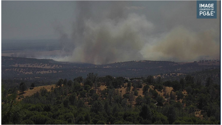
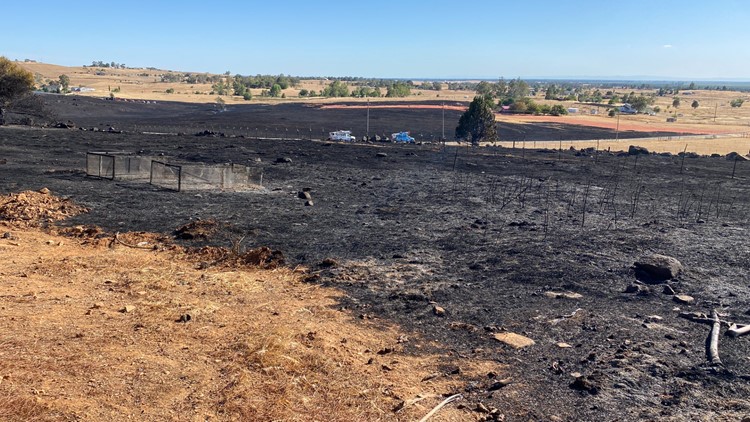
YUBA COUNTY, Calif. — A wildfire near Beale Air Force Base in Yuba County burned at least 900 acres and destroyed at least one home Tuesday afternoon. The so-called Intanko Fire is about 40% contained, according to Cal Fire.
All evacuation warnings have been lifted, according to Yuba County Sheriff's Office, and the partial on-base housing evacuation at Beale Air Force Base has also been lifted. The zone near the ignition point of the fire, Zone YUB-018, will remain under an evacuation advisory due to utility line repair work in the burn zone, officials said.
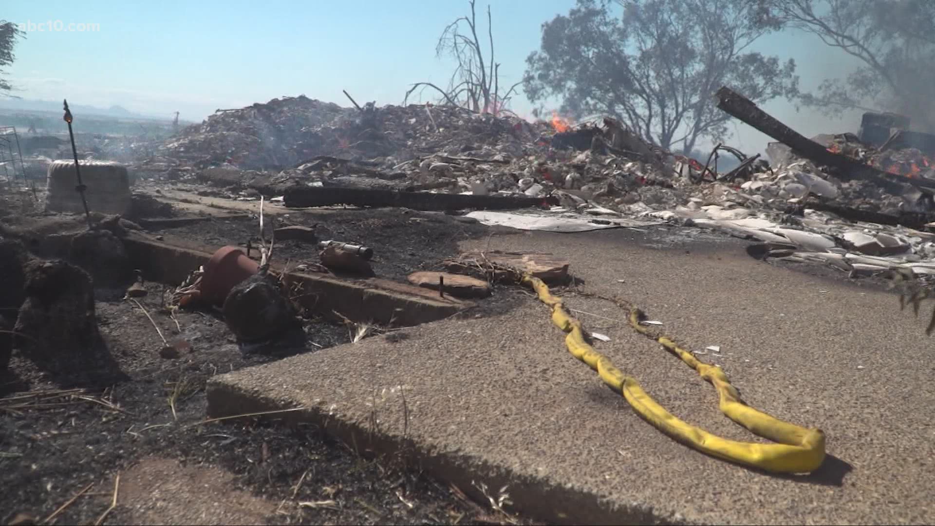
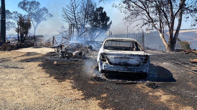
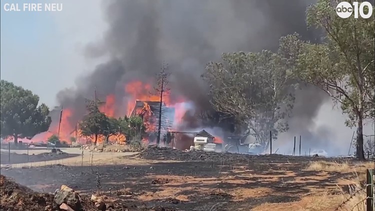
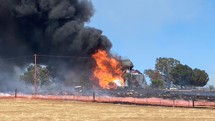
One home on Intanko Lane was destroyed. Resident Sam Houston told ABC10 he burned his arm trying to help.
"We cut double fire lines and still jumped out fire line so whenever you have wind this much there’s nothing you can do," Houston said. "There’s not much more to say other than we are happy to have survived it."
The Latest:
9:50 p.m. update:
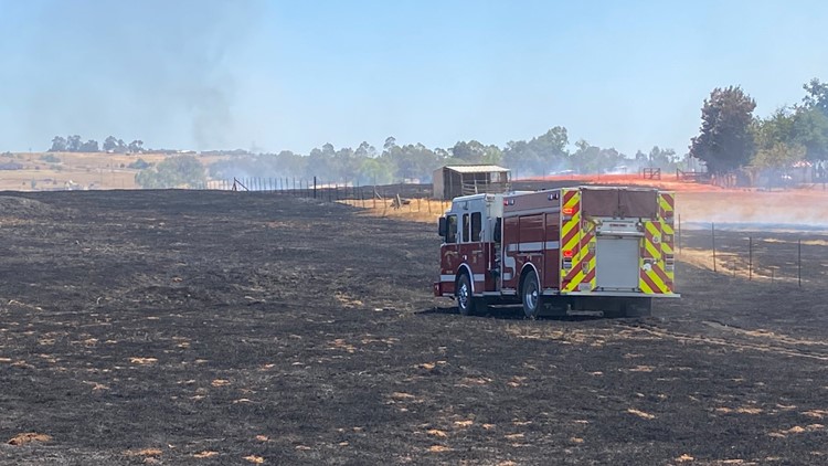
According to the latest update from Cal Fire, the Intanko Fire has burned 900 acres and is 40% contained.
No injuries have been reported and the cause of the wind-driven fire is under investigation, according to Cal Fire.
Crews will be working throughout the night to strengthen containment and continue extinguishing hotspots.
9 p.m.update:
According to the latest update from Cal Fire, the Intanko Fire has burned 950 acres and is 25% contained.
8:20 p.m. update:
An evacuation order for part of the on-base housing at Beale AFB was lifted at 6:30 p.m., allowing people to go back home.
Officials said they based this decision off of the Air Quality Index in affected areas and said it was safe for people to go back home.
There are no structural damages of on-base facilities at this time, Beale AFB said on Facebook. Vassar Lake Gate has also re-opened with its normal hours; Cal Fire said the fire started off base near this area.
Maps:
The fire was first reported near Kapaka and Intanko Lanes.
On the Ground:

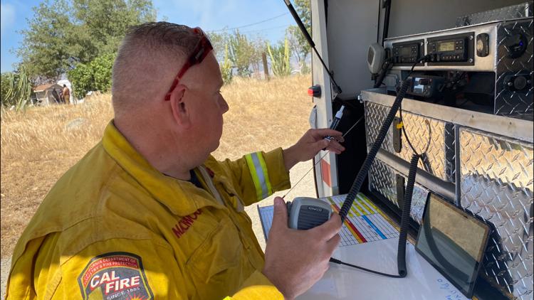
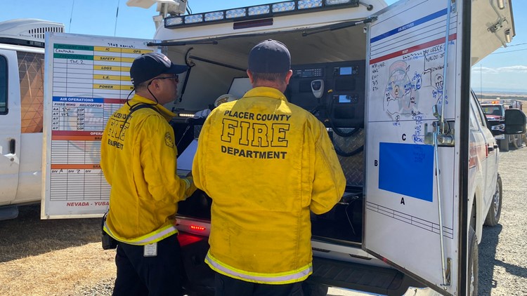
Cal Fire battles Intanko Fire in Yuba County near Beale Air Force Base


Who to Follow
Earlier Updates:
7:05 p.m. update:
All evacuation warnings prompted by the Intanko Fire in Yuba County have been lifted, the sheriff's office said.
The zone near the ignition point of the fire, Zone YUB-018, will remain under an evacuation advisory due to utility line repair work in the burn zone, officials said.
According to the latest update from Cal Fire, the Intanko Fire has burned 950 acres and is 28% contained.
7 p.m. update:
The Intanko Fire burning near Beale Air Force Base began around 2:30 p.m., according to base officials. The fire started off base in the area of the Vassar Lake Gate.
As of 6:30 p.m., base officials said the fire was fully contained. At its height, the Intank Fire caused about 70% of the homes on the base to be evacuated, officials said, impacting about 300 airmen and their families.
Just before 7 p.m., officials said all residents had been advised they could return to their homes.
"If your residence is uninhabitable due to smoke, contact your Squadron Commander by 2200L," officials said in an email to base personnel.
6:15 p.m. update:
Cal Fire is getting a better handle on the Intank Fire burning in Yuba County.
As of 6 p.m., fire officials say they have gained 25% containment on the fire as it has burned more than 850 acres of land. Only one structure has been lost and no injuries have been reported.
According to Cal Fire spokesperson Lin Tolmachoff, forward progress on the fire has been stopped.
“Wind is always a challenge for firefighters when it comes to containment lines, so that’s what their biggest concern is right now,” Tolmachoff said. “Right now they do have some line around the fire, but a good gust of wind could always push it over the line.”
5:20 p.m. update:
The Intanko Fire burning near Beale Air Force Base has prompted three evacuation points at the base, according to the 9th Reconnaissance Wing Commander.
Those sites are the fitness center, the community activity center, and Recce Point.
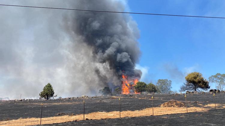
“The fire is currently about 150 yards south of Lone Tree Elementary, shifting winds and hot spots are challenging full containment but our Fire Dawgs are making great progress towards getting under control. Residents in homes not evacuated should remain vigilant, but we do not anticipate any further evacuations,” base officials wrote on Facebook.
The 9th Reconnaissance Wing Commander said a total force telephone recall has been initiated. Airmen are being told to check in with their units.
4:45 p.m. update:
The Intanko Fire has burned more than 400 acres and is 0% contained according to the latest update from Cal Fire. At least one structure has been destroyed.
High winds are driving the fire northward toward Chuck Yeager Road from Intanko Lane near Spencerville Road in Yuba County.
Fire at 400+ acres and zero percent contained. This wind-driven fire is moving north toward Chuck Yeager Road from Intanko Lane near Spenceville Road in Yuba County. CAL FIRE Firefighters on scene of a vegetation fire with at least one structure destroyed.
According to the Feather River Air Quality Management District (AQMD), smoke from the Intanko Fire is impacting some communities to the north of the fire. Those sensitive to wildfire smoke should take precautions. Check AQI conditions here.
4:40 p.m. update:
Officials have upgraded an evacuation advisory to an evacuation warning for the Waldo Junction area (zone YUB-E060), the sheriff’s office said.
Additionally, two new zones have been placed in an evacuation advisory: YUB-E061 and YUB-E045.
The sheriff’s office said they have implemented a “hard road closure” at Chuck Yeager Road and Waldo Road.
The Intanko Fire has burned about 500 acres and is 10% contained, according to the latest update from Cal Fire. At least one structure has been destroyed.
4:30 p.m. update:
Large animals that have been evacuated from the path of the Intanko Fire can be taken to the Yuba County Posse Arena beginning at 4:30 p.m., officials said.
The arena is located at 5396 Marysville Road in Browns Valley – from Highway 20 north on Marysville Road just past a 76 gas station, the Yuba County Sheriff’s Office wrote on Twitter.
Posse/Search & Rescue, and Animal Care Services will be at the arena to assist in getting the animals secured.
4 p.m. update:
Beale Air Force Base residents are getting new evacuation information. The Beale Air Force Base Fire Chief said that all residents of East Garryana must immediately evacuate to the base gym, according to a tweet.
Vassar Lake Gate is closed until further notice, due to the fire.
Original story:
Evacuation warnings are in effect north of Camp Far West Lake Wheatland due to a fast-moving grass fire, according to Yuba County Sheriff.
In a tweet Tuesday, the sheriff said the fire is burning near Intanko Lane, Kapaka Lane and Wichita Way. Deputies are going door-to-door to notify residents that the areas are being evacuated.
More than 300 acres and at least one structure have been destroyed, according to Cal Fire. A second structure has also been damaged.
Click here to check on the status of evacuations for the Intanko Fire in Yuba County.
According to a Beale Air Force Base Facebook post, all residents east of East Garryanna in base housing must immediately evacuate to the elementary school parking lot. Yuba County Sheriff is also closing the Vassar Lake Gate at the Beale Air Force Base due to the fire.
A temporary evacuation center is being set up at the Wheatland Community Center at 101 C Street, according to Yuba County on Twitter.
Nevada County Sheriff's Office said that they are standing by and are "ready to conduct evacuations in Nevada County if it becomes necessary," they said on Facebook. The fire is not in the county
There is no word on how large the fire is or what caused it. No injuries have been reported at this time.
Wildfire Preps
According to Cal Fire, 2020 was one of the most severe fire seasons on record as 9,917 wildfires burned 4.2 million acres. Over 9,000 structures were destroyed, and 31 people (civilians and firefighters) were killed.
California also experienced its first "Gigafire" because of the August Complex Fire, burning over 1 million acres by itself. Four of California's top five largest wildfires in state history happened in 2020.
If you live in a wildfire-prone zone, Cal Fire suggests creating a defensible space around your home. Defensible space is an area around a building in which vegetation and other debris are completely cleared. At least 100 feet is recommended.
The Department of Homeland Security suggests assembling an emergency kit that has important documents, N95 respirator masks, supplies to grab with you if you’re forced to leave at a moment’s notice. The agency also suggests signing up for local warning system notifications and know your community’s evacuation plans best to prepare yourself and your family in cases of wildfires.
Some counties use Nixle alerts to update residents on severe weather, wildfires, and other news. To sign up, visit www.nixle.com or text your zip code to 888777 to start receiving alerts.
PG&E customers can also subscribe to alerts via text, email, or phone call. If you're a PG&E customer, visit the Profile & Alerts section of your account to register.


