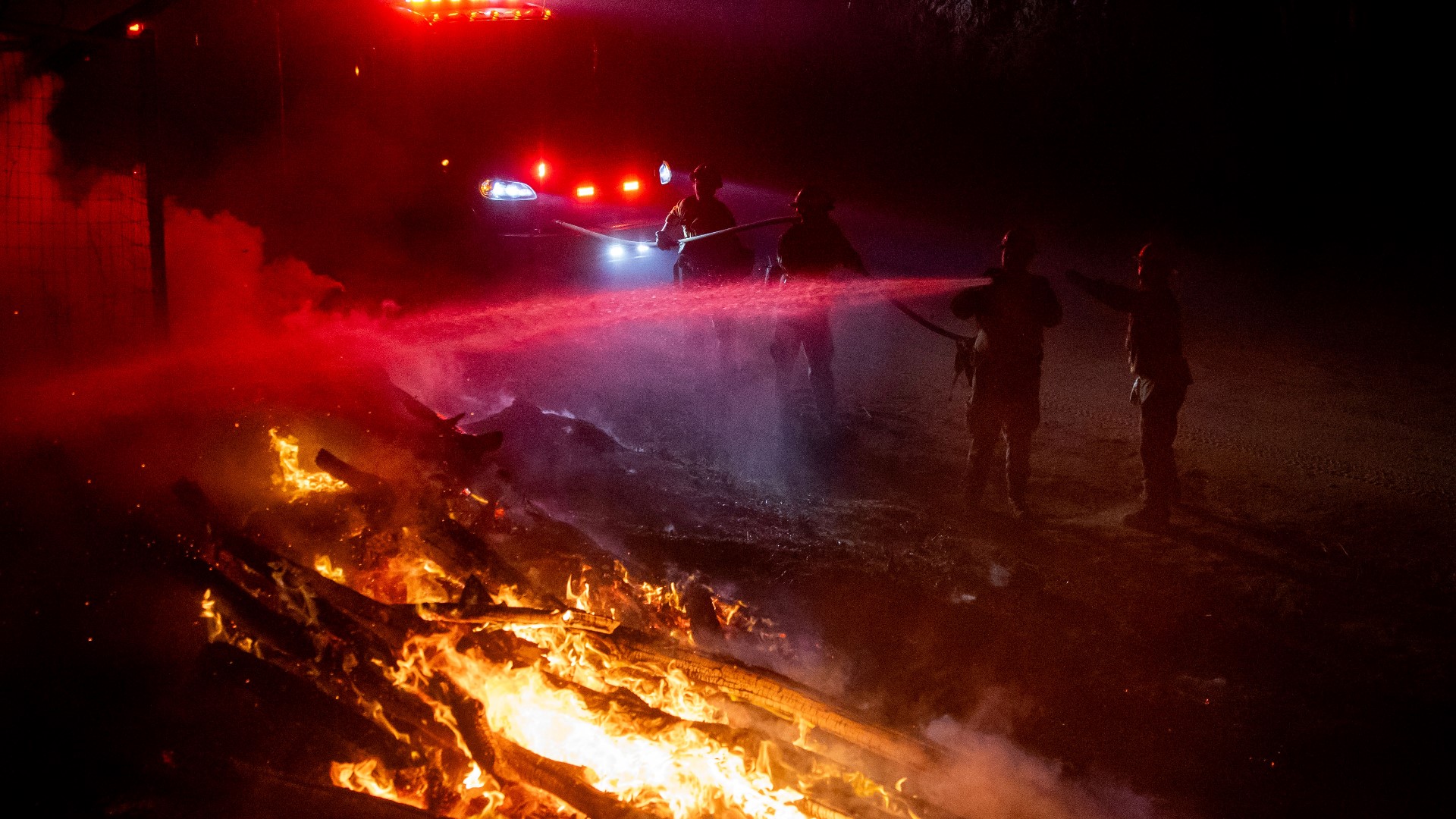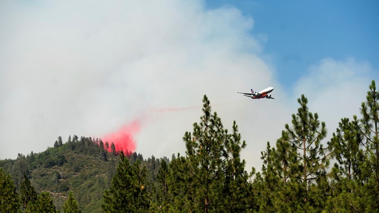
SHASTA COUNTY, Calif. — Containment continues to grow on the Salt Fire in Shasta County, allowing some resources from this fire to be reassigned to one of the other areas in Northern California up in flames.
The fire is currently 12,650 acres and containment is now 45%, according to the latest update.
The Salt Fire broke out Wednesday, June 30, near the Lakehead-Lakeshore community of unincorporated Shasta County, north of the city of Redding. Investigators determined that the cause of the Salt Fire was "extremely hot materials separated from the vehicle and landed in dry vegetation that sparked the wildfire," according to a post by the U.S. Forest Service - Shasta-Trinity National Forest.
Some evacuation orders and warnings remain in place for several areas near the fire, but other residents are slowly being allowed to return to their homes.
As of 6 p.m. on Saturday, evacuation orders were lifted for:
- Gilman Road from I-5 to Old Mill Road, (open to residents only)
- Toms Head Road
- Antlers View Road
Accounts to follow:
MAPS
WILDFIRE PREPS
According to Cal Fire, 2020 was one of the most severe fire seasons on record as 9,917 wildfires burned 4.2 million acres. Over 9,000 structures were destroyed, and 31 people (civilians and firefighters) were killed.
California also experienced its first "Gigafire" because of the August Complex Fire, burning over 1 million acres by itself. Four of California's top five largest wildfires in state history happened in 2020.
If you live in a wildfire-prone zone, Cal Fire suggests creating a defensible space around your home. Defensible space is an area around a building in which vegetation and other debris are completely cleared. At least 100 feet is recommended.
The Department of Homeland Security suggests assembling an emergency kit that has important documents, N95 respirator masks, supplies to grab with you if you’re forced to leave at a moment’s notice. The agency also suggests signing up for local warning system notifications and know your community’s evacuation plans best to prepare yourself and your family in cases of wildfires.
Some counties use Nixle alerts to update residents on severe weather, wildfires, and other news. To sign up, visit www.nixle.com or text your zip code to 888777 to start receiving alerts.
PG&E customers can also subscribe to alerts via text, email, or phone call. If you're a PG&E customer, visit the Profile & Alerts section of your account to register.
WATCH MORE: Experts say aftershocks will continue for days following Thursday's earthquake