
Update: 10/04/20 6:15 p.m.
Firefighters upped containment on the deadly Zogg Fire in Shasta County.
Crews were able to grow containment to 70% and kept the size of the fire to 56,305 acres.
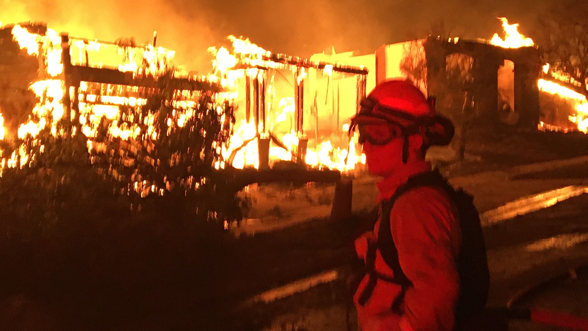
The Zogg Fire sparked on Sept. 27, destroying 202 structures and killing four people.
Update: 10/03/20
The Zogg Fire did not grow in size on Saturday, according to Cal Fire officials.
The Zogg Fire burned 56,305 acres and is 66% contained.
Cal Fire officials said there is still a chance for active fires forecasted due to northwest, downslope winds.
3:15 p.m. update:
Evacuation and road closures have been lifted and a repopulation order is in effect for residents on Placer Road west from Cloverdale Road to the intersection of Platina Road, according to Cal Fire.
The evacuation order will remain in effect for all residents and roadways off of South Fork Road to include Zogg Mine Road, Archer Road, Bender Road and all other adjoining roads. The order will also remain in place for all residents and roadways on Platina Road west from Placer Road to the intersection of Platina Road and Bland Road, Cal Fire said.
Orders have been lifted and a repopulation order is in effect for Foster Road and adjoining roads, west to of Gas Point Road.
9:45 a.m. update:
Two inmate firefighters were injured and taken to a local hospital Friday night, according to Cal Fire. One inmate was released while the other remains hospitalized.
The Zogg Fire "grew minimally" overnight, according to Cal Fire. It is now 56,305 acres and 57% contained. The fire continue to burn in grass, oak, woodland, chaparral and mixed timber, according to Cal Fire.
Damage assessment teams will be out Saturday to verify damaged and destroyed buildings, Cal Fire said.
9 p.m. update:
SHASTA COUNTY, Calif. -- Firefighters increased containment on the Zogg Fire and saw minimal growth in the fire's size on Friday, Cal Fire officials said.
Cal Fire officials said the fire is burning in grass, oak woodland, chaparral, and mixed tinder.
The Zogg Fire burned 56,168 acres and is 56% contained. The fire destroyed 170 buildings and damaged 23 more.
3 p.m. update:
A mountain lion cub rescued by Cal Fire from the Zogg Fire has been named after the firefighting agency in a tribute to his heroes.
Cal is being treated at the Oakland Zoo with burned paws, but it doing well, says the zoo's vet staff.
11:30 a.m. update:
More evacuation orders have been lifted, this time for the town of Platina. This includes adjoining roadways along the Highway 36 corridor west from the Shasta County and Tehama County line to the Shasta County and Trinity County line.
A road closure remains in effect for westbound traffic on Highway 36 at the intersection of Highway 36 and Highway 3 in Trinity County. An evacuation order and roadway closure remains in effect at Platina Road east of Highway 36.
More information on access to re-entry areas and traffic control points can be found here.
Watch Cal Fire SHU provide updates on the Zogg Fire:
10:30 a.m. update:
Some evacuation orders in Shasta County have been lifted and roads opened for re-entry.
Repopulation will include all roadways and residences in the area along Placer Road between Muletown Road and Texas Springs Road and Gas Point Road between Foster Road and Clear Creek Road. These areas have been opened for re-entry beginning Friday at 10:00 a.m.
Cloverdale Road is also open, but an evacuation order and road closure will remain in effect for westbound traffic on Placer Road west of Cloverdale Road.
More information on repopulation and traffic control can be found here.
Original story:
Cal Fire SHU says it was another "successful day" on the fire line as the Zogg Fire reaches 46% containment at 56,018 acres.
"The fire had minimal growth in size overnight and the fire continues to burn in grass, oak woodland, chaparral and mixed timber," Cal Fire said in an incident update.
Weather is still a concern for firefighters, and hot and dry conditions are still predicted for Friday. Cal Fire also says damage assessment teams are currently verifying the extent of destruction in the fire area.
An 11 a.m. press conference hosted by Cal Fire will provide more updates on the wildfire.
There are still some evacuation orders and warnings in place in Shasta and Tehama counties. Evacuation centers have been put in place to aid survivors of the fire.
Evacuation centers:
- Temporarily evacuation point open 10:00 a.m. to 5:00 p.m.: Holiday Market, 3315 Placer St., Redding, Calif.
- Large animal evacuation center: Cottonwood Rodeo Grounds, 3917 Main St.,Cottonwood, Calif.
- Small animal evacuation center: Haven Humane Society, 7449 Eastside Road, Anderson, Calif.
MAPS
This map includes mandatory evacuations and warnings in the area, as well as road closures. Red indicates a mandatory evacuation and yellow indicates a warning.
Several roads in Shasta County are temporarily closed because of the fire.
WILDFIRE PREPS
If you live in a wildfire-prone zone, Cal Fire suggests creating a defensible space around your home. Defensible space is an area around a building in which vegetation and other debris are completely cleared. At least 100 feet is recommended.
The Department of Homeland Security suggests assembling an emergency kit that has important documents, N95 respirator masks, supplies to grab with you if you’re forced to leave at a moment’s notice. The agency also suggests signing up for local warning system notifications and know your community’s evacuation plans to best prepare yourself and your family in cases of wildfires.