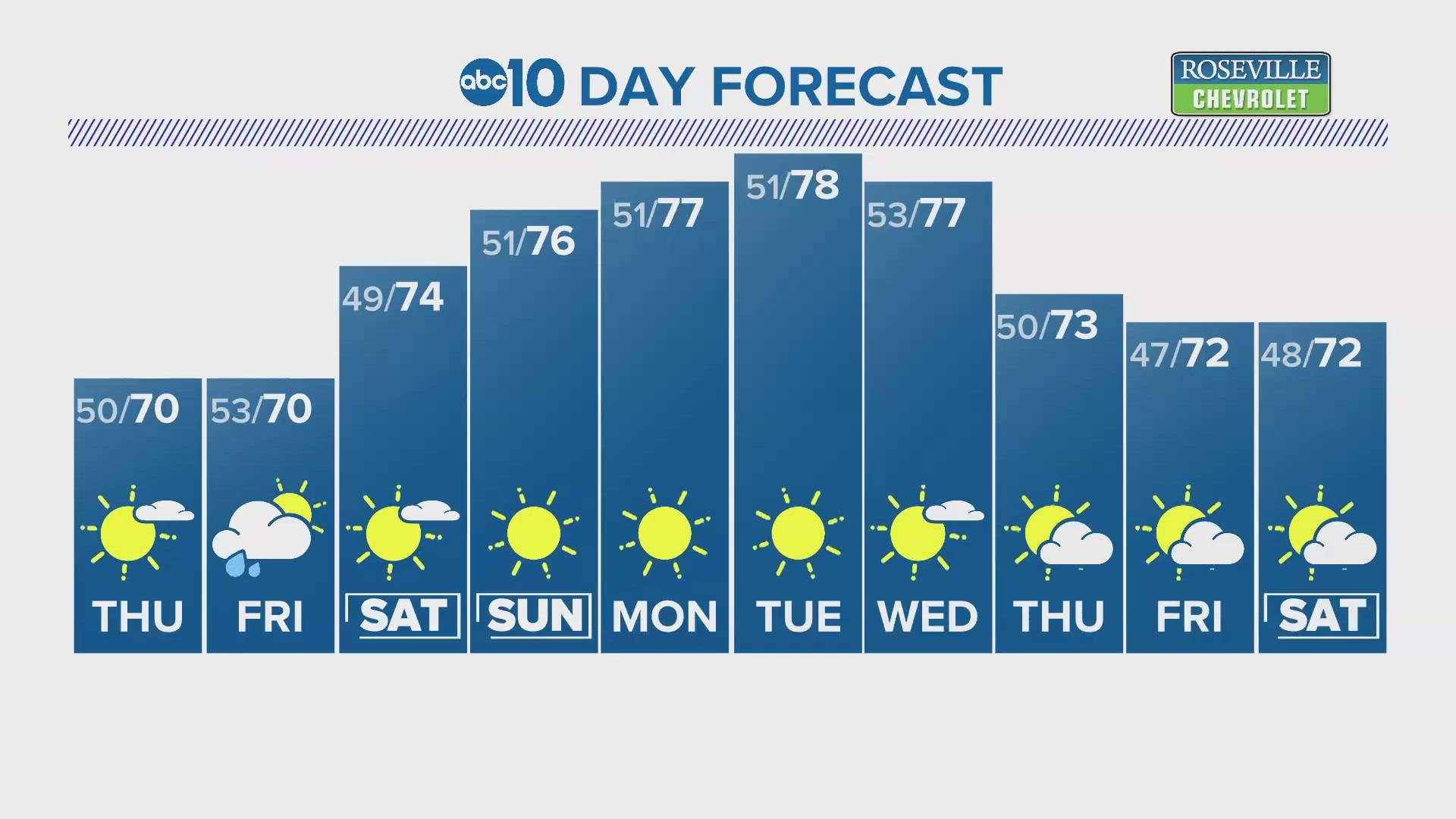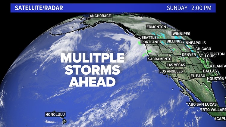
SACRAMENTO, Calif. — More wet weather is on tap for the week as the Pacific storm track continues to favor a wetter weather pattern for Northern California.
This is much-needed rain after Jan. and March 2022 ended as the driest on record for much of California.
The pattern shift in mid-April brought much-needed rain and snow but not enough to catch up to big deficits that grew through the end of the wet season.
The first weather system to affect the state will mainly hit Northern California late Monday through Tuesday.

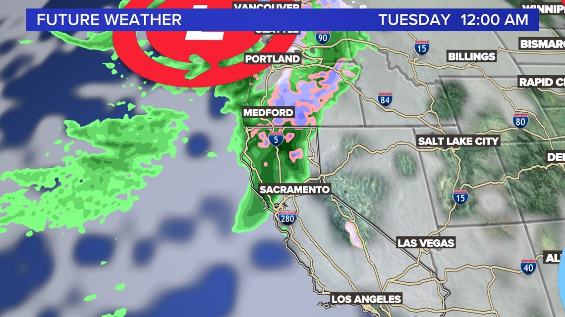
It is the weaker of the two weather makers and will deliver around 0.10 - 0.25 inches of rain in the valley. The Sierra has the potential to see 4 - 12 inches of snow by late Tuesday.
A break in the wet weather comes early Wednesday. The second, stronger system arrives later on Wednesday with the heaviest rain and snow on Thursday. Shower chances linger into Friday.

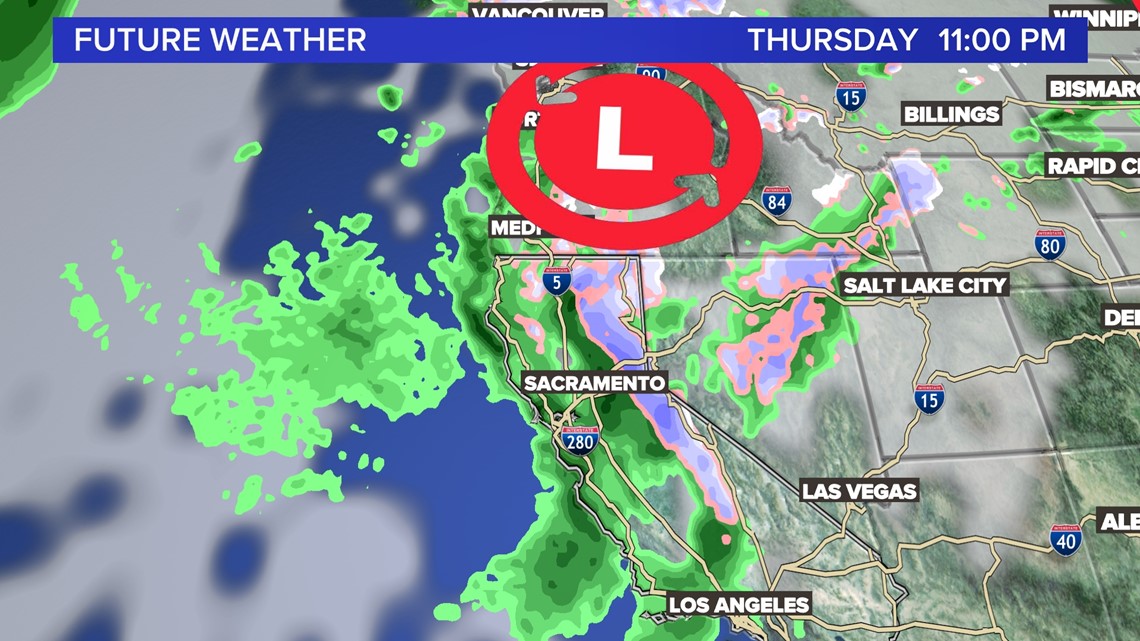
Totals right now for the valley are coming in around 0.50 inches over the three days. The Sierra could see 1 - 2 feet of new snow.
Travel will be difficult on and off in the valley and the Sierra. Snow level with each weather system will be below the passes. Periods of chain controls and gusty winds will make travel slow in the high country.
ABC10: Watch, Download, Read


Watch more on ABC10