
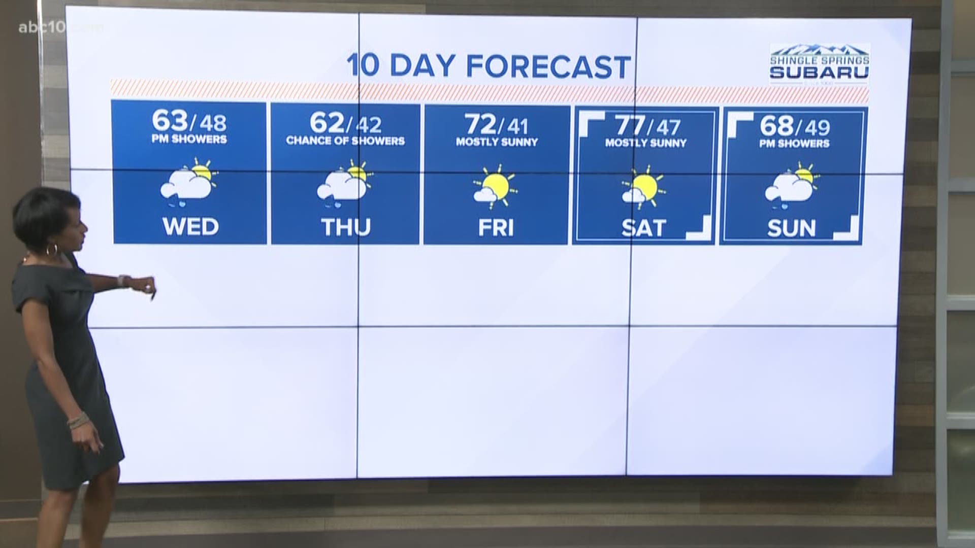
Update from Monica 6:00 p.m.
Get ready for the rain and snow. We'll see moderate rain in the valley around 7 p.m.
Snow level drops as low as 2800 feet by early Thursday. Most accumulations will be above 4,000 feet with snow near the passes totaling 12-18 inches.
The valley will be dry but cool on Thursday with highs only reaching the low 60s.
1 p.m. Storm Update:
Winter Weather Advisory in effect until 9 a.m. Thursday.
Chain controls possible tonight and tomorrow at pass levels, as travel delays are expected. We're also expecting gusty winds of 15-25 mph with gusts up to 45 mph through the evening. This same system will bring rainfall to the Central Valley, up to .25" for the Sacramento area, up to 1.00" for foothill locations.
LOS ANGELES (AP) — California's roller coaster spring will bring more snow to the Sierra Nevada while the southern half of the state transitions from a mini heat wave to cooler weather with potentially damaging winds in the mountains.
The National Weather Service says a cold, wet system moving through Northern California will rapidly lower snow levels Wednesday night to around 2,500 feet (762 meters) in Shasta County mountains and 3,000 feet (914 meters) in the Sierra.
Forecasters say travelers heading over mountain passes should be prepared for winter driving conditions.