
CALIFORNIA, USA — The Department of Water Resources' "water supply forecasting" team updated their April-July runoff forecast. The team studies the snow depth and the rate the water begins to run-off as it relates to melting.
Right now is the peak of snowfall accumulation with runoff projected to continue into late spring. By June or July, the Department of Water Resources says the reservoir levels are typically the highest due to the snowpack almost completely run off.
The report released, shows that natural flow rates in rivers have increased, and are more pronounced in the central and southern Sierra. Despite the increased flow, all the rivers are running below half the March average rate, except the San Joaquin River that is running just above half, at 56% rate.
This week, temperatures in the valley reached the 80s, while the Sierra saw temperatures in the mid 60s. This is causing snowpack to melt off quicker than expected.
"Our latest forecast for Snowmelt Runoff are only roughly about 49% of average for that April through July, snow melt period. That's typically when snow melt occurs in the state, and it's when (it) starts to warm up, sun's higher up in the sk. so we start to get more of that melt. And that's also the time when those reservoirs fill up when water is needed during the summertime, but still, those runoff forecasts are only running right around 49% of average statewide" said Sean de Guzman manager of the Department of Water Resources snowpack survey and water supply forecasting unit.
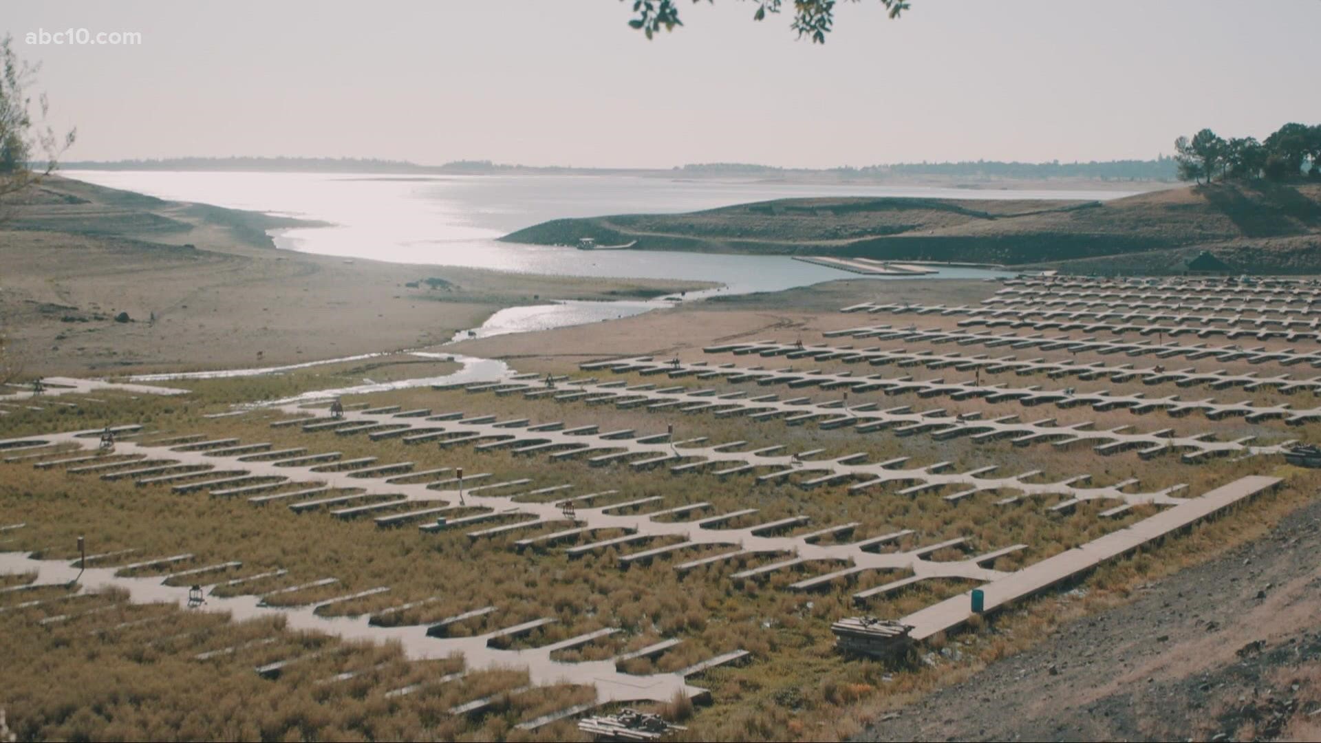
De Guzman says the state is already below average in water supply storage, so the added runoff may only leave reservoirs around half of their historic average.
As temperatures rise, the storms coming through in early spring haven't been impressive in moisture content, and they've also been much warmer.
"At this point, we'll take any water that we can get if it's coming in as rain, if it's coming as snow. Once you get towards that middle of March, right around April 1, that's when the reservoirs are really starting to fill up as much as possible," he said.
The climate prediction center is bracing for another La Nina year, meaning the temperatures at the sea's surface are below average. This typically brings very dry conditions to the area with what's called a "blocking high" set up.
A blocking high has and usually will set up over the western U.S. moving into the summer, and does not allow any low pressure systems to get close to California. We've even encountered this quite a big during California's winter as well, as we went 66 days without winter rain in Sacramento.
Basically, expect a very dry and warm summer ahead.
Many reservoirs are expected to see water under half their capacities. It will only be a matter of time until reservoirs can be assessed to determine recreational limits.
WATCH ALSO:


