
CALIFORNIA, USA — Major rain and snow are still en route to Northern California. It has been dry, even sunny at times this afternoon, but those conditions will not last much longer.
OVERNIGHT
The valley is likely to see a break in the rainfall once again overnight tonight. Some scattered showers will be possible, but significant rain, while you sleep, is unlikely. Lows will be in the mid to upper 40s in the valley.
Unlike in the valley, snowfall is likely to continue through much of the overnight hours. Many of the local ski resorts have already seen between 6 and 12 inches of snow, and another 6 to 12 inches is expected on the ground by sunrise.
Snow levels will drop from the 4,500-5,500 elevation range down to about 3,000 feet. Snow levels climb back to around 4,500 feet by sunrise.
RELATED: Sacramento Weather Forecast
TUESDAY MORNING COMMUTE
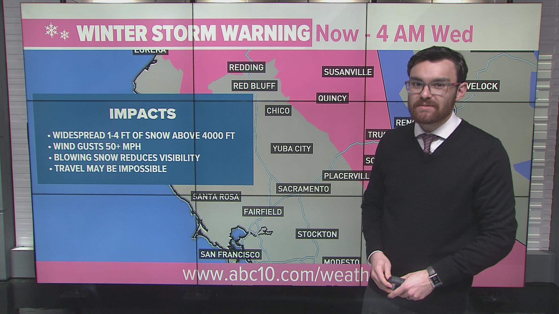
The worst commutes of the week will be on Tuesday – just in time for Election Day. The main event begins about an hour or two before sunrise as heavy bands of rain move into the valley. All of the valley is likely to see rain Tuesday morning - and heavy rain at that. Roads will absolutely be slick. By the time polls open at 7 A.M., heavy rain is likely in the valley.
In the Sierra, snow will have been falling pretty much since Monday evening. Roads will be slick and likely snow-covered. Wind gusts of 50 mph or more will be possible throughout the mountains, creating low visibility conditions due to blowing snow.
Chain controls will be needed again through portions of Highway 50 and Interstate 80. If you do not have to travel through the Sierra on Tuesday, don't. It'll make your life a lot easier. If you do have to travel through, make sure you've got chains and prepare for extensive travel delays.
LUNCHTIME
Rain and snow will continue through the middle part of Election Day. Thunderstorms are once again possible in the valley and foothills during the daytime on Tuesday. Leaves and ponding on roadways could make for slick spots. Temperatures will only be in the lower 50s.
Heavy snow continues in the Sierra. Travel will still be extremely difficult, if not impossible at times.
TUESDAY EVENING COMMUTE
Driving home on Tuesday evening will not necessarily be any better than your drive to work earlier that morning. Even though rainfall looks to be gradually tapering off, roads will still be wet and ponding on roadways could still be present. Thunderstorm chances linger as well.
Unlike the rain, snow will not be letting up Tuesday evening. Traveling in and out of the Sierra will still be extremely difficult. By sundown, areas above 4,000 feet are likely to have over 20 inches of additional snow on the ground, while areas south of Highway 50 could have over 30 inches of new snowfall.
OVERNIGHT TUESDAY INTO WEDNESDAY
The rain finally starts to taper off in the valley after sundown on Tuesday, though showers will linger throughout the overnight hours. Rainfall totals will be highly dependent on which areas saw thunderstorms, but generally looking for 1 to 2 inches of rain in the valley, especially along and east of Interstate 5.
Snowfall continues into the overnight hours, finally letting up by the Wednesday morning commute. Snow showers will linger in the Sierra until lunchtime on Wednesday.
When all is said and done, widespread snowfall totals of 24 to 48 inches are expected for areas above 4,000 feet, with the highest peaks and passes south of Highway 50 potentially seeing 50 inches or more. It's a good start to the water year and good news for ski resorts as they prepare to open for the season.
WATCH ALSO:


