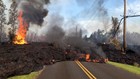

Hawaii owes its very existence to volcanoes like Kilauea, currently ripping through Leilani Estates in Pahoa – but volcanoes also are a fact of life in California, albeit a subterranean one.
The ground beneath your feet might seem pretty solid, but deep down it’s another story.
Magma simmers miles below the surface, and the movement of that molten material as it heats and rises, then cools and falls powers plate tectonics -- the cause of earthquakes like those along the San Andreas fault.
Cracks around the plates' edges allow the magma to ooze up to the surface and create volcanoes, and in California, they can be traced from Shasta and Lassen peaks in Northern California, down through Long Valley near Yosemite to the Salton Buttes near the Mexico border. Here, seven volcanoes are deemed “dangerous” said State Geologist John Parrish with the California Geological Survey.
These include Mount Shasta, Lassen Volcanic Area, Medicine Lake Volcano, Long Valley Volcanic Field, Clear Lake Volcanic Field, Coso Volcanic Field and Salton Buttes, according to the US Geological Survey.
“They’re considered dangerous because they have active magma chambers beneath them,” he said.
Not to panic, though. California volcanoes (which are in some of the less populated parts of the states -- only about one percent of the population lives near a volcano) have been quiet for some time.
“When we look at the active volcanoes, they’re really not that active in California anymore,” Parrish said. “And most of the volcanoes are up now in Oregon and Washington and up in Alaska and of course over in Japan.”
The way the Pacific plate is rotating, it slips side by side as it goes by California, he explained. But it is begin forced beneath the landmasses north of us, which breaks up the crust and activates magma chambers, resulting in lines of volcanoes like those of the Aleutian Islands.
The U.S. Geological Survey monitors those with the potential for danger in three ways, Parrish explained: through seismic monitors, that measure movements in the earth, Global Positioning Systems that monitor swelling that might indicate activity, gas vapor monitors to detect sulfur dioxide or methane gasses that might seep from cracks due to activity.
These volcanic observation stations, known in California as ‘CalVo,’ are strategically placed around potentially dangerous volcanos. In theory, scientists can detect slow changes that might predict a major eruption, Parrish said – unless of course an eruption happens suddenly.
“We hope it doesn’t decide to act very fast – and just happen in a couple hours," he said.
The most recent volcanic activity in California took place when Mount Lassen erupted May 22, 1915, raining volcanic ash up to 200 miles to the east, according to information posted on Lassen Volcanic National Park website.
Although scientists know far more about the world than they did in past years, they still don’t know it all, and predicting natural disasters like earthquakes and volcanoes is still a pretty dicey proposition.
“There’s a lot we don’t know,” Parrish said. “We cannot predict anything. We can do probabilistics and say what the chances are…”
Parrish quoted a historian, Will Durant, who studied 30,000 years of human civilizations as the rose, flourished and fell.
“His conclusion was that ‘Civilization exists by geological consent, subject to change without notice,’” Parrish said.