SACRAMENTO, Calif. — After a week of hot weather for Northern California and record-breaking temperatures the region will experience a huge pattern change for the weekend.
Thursday will round out the period of widespread excessive heat above 100 degrees and Friday will still be hot with most areas seeing temperatures in the mid 90's.
On Friday night areas in far northern California and the foothills may see some evening thunderstorms as cooler air rushes in.

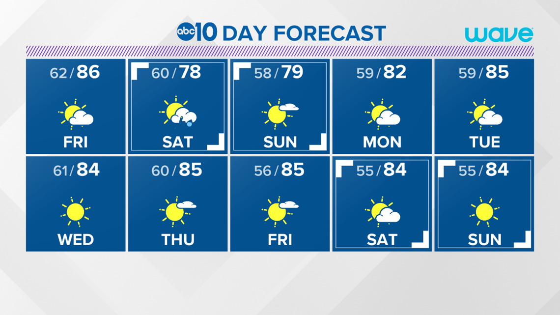
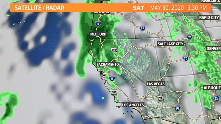
By Saturday a weak storm will roll in bringing a huge drop in temperatures by as much as 20 degrees for afternoon highs in some areas. Widespread light showers are likely for the higher elevations but some light rain will fall in many valley locations as well. Totals should be less than 0.10" for rain are possible in the valley with highs in the upper 70's. Most rain will fall in the morning to early afternoon.
There is also a chance of thunderstorms into the afternoon for the valley and Sierra.
► JOIN THE ABC10 WEATHER FORCE TO GET YOUR PHOTOS ON THE NEWS
The cooler air sticks around for Sunday and it should be dry with highs in the low 80's.
Next week we hang on to more mild weather typical of this time of the year with highs in the mid 80's.
► RAIN OR SHINE? GET THE LATEST FORECAST IN YOUR NEIGHBORHOOD BY DOWNLOADING OUR APP:


►Get the forecast in your email! Sign up now for the Daily Blend Newsletter