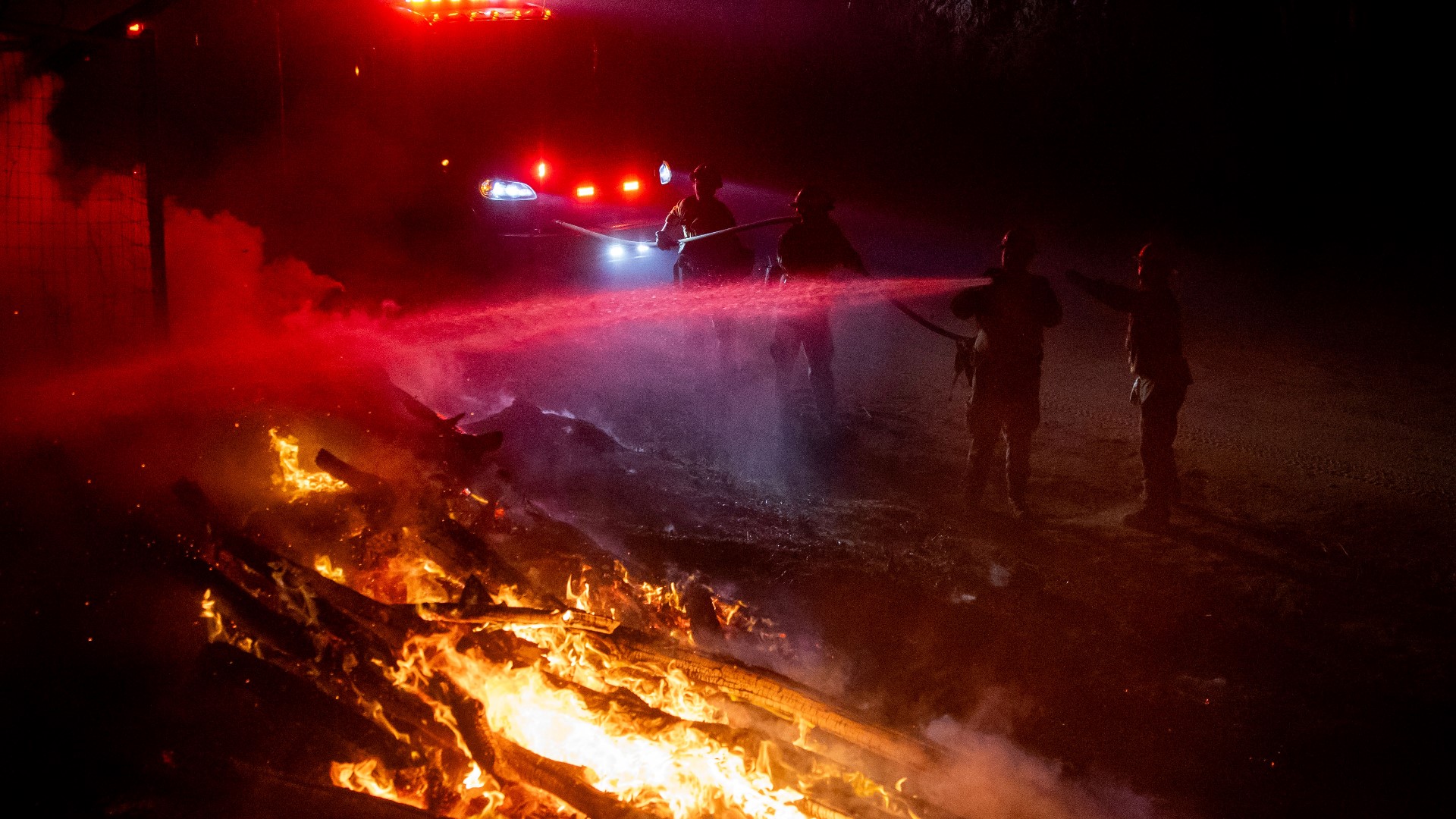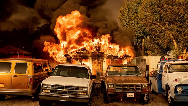
PLUMAS COUNTY, Calif. — Firefighters made modest progress against the Beckwourth Fire Complex over the weekend.
According to the latest figures from the US Forest Service, the Beckwourth Complex Fire has now burned roughly 91,200 acres and is 26% contained.
The Beckwourth Complex Fire is the largest wildfire of the year, so far, in California. It is burning along the Nevada state line and has burned about 134 square miles.
The Dotta Fire started by lightning on June 30, 2021, in the area of Dotta Canyon on the Beckwourth Ranger District of the Plumas National Forest. On July 2, 2021, the Sugar Fire started by lightning west of Sugarloaf Peak on the Beckwourth Ranger District of the Plumas National Forest.
On July 4 at 6 a.m., the California Interagency Incident Management Team 4 took over command and control of the two fires, combining them as the Beckwourth Complex.
Accounts to follow:
Evacuations
On Monday, all evacuations were lifted for Washoe County, Nevada in the communities of Rancho Haven, Fish Springs, and Flannigan Flats.
Evacuation warnings were upgraded to mandatory along Highway 395 in Lassen County.
Plumas County Sheriff's Office has issued mandatory evacuations for areas near Frenchman Lake and Dixie Valley Road. All people in Chilcoot and Vinton should also evacuate. People living north of Highway 70 and between Beckwourth-Genesee Road and the Lassen-Plumas county line should also evacuate.
For Lassen County, some evacuation orders were reduce for some areas.
The following areas were reduced from Evacuation Order to Evacuation Warning status and residents are able to return to their homes:
• Doyle east of US 395 including Doyle Loop and all roads connecting to Doyle Loop and Hackstaff Road to Laver Crossing is now under evacuation warning including the town of Herlong south to the Lassen/Sierra County line.
• West of US 395 from the north end of Constantia Rd. south to the Lassen/Sierra County line and from the intersection of A26 north to Milford Grade is now under Evacuation Warning.
A mandatory evacuation order is still in effect for:
• Doyle Proper west of US 395 from the intersection of County Road A26 and US 395 south to Constantia Rd. but not including Constantia Rd. is still under mandatory evacuation order.
Evacuation centers are at Proctor R. Hug High School and Reno-Sparks Livestock Events Center in Reno and the Lassen County Fairgrounds.
Wildfire Maps
WILDFIRE PREPS
According to Cal Fire, 2020 was one of the most severe fire seasons on record as 9,917 wildfires burned 4.2 million acres. Over 9,000 structures were destroyed, and 31 people (civilians and firefighters) were killed.
California also experienced its first "Gigafire" because of the August Complex Fire, burning over 1 million acres by itself. Four of California's top five largest wildfires in state history happened in 2020.
If you live in a wildfire-prone zone, Cal Fire suggests creating a defensible space around your home. Defensible space is an area around a building in which vegetation and other debris are completely cleared. At least 100 feet is recommended.
The Department of Homeland Security suggests assembling an emergency kit that has important documents, N95 respirator masks, supplies to grab with you if you’re forced to leave at a moment’s notice. The agency also suggests signing up for local warning system notifications and know your community’s evacuation plans best to prepare yourself and your family in cases of wildfires.
Some counties use Nixle alerts to update residents on severe weather, wildfires, and other news. To sign up, visit www.nixle.com or text your zip code to 888777 to start receiving alerts.
PG&E customers can also subscribe to alerts via text, email, or phone call. If you're a PG&E customer, visit the Profile & Alerts section of your account to register.