
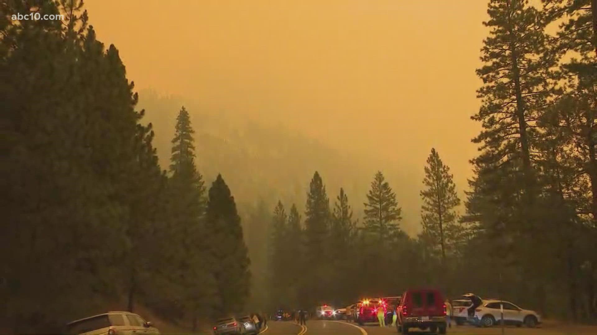
POLLOCK PINES, Calif. — The Caldor Fire jumped Highway 50 near Kyburz, according to Cal Fire.
Caltrans closed Highway 50 between Sly Park Road and the town of Meyers citing safety concerns due to the Caldor Fire. There is no estimated time for how long the freeway will remain close.
The Sly Park Road ramps onto Highway 50 have been re-opened to allow drivers to turn around during the closure of Highway 50.
New mandatory evacuation orders were issued for residents near the Amador County Line on Saturday.
Those in the areas south of Farnham Ridge Road and east of Bridgeport School Road to the Amador County Line are ordered to evacuate.
There is no estimated time for how long Highway 50 will remain closed.
The Caldor Fire arrived during a normally busy time for tourism in El Dorado County. Instead of tourists, fire crews from across the state are working hard and discouraging travel in the area.
“These fires are impacting this whole region right now," Cpt. Keith Wade with the Sacramento Fire Department said. "Anyone who's hoping to come up into this area to either recreate or come up here to visit people, we're asking them to please don't travel through this area. It's heavily impacted with this fire activity."
Those who don’t listen to the warning won’t find much to do in the communities evacuated anyways.
“Many of our wineries are evacuated or at least in the evacuation zone at this point,” Kara Sather, spokesperson with the El Dorado Winery Association, said. “It's just not in anyone's safety or best interest to venture into our region right now.”
Camp Richardson Resort & Marina in South Lake Tahoe will temporarily close for about two weeks due to the threat of the Caldor Fire.
The resort will be closed between midnight Aug. 22-Sept. 6, according to a post on Facebook. The resort said it will contact people who made a reservation during that time frame. Those with reservations will have the option to move the date, or cancel their reservation for a full refund.
The Camp Richardson Marina will remain open and Rum Runner Cruises will operate as long as conditions allow.
The El Dorado County Chamber of Commerce agrees with fire crews and suggests people should leave firefighters the space needed to fight the fire.
“All those campers kind of doing last-minute camping before school starts and all that were evacuated, it doesn’t look like the [El Dorado] National Forest is going to open until September 30 so that’s going to have an impact,” Jody Franklin, a spokesperson with the El Dorado County Chamber of Commerce, said.
The Caldor Fire started on Saturday, Aug. 14, two miles east of Omo Ranch and four miles south of the community of Grizzly Flats in El Dorado County. On its first day, it only grew 45 acres, but since then, it has burned thousands of acres of land. In Saturday's active fire of interest report, it was reported the fire burned 90,107 acres, according to Cal Fire. There is still no current containment.
"With historic drought conditions, there is heavy dead and down fuels through the fire area," Cal Fire's report states.
Over 100 structures have been destroyed.
While the fire hasn't crossed into Amador County, the evacuation warnings remain in effect. Many roads and properties along Highway 50 now have ribbons tied to poles signaling that fire crews passed through the area.
El Dorado County residents who have been impacted by the fire and are concerned about voting in the upcoming gubernatorial recall election will still be able to. Tap here to learn more from El Dorado County Elections.
Evacuations and Road Closures
Click HERE for in-depth evacuation orders and warnings in El Dorado County. For evacuation orders and warnings in Amador County, click HERE for the Amador County Sheriff's Facebook page and HERE for their website. For current state highway/route information visit roads.dot.ca.gov.
Evacuation centers
- El Dorado Community Center 6139 Pleasant Valley Road in El Dorado
- Green Valley Community Church 2500 Missouri Flat Road in Placerville
- Amador County Fairgrounds 18621 Sherwood Street (Temporary Evacuation Point)
- Evelyn Bishop Hall 701 CA 124, Ione, CA
- Rolling Hills Church, 800 White Rock Road, El Dorado Hills
The shelter at Cameron Park CSD is currently full.
Large animals can be taken to the Amador County Fairgrounds, Empire Street at Highway 49, use the Empire Street gate. Call 530-621-5795 or 530-647-6227 for more information. For small animal shelter needs, contact the El Dorado County Animal Services at 530-621-5795.
Accounts to follow
Evacuation Maps
A map of evacuations from the El Dorado County Sheriff's Office is available below.
Wildfire map
Structure Damage Map
A map of structural damage from the El Dorado County Sheriff's Office is available below.
►Stay in the know! Sign up now for the Daily Blend Newsletter
What questions do you have about the latest wildfires? If you're impacted by the wildfires, what would you like to know? Text the ABC10 team at (916) 321-3310.
Wildfire Preps
If you live in a wildfire-prone zone, Cal Fire suggests creating a defensible space around your home. Defensible space is an area around a building in which vegetation and other debris are completely cleared. At least 100 feet is recommended.
The Department of Homeland Security suggests assembling an emergency kit that has important documents, N95 respirator masks, supplies to grab with you if you’re forced to leave at a moment’s notice. The agency also suggests signing up for local warning system notifications and know your community’s evacuation plans best to prepare yourself and your family in cases of wildfires.
Some counties use Nixle alerts to update residents on severe weather, wildfires, and other news. To sign up, visit www.nixle.com or text your zip code to 888777 to start receiving alerts.
PG&E customers can also subscribe to alerts via text, email, or phone call. If you're a PG&E customer, visit the Profile & Alerts section of your account to register.
ABC10: Watch, Download, Read


Watch more from ABC10