
BUTTE COUNTY, Calif. — Update:
The Dixie Fire has prompted evacuation orders in Shasta County as the fire makes a run to the northeast.
The Shasta County Sheriff's Office issued the order for the community of Old Station in Eastern Shasta County.
Residents between Lassen National Park entrance and the Bridge campground are being told to leave immediately along with homes on Highway 44 from the Lassen County line.
The orders were joined by new evacuation orders in Lassen County. The sheriff's office issued the orders for north of Hwy 44 from the Lassen County line east to Pitville Rd and north to Blacks Mountain/Forest Services Route 32NO2.
In a Wednesday update, Operation Section Chief Tony Brownell said the fire was outpacing crews on that side and said communities needed to be on alert for the call to leave. He said crews were trying to keep the fire from crossing Highway 44 as crews tend to a spot fire that cross to the other side.
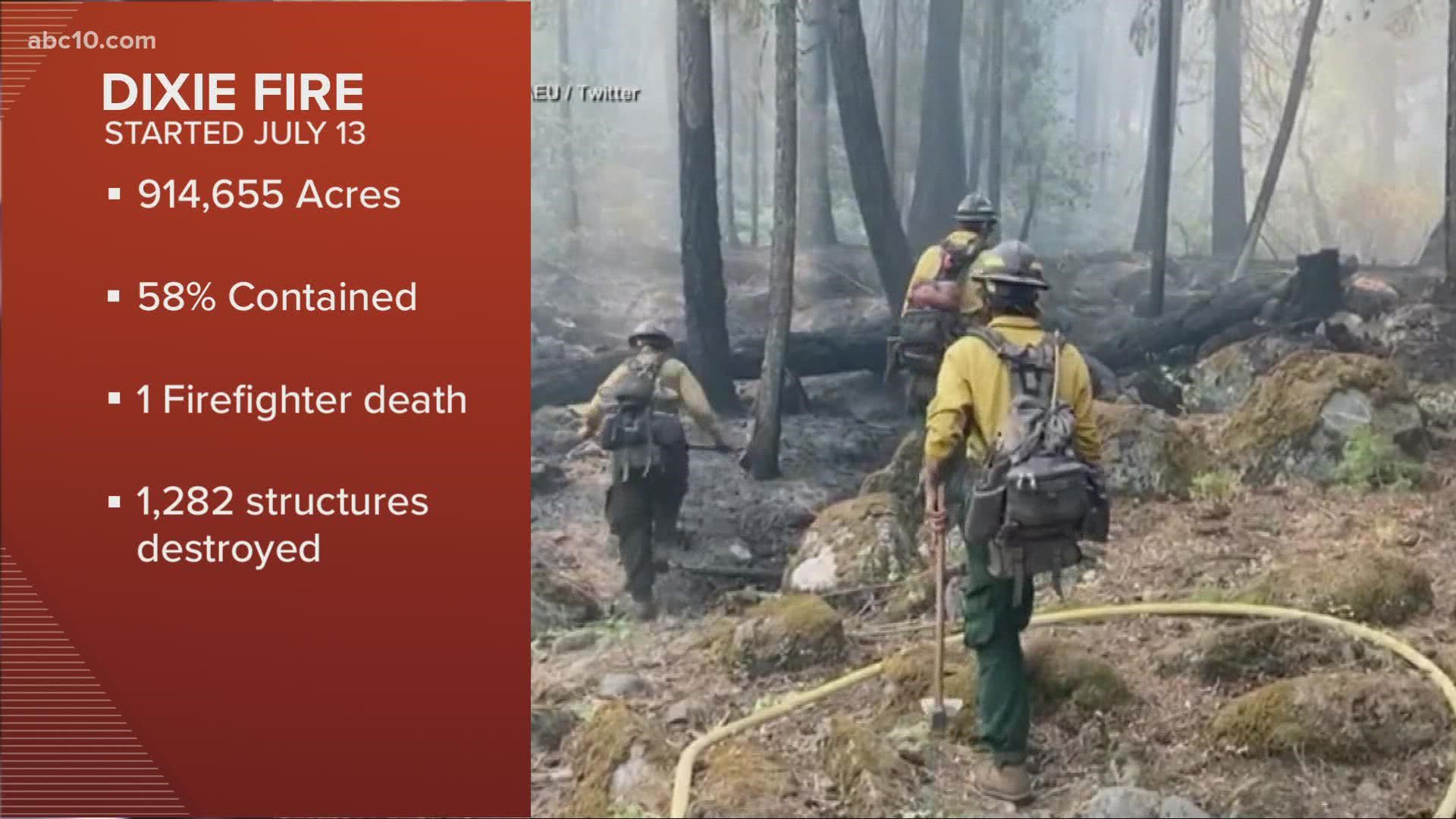
The Dixie Fire has burned 922,507 acres and is 59% contained. It has destroyed 688 homes.
Original story:
According to Cal Fire, evacuation warnings in Lassen County have been lifted in several areas in the Dixie Fire.
This is effective immediately. All other evacuation orders and warnings remain in effect.
The Dixie Fire is impacting five counties in Northern California: Butte, Plumas, Tehama, Lassen, and Shasta, according to Cal Fire. The fire has burned 922,192 acres and is 59% contained. It has destroyed 688 homes.
In the west zone of the fire, the California National Guard have joined firefighting efforts. There were spotting issues in the Lassen Volcanic National Park area and the northern section of the fire, so crews continue to create contingency lines north and south of Janesville and Milford. In addition, crews are prioritizing areas including the Lassen and Shasta Sector, Old Station and surrounding communities, the Highway 395 corridor escarpment, the communities of Greenhorn, Cromberg, and Lake Davis.
Weather still plays an important part, with forecasted nocturnal thunderstorms for Thursday and Friday.
In the east zone, there is a slight chance of thunderstorms for Thursday, but hot and hazy weather conditions remain stable. There was very little fire growth reported in the east zone and firefighters made tremendous progress holding containment lines on Dixie Mountain, in Dixie Valley, and on Horton Ridge.
Overnight, crews continued to provide structure protection, patrol, and closely monitor fire activity in the Beckwourth-Genesee Road areas as well as actively monitor a fire burning in the Devil’s Punchbowl area.
The Dixie Fire is roughly 100,000 acres away from becoming the largest wildfire in California state history. Currently, the largest fire in state history is the August Complex Fire from 2020. It burned 1,032,648 acres in seven counties.
Dixie Fire accounts to follow:
- Butte County Sheriff
- Butte County
- Cal Fire
- CAL FIRE Butte Unit/Butte County Fire Department
- Caltrans District 2
- Lassen County Website
- National Forest Closures
- Plumas County Sheriff's Office
- Plumas County Website
- Shasta County Website
- Shasta Sheriff Website
- Shasta 2-1-1 Dixie Info
- Code Red Sign Up
- Tehama County Website
- Tehama Sheriff Website
- Tehama Alert
Evacuations and road closures
Click HERE for in-depth evacuation orders and warnings in Plumas, Butte, Tehama, and Lassen Counties. For current state highway/route information visit roads.dot.ca.gov.
Evacuation centers
Plumas County:
- All shelters in Plumas County have been consolidated to the Holy Family Catholic Church at 108 Taylor Ave, Portola
Tehama County:
- Los Molinos Veterans Hall 7980 Sherwood Blvd, Los Molinos, CA
96055
NOTE: The Lassen High School shelter has closed
American Red Cross: Public Information Line (855)-755-7711
Animal Evacuation Centers:
Plumas County:
- Plumas County Fairgrounds 204 Fairground Road, Quincy
(large animals) - 201 Mill Creek Road, Quincy
(small animals) - Recreation Center 101 Meadowview Lane, Chester
Tehama County:
- Tehama County Complex 1830 Walnut Street, Red Bluff
(large and small animals)
Wildlife Rescue
- Response for injured wildlife: 1-800-942-6459
- Gold Country Wildlife Rescue: 1-530-885-0862
Dixie Fire Structure Status Map
A live map showing which structures have been destroyed or at risk is available below.
Evacuation Map
A live evacuation map is available below.
Wildfire Map
An updated map of the acreage of the Dixie Fire.
►Stay in the know! Sign up now for the Daily Blend Newsletter
WILDFIRE PREPS
According to Cal Fire, 2020 was one of the most severe fire seasons on record as 9,917 wildfires burned 4.2 million acres. Over 9,000 structures were destroyed, and 31 people (civilians and firefighters) were killed.
California also experienced its first "Gigafire" because of the August Complex Fire, burning over 1 million acres by itself. Four of California's top five largest wildfires in state history happened in 2020.
If you live in a wildfire-prone zone, Cal Fire suggests creating a defensible space around your home. Defensible space is an area around a building in which vegetation and other debris are completely cleared. At least 100 feet is recommended.
The Department of Homeland Security suggests assembling an emergency kit that has important documents, N95 respirator masks, supplies to grab with you if you’re forced to leave at a moment’s notice. The agency also suggests signing up for local warning system notifications and know your community’s evacuation plans best to prepare yourself and your family in cases of wildfires.
Some counties use Nixle alerts to update residents on severe weather, wildfires, and other news. To sign up, www.nixle.com or text your zip code to 888777 to start receiving alerts.
PG&E customers can also subscribe to alerts via text, email, or phone call. If you're a PG&E customer, visit the Profile & Alerts section of your account to register.
WATCH MORE ON ABC10: Dixie Fire update: September 7th, 2021 | California Wildfires