
BUTTE COUNTY, Calif. — Two months after the Dixie Fire first sparked, thousands of firefighters are still working to contain the massive blaze, which has grown to the second-largest wildfire in California history.
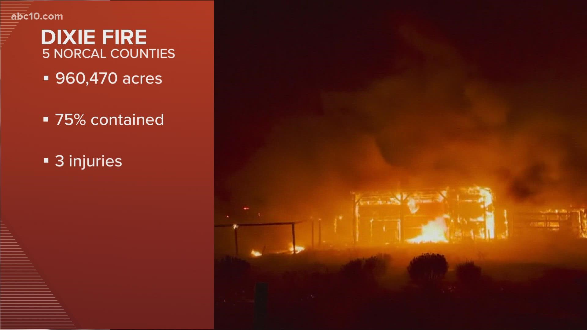
The Dixie Fire has burned 960,470 acres since it started in July, with containment holding at 75% for the second day in a row.
The good news is more homeowners are being allowed to return to evacuation zones. This morning, evacuation orders in the Old Station and Hat Creek areas were downgraded from an order to a warning.
But firefighters are concerned about a shift in the weather. A morning briefing from the Forest Service said, "forest fuels are as dry as they were prior to last week’s rainfall." There is concern that stumps and logs could still be burning and gusty winds could spread the fire.
According to Cal Fire, in the west zone, there was minimal activity across the fire area and as the weather begins to get warmer and drier, there is an increase in visible smoke.
In the east zone, there was minimal activity, but forest fuels still remain dry. Firefighters were very active in the Grizzly Peak/Devil's Punchbowl area. Today, their main priority is to reinforce containment lines. In addition, firefighters remain committed to reducing interior heat and containing some hot spots in the form of large fuels – stumps, logs, standing snags that are burning inside the control lines.
As the Dixie Fire continues to grow, it is now less than 100,000 acres from becoming the largest wildfire to burn in California history. The August Complex, which was made up of several lightning-sparked fires, is currently the largest fire, burning 1,032,648 acres in 2020.
Dixie Fire accounts to follow:
- Butte County Sheriff
- Butte County
- Cal Fire
- CAL FIRE Butte Unit/Butte County Fire Department
- Caltrans District 2
- Lassen County Website
- National Forest Closures
- Plumas County Sheriff's Office
- Plumas County Website
- Shasta County Website
- Shasta Sheriff Website
- Shasta 2-1-1 Dixie Info
- Code Red Sign Up
- Tehama County Website
- Tehama Sheriff Website
- Tehama Alert
Evacuations and road closures
Click HERE for in-depth evacuation orders and warnings in Plumas, Butte, Tehama, and Lassen Counties. For current state highway/route information visit roads.dot.ca.gov.
Evacuation centers
Shasta County:
Word of Life Assembly of God Church 37341 Main Street off HWY 299 Burney, CA 96013
Plumas County/Lassen County:
- Holy Family Catholic Church 108 Taylor Ave. Portola, CA (At Capacity)
- Sparks Convention Center Hall #5, 4590 S. Virginia St., Reno, NV
American Red Cross: Public Information Line (855)-755-7711
Animal Evacuation Centers
- Plumas County
- Plumas County Fairgrounds 204 Fairground Road, Quincy
(large animals) - 201 Mill Creek Road, Quincy
(small animals) - Recreation Center 101 Meadowview Lane, Chester
- Plumas County Fairgrounds 204 Fairground Road, Quincy
Wildlife Rescue
- Response for injured wildlife: 1-800-942-6459
- Gold Country Wildlife Rescue: 1-530-885-0862
Dixie Fire Structure Status Map
A live map showing which structures have been destroyed or at risk is available below.
Evacuation Map
A live evacuation map is available below.
Wildfire Map
An updated map of the acreage of the Dixie Fire.
►Stay in the know! Sign up now for the Daily Blend Newsletter
WILDFIRE PREPS
According to Cal Fire, 2020 was one of the most severe fire seasons on record as 9,917 wildfires burned 4.2 million acres. Over 9,000 structures were destroyed, and 31 people (civilians and firefighters) were killed.
California also experienced its first "Gigafire" because of the August Complex Fire, burning over 1 million acres by itself. Four of California's top five largest wildfires in state history happened in 2020.
If you live in a wildfire-prone zone, Cal Fire suggests creating a defensible space around your home. Defensible space is an area around a building in which vegetation and other debris are completely cleared. At least 100 feet is recommended.
The Department of Homeland Security suggests assembling an emergency kit that has important documents, N95 respirator masks, supplies to grab with you if you’re forced to leave at a moment’s notice. The agency also suggests signing up for local warning system notifications and know your community’s evacuation plans best to prepare yourself and your family in cases of wildfires.
Some counties use Nixle alerts to update residents on severe weather, wildfires, and other news. To sign up, www.nixle.com or text your zip code to 888777 to start receiving alerts.
PG&E customers can also subscribe to alerts via text, email, or phone call. If you're a PG&E customer, visit the Profile & Alerts section of your account to register.
WATCH MORE ON ABC10: Tuesday morning wildfire updates: Caldor and Dixie Fires