
COLFAX, Calif. — ----
Thursday's updates are at /article/news/local/wildfire/river-fire-evacuations-maps-and-updates/103-06b2fa70-dce3-4e8e-a9bd-9d7840047330
----
Evacuation orders and warnings are in effect for the so-called River Fire burning near Colfax.
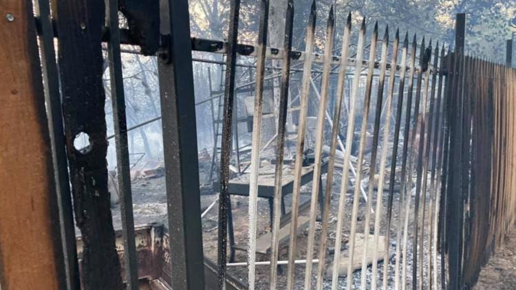
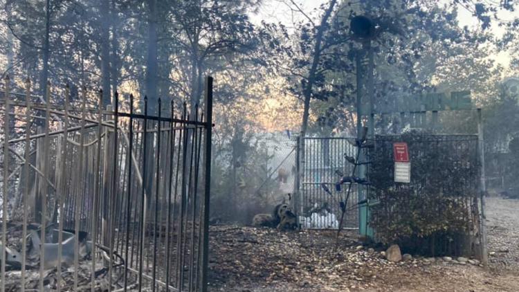
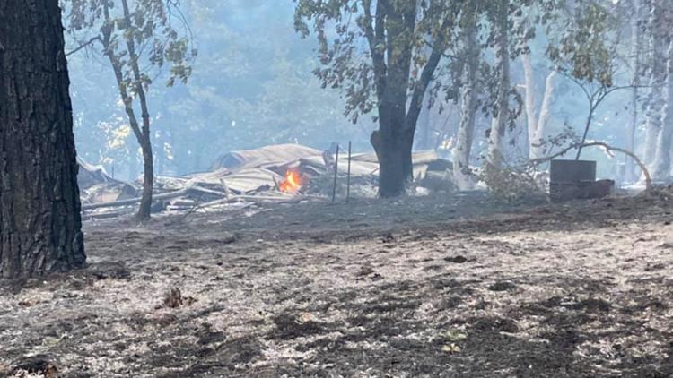
Cal Fire tweeted that the River Fire is currently at 1,400 acres and has no containment. In a Wednesday press briefing, Cal Fire Nevada-Yuba-Placer Unit Deputy Chief Jim Hudson said 35 to 40 structures were possibly damaged or destroyed by the fire.
The Placer County Sheriff's Office issued an evacuation order for the town of Colfax and the area starting at the Bear River Campground and extending on both sides of Milk Ranch Road to Tokyana Road; West of the railroad tracks to the river; From Mt Howell Rd north to Rollins lake.
Placer County issued evacuation warnings to residents outside that area while the Nevada County Sheriff's Office is issuing evacuation orders for zone NCO-E102, calling on all residents East of Dog Bar Rd; South of Leitner Drive and North of Misty Winds are to evacuate immediately.
The Nevada County Sheriff's Office also issued evacuation orders for zones NCO-E050, NCO-E103, and NCO-E178. The county's office of emergency services said the fire jumped the fire into Nevada County and is threatening areas East of Dog Bar Rd.
The calls to evacuate have impacted at least 2,400 people in Placer County. In Nevada County, at least 4,200 people have fallen under both evacuation orders and warnings due to the fire.
More evacuation orders for this fire are below.
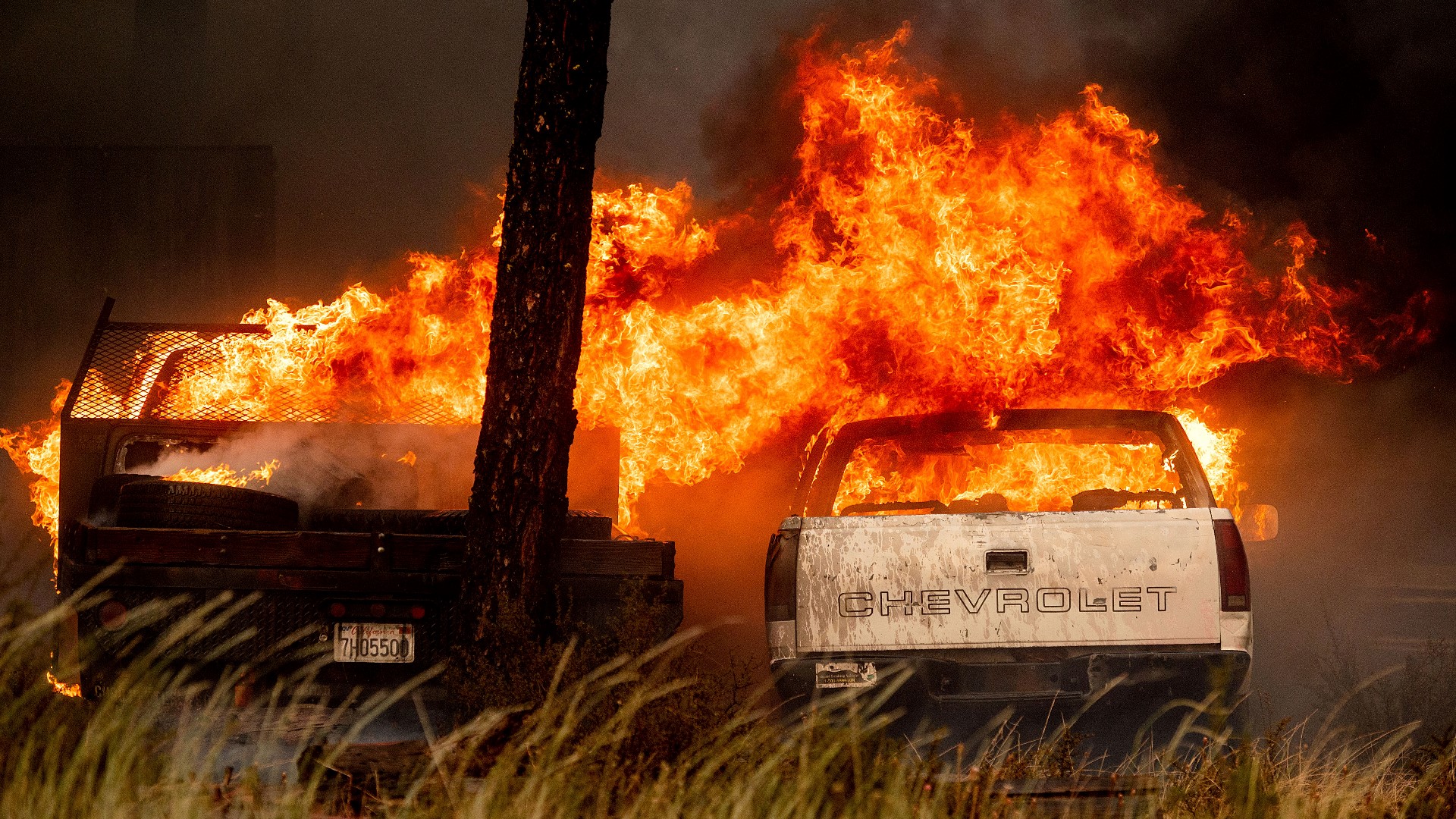
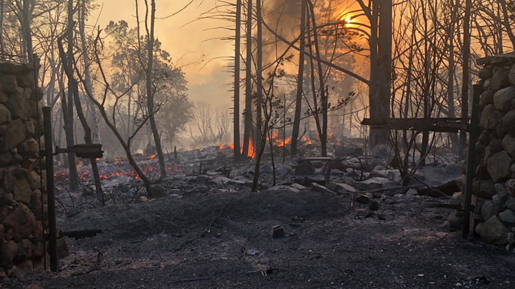
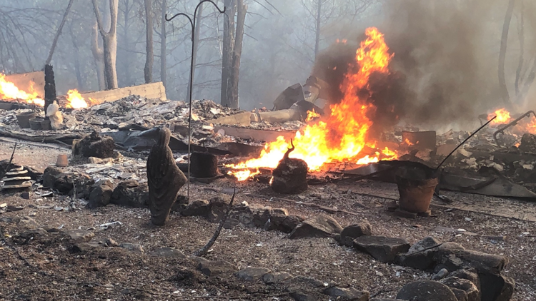
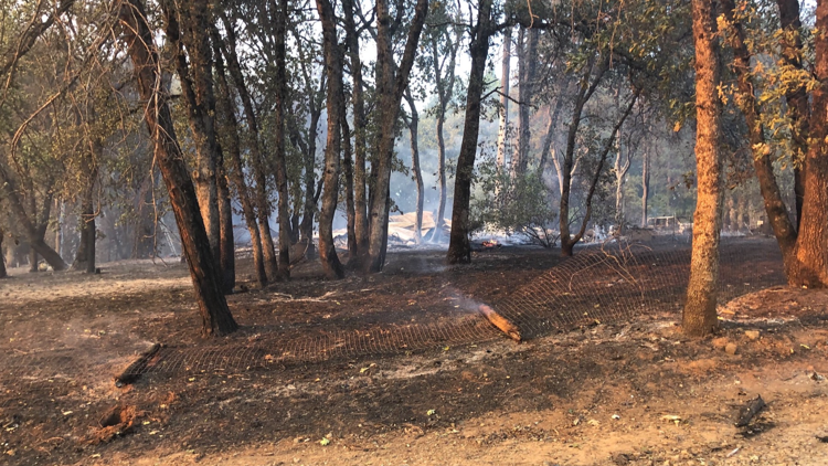
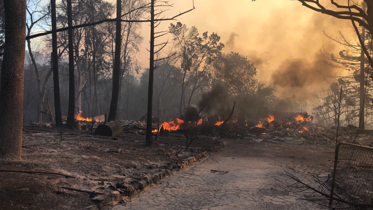
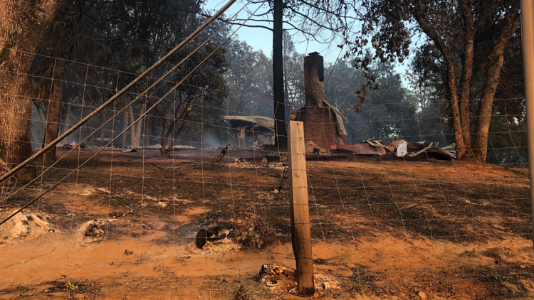
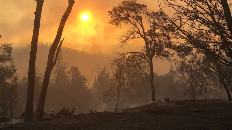
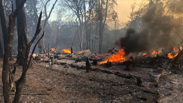
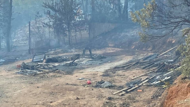
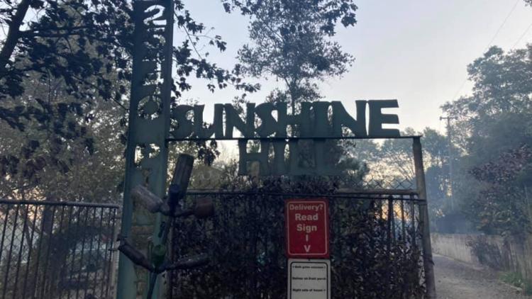
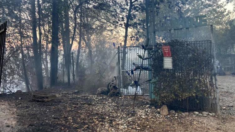
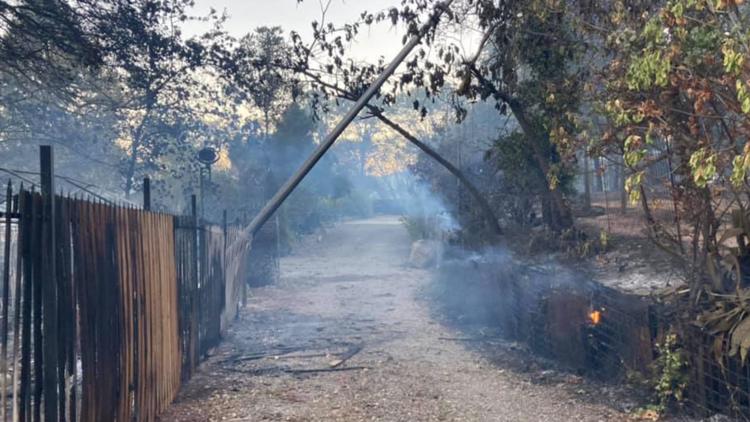
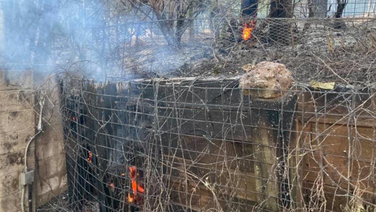
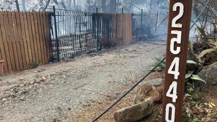
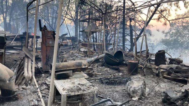
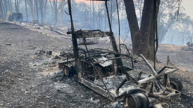
ABC10's Van Tieu captured images of some of the destruction caused by the River Fire in Colfax. So far, fire officials have not released just how many structures have been damaged or destroyed.
Gallery: Photos show destruction from River Fire in Colfax


Nevada County OES is opening the Nevada County Fairgrounds to take animals in need of evacuation due to the River Fire. They also opened temporary evacuation points at Bear River High School and Nevada Union High School.
Placer County Sheriff's Office worked with the American Red Cross and opened the Auburn Veterans Memorial Hall, which takes pets and the Gold Country Fairgrounds and Event Center, which does not take pets, in Auburn as evacuation centers.
Caltrans closed both eastbound and westbound Interstate 80 on and off ramps at Canyon Way and Highway 174 and Colfax due to the fire.
Scroll to see an evacuation map.
Caltrans announced a road closure due to the fire for Highway 174 at Orchard Springs Road (Chicago Park). All traffic is being turned, and alternate routes like SR-49, SR-20 and I-80 are advised.
Accounts to follow:
Evacuation orders:
Placer County:
- The town of Colfax and the area starting at the Bear River Campground and extending on both sides of Milk Ranch Road to Tokyana Road; West of the railroad tracks to the river; From Mt Howell Rd north to Rollins lake.
Nevada County:
- Zone NCO-E102
- All residents East of Dog Bar Road; South of Mount Olive Road and West of Mountain Lion Road; South of Leitner Drive and North of Misty Wind
- Zone NCO-E050
- Zone NCO-E103
- Zone NCO-E180
- Zone NCO-E386
- Zone NCO-E178
Evacuation warnings:
Placer County:
- Residents outside Bear River Campground evacuation order
Nevada County:
Map of evacuations:
Evacuation centers:
- Nevada County Fairgrounds for animals (11228 McCourtney Rd, Grass Valley)
- Bear River High School is a congregate shelter (11130 Magnolia Road, Grass Valley)
- Nevada Union High School is a temporary evacuation point (11761 Ridge Road, Grass Valley)
- Auburn Veterans Memorial Hall (100 East Street, Auburn)
- Takes pets
- Gold Country Fairgrounds and Event Center (209 Fairgate Road, Auburn)
- No pets
Road closures:
- I-80 eastbound and westbound on and off ramps at Canyon Way/Placer Hills Road
- I-80 eastbound and westbound on and off ramps at Highway 174 and Colfax
- Highway 174 southbound at Cedar Ridge and Orchard Springs Road
- Highway 174 northbound at Bear River Bridge
- Highway 174 at Lower Colfax Road and Bear River Bridge
Wildfire preps:
According to Cal Fire, 2020 was one of the most severe fire seasons on record as 9,917 wildfires burned 4.2 million acres. Over 9,000 structures were destroyed, and 31 people (civilians and firefighters) were killed.
California also experienced its first "Gigafire" because of the August Complex Fire, burning over 1 million acres by itself. Four of California's top five largest wildfires in state history happened in 2020.
If you live in a wildfire-prone zone, Cal Fire suggests creating a defensible space around your home. Defensible space is an area around a building in which vegetation and other debris are completely cleared. At least 100 feet is recommended.
The Department of Homeland Security suggests assembling an emergency kit that has important documents, N95 respirator masks, supplies to grab with you if you’re forced to leave at a moment’s notice. The agency also suggests signing up for local warning system notifications and know your community’s evacuation plans best to prepare yourself and your family in cases of wildfires.
Some counties use Nixle alerts to update residents on severe weather, wildfires, and other news. To sign up, visit www.nixle.com or text your zip code to 888777 to start receiving alerts.
PG&E customers can also subscribe to alerts via text, email, or phone call. If you're a PG&E customer, visit the Profile & Alerts section of your account to register.
WATCH MORE FROM ABC10: PG&E could be in more hot water | Wildfire Update
PG&E says investigators are examining a tree found on power lines in Plumas County where the Fly Fire began July 22.