SACRAMENTO, Calif. — Find the latest updates on the McKinney Fire HERE.
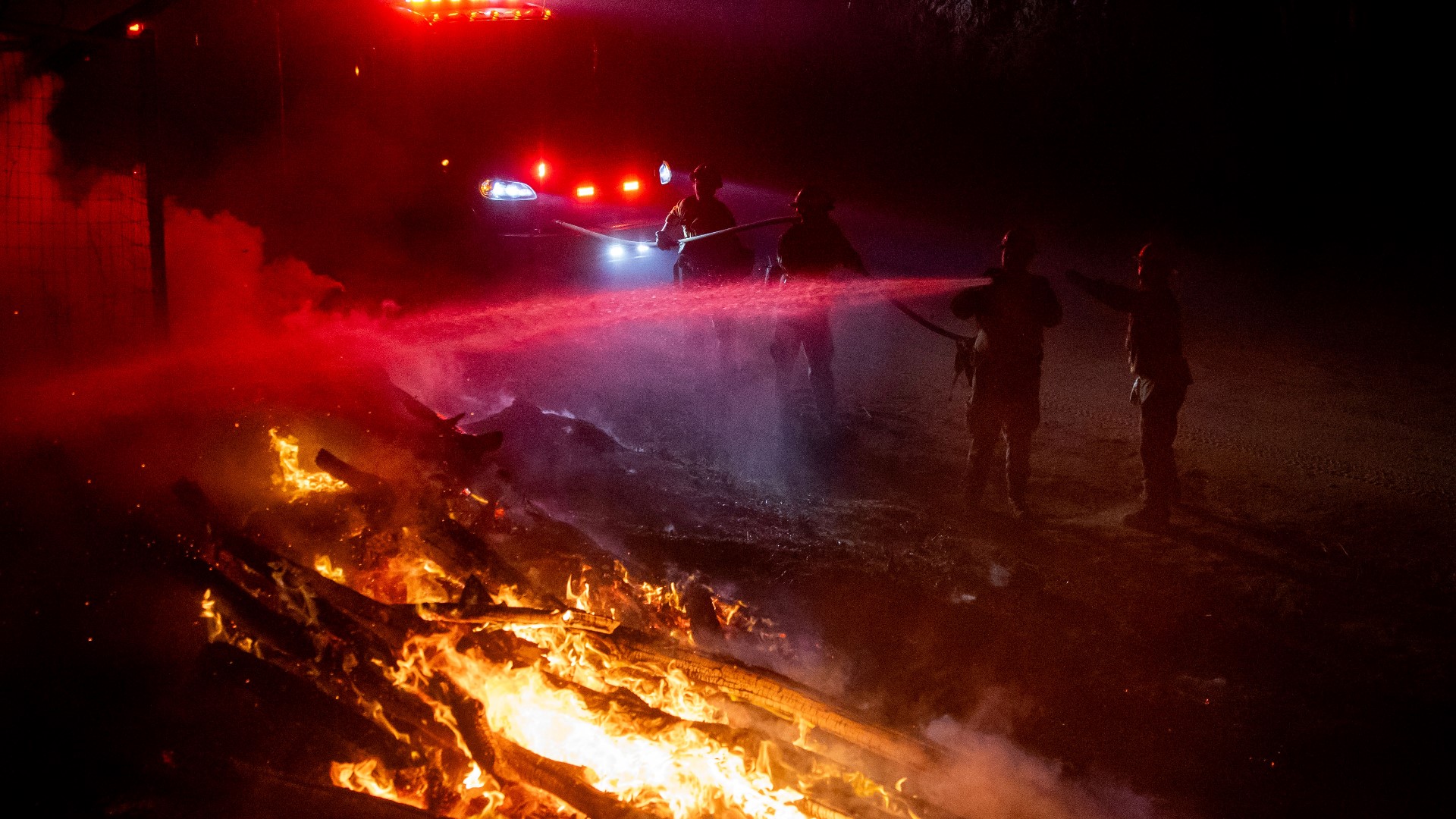
Crews battling the largest wildfire so far this year in California braced for thunderstorms and hot, windy conditions that created the potential for additional fire growth Sunday as they sought to protect remote communities.
The McKinney Fire was burning out of control in Northern California’s Klamath National Forest, with expected thunderstorms a big concern Sunday just south of the Oregon state line, said U.S. Forest Service spokesperson Adrienne Freeman.
“The fuel beds are so dry and they can just erupt from that lightning," Freeman said. “These thunder cells come with gusty erratic winds that can blow fire in every direction.”
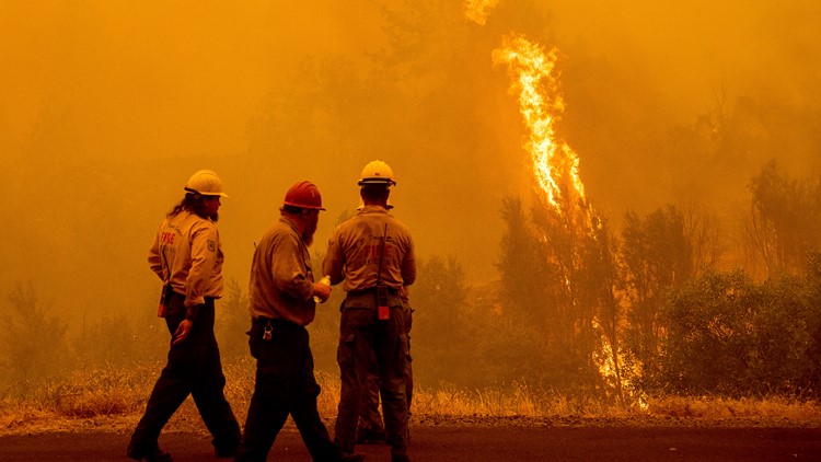
The blaze exploded in size to more than 80 square miles (207 square km) just two days after erupting in a largely unpopulated area of Siskiyou County, according to a Sunday incident report. The cause was under investigation.
The blaze torched trees along California Highway 96, and the scorched remains of a pickup truck sat in a lane of the highway. Thick smoke covered the area and flames burned through hillsides in sight of homes. The fire Sunday cast an eerie, orange-brown hue, in one neighborhood where a brick chimney, stood surrounded by rubble and scorched vehicles.
A second, smaller fire just to the west that was sparked by dry lightning Saturday threatened the tiny town of Seiad, Freeman said. About 400 structures were under threat from the two California fires. Authorities have not confirmed the extent of the damage yet, saying assessments would begin when it was safe to reach the area.
A third fire, which was on the southwest end of the McKinney blaze, prompted evacuation orders for around 500 homes Sunday, said Courtney Kreider, a spokesperson with the Siskiyou County Sheriff’s Office. The office said crews had been on the scene of the fire since late Saturday but that the fire Sunday morning “became active and escaped its containment line."
Several people in the sheriff's office have been affected by evacuation orders due to the fires “and they're still showing up to work so, (a) very dedicated crew,” she said. A deputy lost his childhood home to fire on Friday, she said.
California Gov. Gavin Newsom declared a state of emergency Saturday as the McKinney Fire intensified. The proclamation allows Newsom more flexibility to make emergency response and recovery effort decisions and access federal aid.
Evacuation Map
An evacuation map for Siskiyou County is available below.
Fire Map
This map from ESRI shows fire activity (this may take a few seconds to load).
ation map for Siskiyou County is available below.
Fire Map
This map from ESRI shows fire activity (this may take a few seconds to load).
Wildfire Preps
According to Cal Fire, the 2021 fire season started earlier than previous years, but also ended earlier, as well. January 2021 saw just under 1,200 acres burned from nearly 300 wildfires. Fires picked up in the summer when the Dixie Fire burned in five Northern California counties — Butte, Plumas, Shasta, Lassen and Tehama. The Dixie Fire started on July 13 and wasn't contained until Oct. 25, burning nearly 1 million acres. It has since become the second-largest wildfire in state history and the largest non-complex fire.
Overall, 2.5 million acres were burned in 2021 from 8,835 wildfires. Over 3,600 structures were destroyed and 3 people were killed.
If you live in a wildfire-prone zone, Cal Fire suggests creating a defensible space around your home. Defensible space is an area around a building in which vegetation and other debris are completely cleared. At least 100 feet is recommended.
The Department of Homeland Security suggests assembling an emergency kit that has important documents, N95 respirator masks, and supplies to grab with you if you’re forced to leave at a moment’s notice. The agency also suggests signing up for local warning system notifications and knowing your community’s evacuation plans best to prepare yourself and your family in cases of wildfires.
Some counties use Nixle alerts to update residents on severe weather, wildfires, and other news. To sign up, visit www.nixle.com or text your zip code to 888777 to start receiving alerts.
PG&E customers can also subscribe to alerts via text, email, or phone call. If you're a PG&E customer, visit the Profile & Alerts section of your account to register.
What questions do you have about the latest wildfires? If the wildfires impact you, what would you like to know? Text the ABC10 team at (916) 321-3310.
Watch More from ABC10: Saving Mariposa Grove Redwood Sequoia trees amid Yosemite wildfire