
FORESTHILL, Calif. — Sunday's updates are at /article/news/local/wildfire/mosquito-fire-maps-evacuations-updates-sunday/103-b0336c5f-1765-4f64-8e5e-0c66487008a3
--------------------------
Saturday's updates:
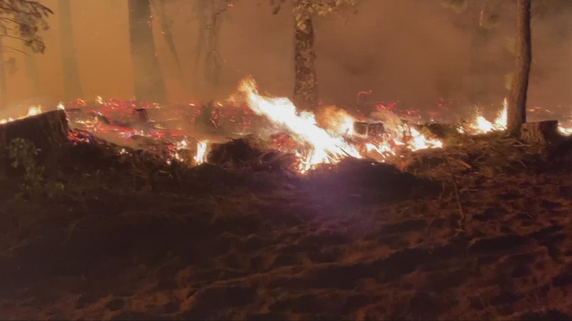
The fast-moving Mosquito Fire in the Sierra Nevada foothills continues to grow in size and threaten over 5,000 homes, while blanketing the region in smoke.
Though lower temperatures and higher humidity kept the fire from growing rapidly, erratic winds kept fire crews from getting ahead of the flames.
“We did get some reprieve with some of the weather that we’ve had, but the fuel conditions are still pretty volatile at this time,” said Ernie Villa, U.S. Forest Service Fire Management Officer, Saturday.
Cal Fire announced Saturday that the fire has burned 37,326 acres and is 0% contained. Officials say over 11,000 people have been evacuated from the area as of Saturday night.
The flames are moving north and northeast due to winds increasing in speed and changing direction. Officials say they are now opening up control lines that were previously used in other fires to try and keep the fire from spreading.
► Scroll down for evacuation maps and other fire resources.
PHOTOS: Scenes from the Mosquito Fire
David Hance slept on the porch of his mother’s Foresthill mobile home when he woke up to a glowing red sky early Wednesday morning and was ordered to evacuate.
“It was actually fricking terrifying, cause they say, ‘Oh yeah, it’s coming closer,’” he said. “It was like sunset in the middle of the night.”
Hance left behind most of his electronic gear, all his clothing and family photos and fled to Auburn, where he found his mother, Linda Hance, who said the biggest stress is wondering: “Is my house still there?”
The Mosquito Fire surpassed the Fairview Fire in size and became the largest fire in California Friday.
The Mosquito Fire’s cause remained under investigation. Pacific Gas & Electric said unspecified “electrical activity” occurred close in time to the report of the fire Tuesday.
El Dorado County Sheriff John D'Agostini issued a local emergency due to the fire and a public health emergency has been issued for the area due to the smoke.
The fire will continue to pose a threat to communities, power lines, critical infrastructure, endangered species and watersheds, Cal Fire officials said Saturday.
Stay Informed
Live Evacuation Maps
Placer County Sheriff's Office evacuation map:
El Dorado County Sheriff's Office evacuation map:
STAY INFORMED WITH ABC10:
► ABC10 In Your Inbox: Sign up now for our daily newsletter for local headlines, weather, tips and even something to make you smile.
► ABC10 On Demand: Get access to our local news, live programming and weather with the free ABC10 app for Roku and Amazon Fire TV.
Evacuation Centers
Placer County
- Evacuation centers:
- Sierra College at 5100 Sierra College Blvd. in Rocklin
- Temporary Location: Auburn Regional Park Gym at 3770 Richardson Dr. in Auburn for parking (for RV/Car), bathrooms and shower access ONLY (no hookups/sleeping spaces/etc.)
- Green Valley Community Church at 3500 Missouri Flat Rd. in Placerville
- For large and small animals: Nevada County Fairgrounds on 11228 McCourtney Road, in Grass Valley. Check-in at Gate 8
- No birds/chickens due to avian flu.
El Dorado County
- Evacuation centers:
- Cameron Park Community Services District, 2502 Country Club Drive, Cameron Park
- Green Valley Community Church, 3500 Missouri Flat Rd, Placerville
- El Dorado County Animal Shelter 6435 Capitol Avenue, Diamond Springs
- Rancho Murieta Equestrian Center, 7200 Lone Pine Dr, Rancho Murieta
- Must call first: (916) 985-7334
- Large animals only: Flying M Ranch, 82 Carefree Way, Oroville
Map
This map from the National Interagency Fire Center shows fire activity (this may take a few seconds to load):
RELATED: Smoke impacting foothill regions and valley overnight into tomorrow as Mosquito Fire expands
Road Closures
For a Waze map with current road closures, click here.
WATCH MORE: How crews planned to battle the fire Friday night: