
SACRAMENTO, Calif — If you live in a fire-prone area, you likely already know that is the case. You may have fire insurance, a plan in place to evacuate or you may be learning it's time to figure it out.
History has proven, really any neighborhood could see a wildfire come close or devastate a town like what happened when the Camp Fire tore through Paradise, Concow and Magalia.
READ ALSO: Redding firefighter says 'you can rebuild a house' but 'we lost a brother' | Carr Fire 1 year later
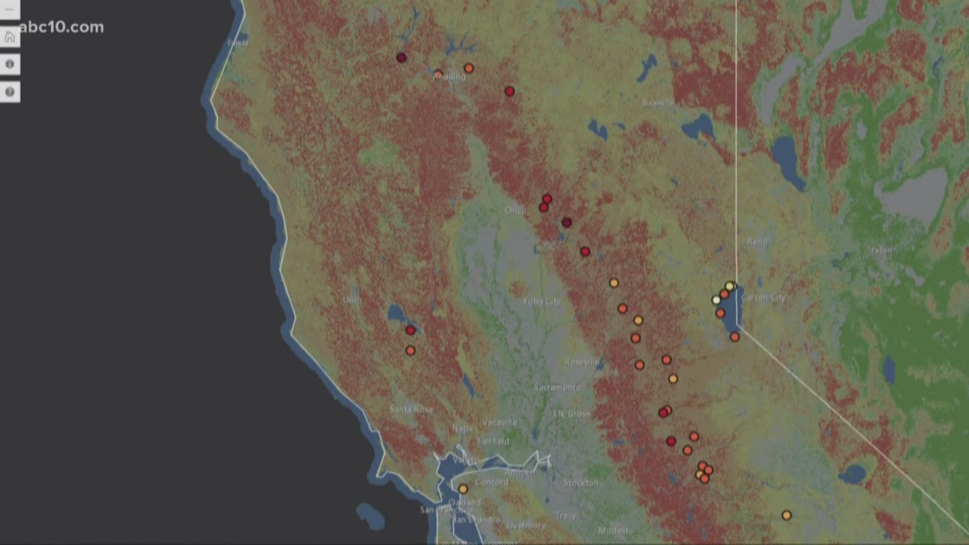
To help Californians understand their risk of becoming a victim to a wildfire, a nonprofit called Direct Relief created a social vulnerability risk map to highlight a handful of towns and cities at risk for wildfires. Their data is all based on income, mobility and age.
In California, there are nine communities with a "very high" or "high" social vulnerability risk. Berry Creek in Butte County is one example. It has a very high vulnerability score. This is due to several factors, including poverty with 23 percent of people living in poverty, 26 percent of the population older than 65-years-old, and 22 percent of the population disabled.
These data points are relevant, according to Direct Relief, because many of the people who died in the Camp Fire were elderly and many were disabled. They did not have any means of escaping the fire.
"We started thinking 'Well, where else in California is like that?' There's a lot of other places in the state that fit the same profile of Paradise and that we as a humanitarian organization need to be very concerned about in terms of preparing for what the next Paradise could look like," said Andrew Schroeder, director of research and analysis for Direct Relief.
Direct Relief wants to make sure people and communities are aware the risk is high, not only for many of these locations but for who makes up the community.
To check out the map for yourself, click here.
Continue the conversation with Madison on Facebook.