
MARKLEEVILLE, Calif. —
(Editor's Note: Monday's Tamarack fire updates are at /article/news/local/wildfire/tamarack-fire-updates/103-17253510-fde7-4466-8cc0-637f0cc26b77 )
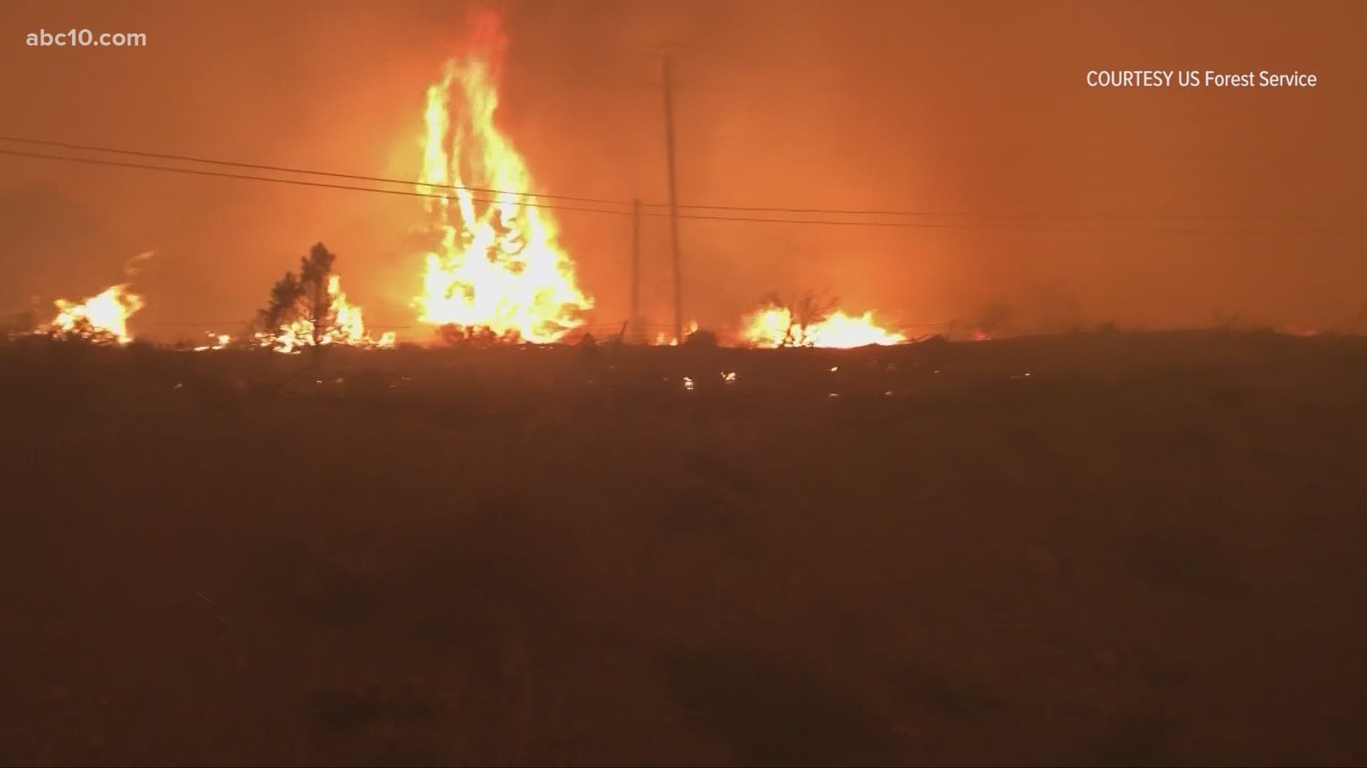
Gusty winds, dry fuels and low humidity has caused the Tamarack Fire to explode to 25,000 acres, according to the Tamarack Fire Facebook page, which is operated by Alpine County.
Despite the figure from Alpine County, the fire is estimated by the United States Forest Service to be around 18,299 acres, however, they expect more accurate figures on the fire's location and size overnight.
Nate Leising, of the US Forest Service, said the fire is moving east along Diamond Valley Road.
On Sunday night, firefighters worked the west flank of the fire to protect buildings and put in fire line to from Highway 89 east to Diamond Valley Road to slow fire spread.
Officials said crews secured the area around Markleeville and will continue mop up on Monday to douse any leftover hot spots. Crews will also be putting in containment line and dousing hot spots around the Carson River Ranch area and Shay Creek and Grover Hot Springs areas.
According to the Tamarack Fire Facebook page, six structures have been destroyed.
Accounts to follow:
- Alpine County Sheriff
- U.S. Forest Service - Humboldt-Toiyabe National Forest
- Caltrans District 10
- Tamarack Fire, operated by Alpine County
Mandatory evacuations
The following locations and their surrounding areas are under a mandatory evacuation, according to the United State's Forest Service:
- Markleeville
- Grover Hot Springs and campground area
- Shay Creek
- Marklee Village
- Alpine Village
- Woodfords
- East Fork Resort and the community of Hung A Lel Ti
- Blue Lakes Road
Evacuation Warnings
- The Mesa area
Evacuation Center
- Douglas County Community Senior Center in Gardnerville, Nevada
Road Closures
- Highway 89 is closed at the intersection of Highway 4 and 89
- Pacific Crest Trail is closed between Carson Pass (Highway 88) and Ebbetts Pass (Highway 4).
Wildfire Map
WILDFIRE PREPS
According to Cal Fire, 2020 was one of the most severe fire seasons on record as 9,917 wildfires burned 4.2 million acres. Over 9,000 structures were destroyed, and 31 people (civilians and firefighters) were killed.
California also experienced its first "Gigafire" because of the August Complex Fire, burning over 1 million acres by itself. Four of California's top five largest wildfires in state history happened in 2020.
If you live in a wildfire-prone zone, Cal Fire suggests creating a defensible space around your home. Defensible space is an area around a building in which vegetation and other debris are completely cleared. At least 100 feet is recommended.
The Department of Homeland Security suggests assembling an emergency kit that has important documents, N95 respirator masks, supplies to grab with you if you’re forced to leave at a moment’s notice. The agency also suggests signing up for local warning system notifications and know your community’s evacuation plans best to prepare yourself and your family in cases of wildfires.
Some counties use Nixle alerts to update residents on severe weather, wildfires, and other news. To sign up, visit www.nixle.com or text your zip code to 888777 to start receiving alerts.
PG&E customers can also subscribe to alerts via text, email, or phone call. If you're a PG&E customer, visit the Profile & Alerts section of your account to register.


