
8:00 p.m. update:
A Shasta County wildfire that sparked Sunday afternoon has exploded in size to 31,237 acres.
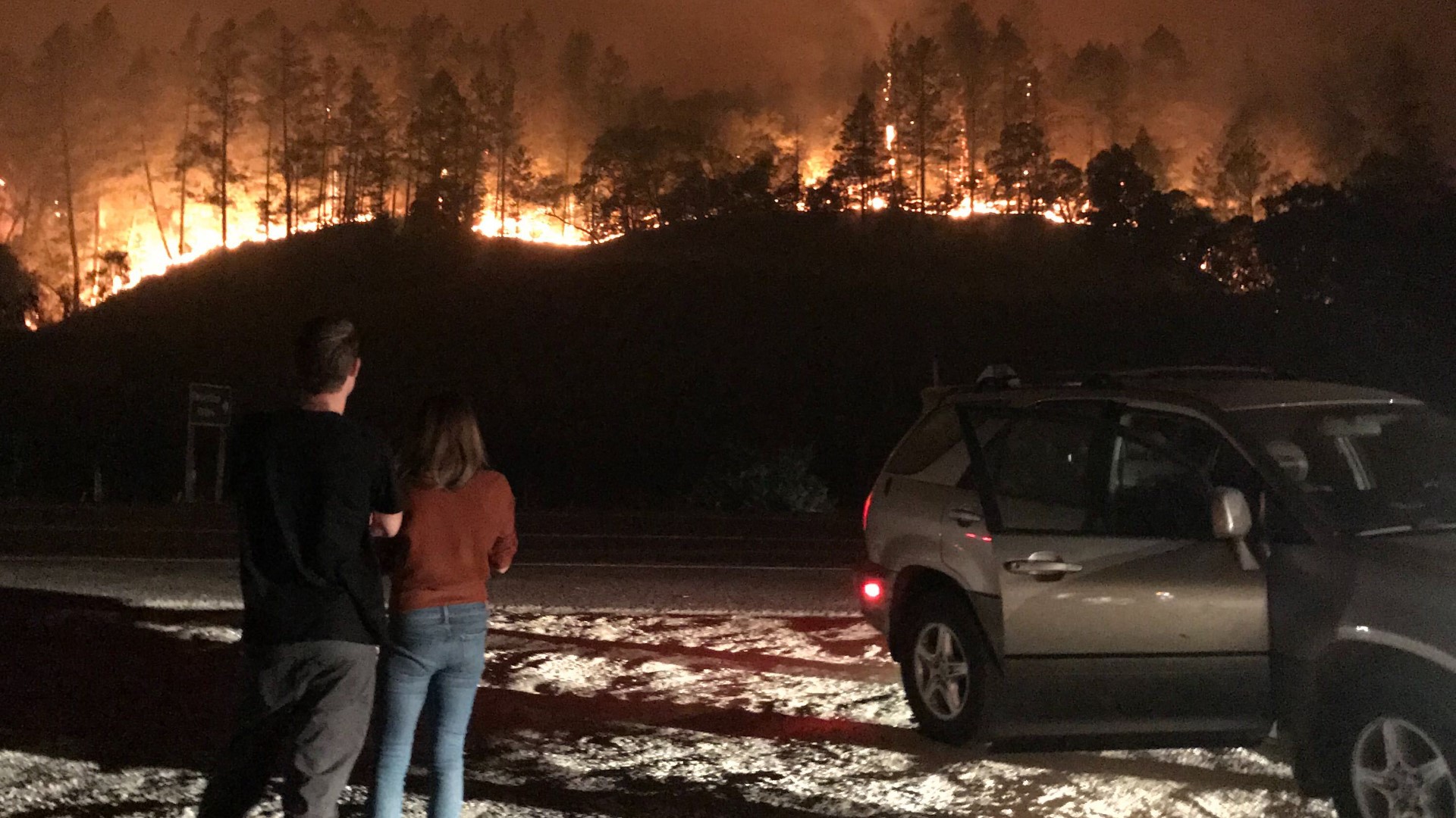
Officials confirmed that three people have died in the Zogg Fire while at least 1,250 have been forced from their homes due to evacuations. 1,538 structures are threatened by the fire.
There are continued threats to the communities of Igo, Ono, Happy Valley, Platina, and other infrastructure in the area.
Cal Fire also announced more evacuations as the fire continues to grow with no containment. The latest Shasta County evacuation orders include everyone from the fire line east to the intersection of Placer Road and Texas Springs Road, which includes all homes on the south and north side of Place Road to Texas Springs Road.
During a Monday press conference, Sheriff Eric Magrini had warned that the number of people evacuated could grow as the fire expands.
As of 4 p.m., the fire was burning out of Clear Creek and into the Carr Fire burn scar. Cal Fire Operation Sections Chief Chris Waters said the fire was moving south toward Highway 36 as you move along Cottonwood Creek and toward the Tehama County line. Fire officials said the fire has also been getting into trees and spotting up to a mile away.
With winds posing a challenge for fire crews, their current priorities are with safety and evacuations.
"Until this red flag warnings and these winds start to dissipate, we're not going to make a lot of headway on suppression efforts other than around the communities, subdivisions, and then help support the evacuation efforts," said Chief Waters.
4:45 p.m. update:
Three people have died due to the Zogg Fire in Shasta County, according to Sheriff Eric Magrini. Magrini didn't offer any additional details on those who died.
Magrini said the fire has pushed about 1,250 people out of their homes due to evacuations, but with the fire rapidly expanding, those numbers could grow.
Cal Fire Operation Sections Chief Chris Waters said there is high intensity fire behavior on all sides of the blaze as it continues to burn out of Clear Creek and into the Carr Fire burn scar.
He said the fire continues to move south toward Highway 36 as you move along Cottonwood Creek and toward the Tehama County line. Fire officials said the fire has also been getting into trees and spotting up to a mile away.
With winds posing a challenge for fire crews, their current priorities are with safety and evacuations.
"Until this red flag warnings and these winds start to dissipate, we're not going to make a lot of headway on suppression efforts other than around the communities, subdivisions, and then help support the evacuation efforts," said Chief Waters.
4 p.m. update:
Officials with the Cal Fire Shasta-Trinity Unit (Cal Fire SHU) are giving an update on the Zogg Fire burning in Shasta County.
2 p.m. update:
Cal Fire SHU will provide an update on the Zogg Fire at 4:00 p.m., available to watch on the unit's Facebook page. The current status of the fire will be discussed, and officials will be able to answer questions.
The list of traffic control points has been updated:
- State Road-36 at Bowman Road
- Diggins Road at Placer Road
- Gaspoint Road at Foster Road
- Clear Creek Road at Cloverdale Road
10:00 a.m. update:
A new Incident Management Team [IMT] has been deployed to fight the Zogg Fire. IMT 3 is now activated in Shasta County to battle the blaze.
A separate IMT team was also activated for the growing Glass Fire in Sonoma and Napa County. IMT are usually comprised of local, state, and Federal Type 1 first responders.
Original story:
The Zogg Fire in Shasta County has doubled in acres since the Cal Fire Shasta Trinity Unit last provided updates on Sunday night. The fire now stands at 15,000 acres and zero containment.
Cal Fire SHU initially responded to the fire at Zogg Mine Road and Horse Canyon Way where it spread quickly. Firefighters said the blaze was initially at 50 acres before updating within the hour to note that it reached 400 acres. As of 7:30 p.m. on Sunday, it reached 7,000 acres.
Several mandatory evacuation orders have been issued, including for all areas south of South Fork Road and Zogg Mine Road, south along Gas Point corridor including all residents along Gas Point Road to Foster Drive, Platina Road west to Tehama County line.
Residents should evacuate eastbound on Highway 36 to a collection point at Holiday Market on Gas Point Road Cottonwood, according to Cal Fire.
An updated list of road closure has also been provided:
- Clear Creek Road and Cloverdale Road
- Placer Road and Muletown Road
- Gaspoint Road and Foster Road
- Highway 36 at Bowman Road
MAPS
WILDFIRE PREPS
According to Cal Fire, in 2019, California wildfires burned just under 260,000 acres from 7,860 incidents. Over 700 structures were damaged or destroyed and three people were killed. This follower two years of some of the “deadliest and most destructive wildfires” in California history.
If you live in a wildfire-prone zone, Cal Fire suggests creating a defensible space around your home. Defensible space is an area around a building in which vegetation and other debris are completely cleared. At least 100 feet is recommended.
The Department of Homeland Security suggests assembling an emergency kit that has important documents, N95 respirator masks, supplies to grab with you if you’re forced to leave at a moment’s notice. The agency also suggests signing up for local warning system notifications and know your community’s evacuation plans to best prepare yourself and your family in cases of wildfires.