
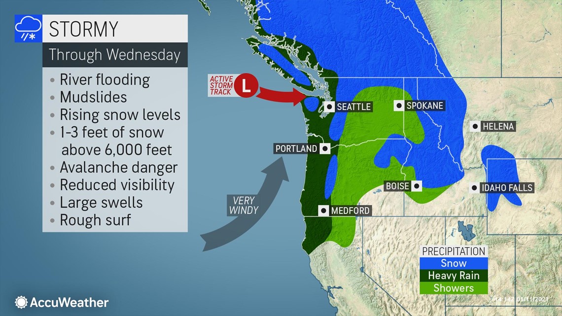
A short series of potent storms -- loaded with moisture stemming all the way from the central Pacific -- is forecast to pound Washington, Oregon, British Columbia, and parts of Northern California and Idaho with enough rain at low elevations to raise the risk of flooding. Meanwhile, snow will pile up over the high country into Wednesday.
A long plume of moisture, or an atmospheric river, was visible Monday morning in satellite imagery over the Pacific Ocean and originated from just north of Hawaii. When a pattern such as this sets up, heavy rain and heavy mountain snow often result along the West Coast.
Freezing levels will be low enough early on Monday to lead to snow, a wintry mix and slippery travel over the passes in the Cascades.
"The storms will be associated a great deal of moisture and warmer air that will cause snow levels to rise and lead to melting snow at intermediate elevations in the Olympics, Cascades and Coast Range," according to AccuWeather Senior Meteorologist Courtney Travis.
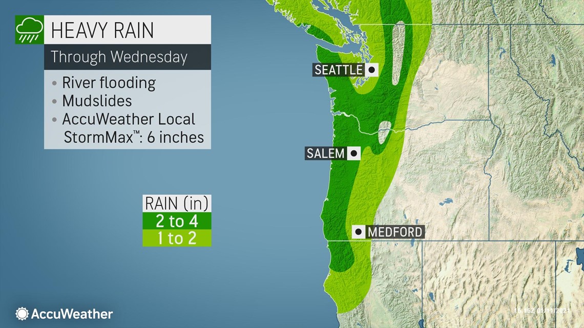
"The storm parade is predicted to unload a general 1-2 inches of rain along the coast at lower elevations, with 2-4 inches anticipated at intermediate elevations between 2,000 and 4,000 feet into early Wednesday morning," Travis said.
An AccuWeather Local StormMax™ of 6 inches is forecast.

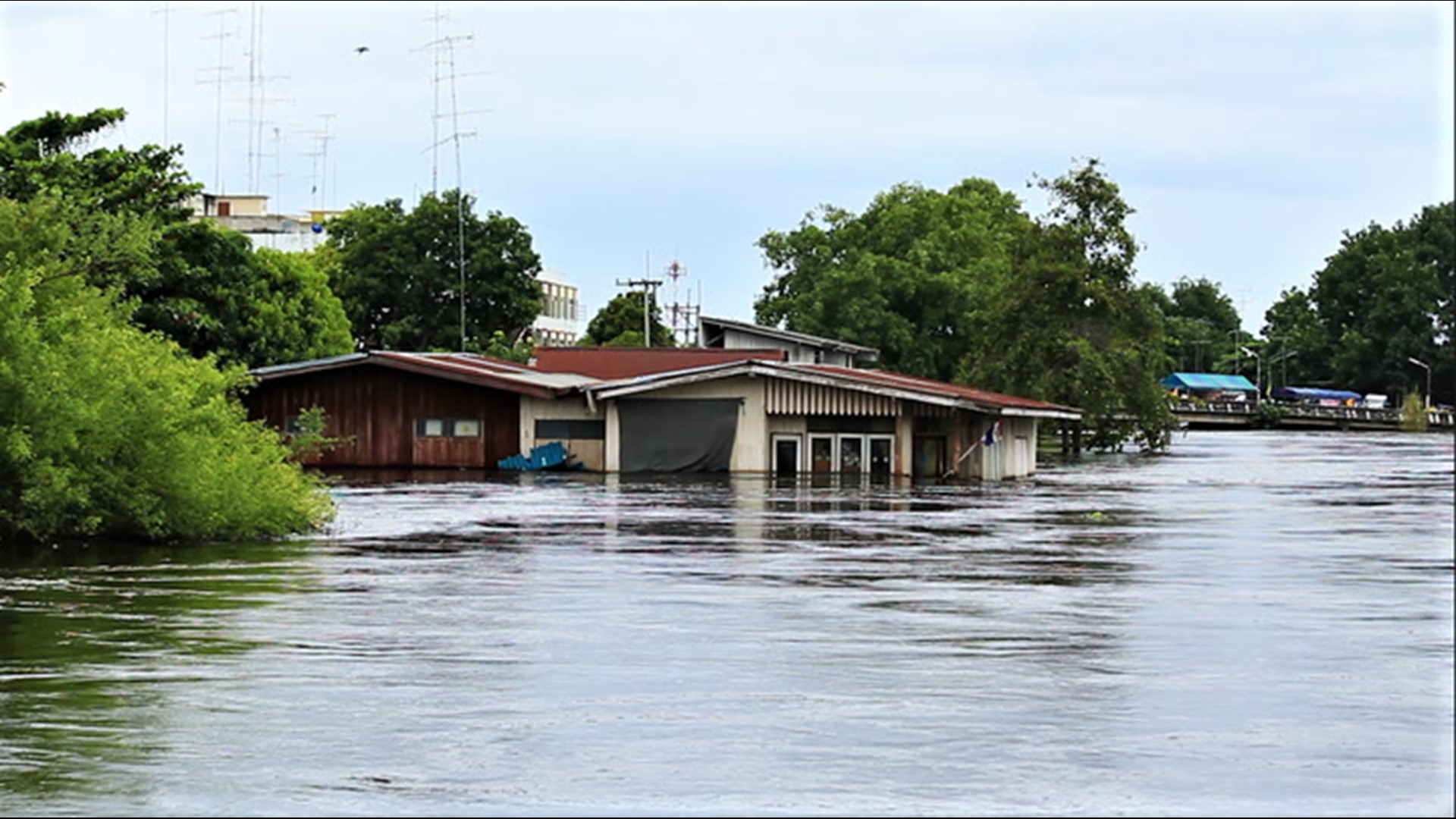
Even though the anticipated rain and high-elevation snow may not be as intense as some atmospheric river setups in the past, it has the potential to lead to significant problems.
To some extent, snow cover over the intermediate elevations will absorb the rainfall, but in some cases, the combination of rain and melting snow at intermediate elevations can release enough water into small streams and the short-run rivers flowing out of the Cascades and Olympics to lead to flooding. Water locked up in the snow can have the effect of unleashing an additional 1-3 inches of rain. Hence, the concern for flooding.

"The combination of rain and saturated soil may also lead to mudslides. In areas that were hit by wildfires in the past few years, and especially this past season, the risk will be greater," Travis said.
AccuWeather meteorologists warned about another danger that could arise from the stormy weather this week. Wet snow falling from the storms this week and milder conditions could cause snowpack over the high country to become unstable enough to lead to avalanches.
From mid- to late-week, the weather pattern will change along the Pacific coast.

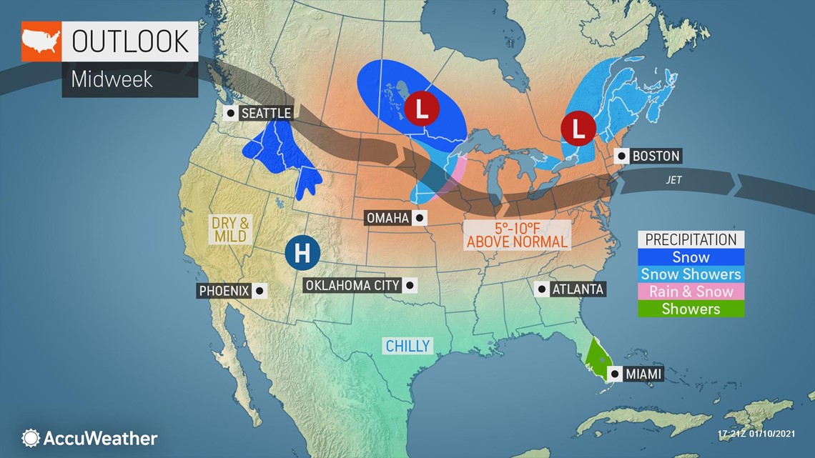
A northward bulge in the jet stream is forecast to develop that should force Pacific storms well to the north toward Alaska late this week to late next week and perhaps into the latter part of January. The pattern may allow only weak systems to bring spotty showers to the Northwest on a couple of occasions.
The same pattern will result in temperatures reaching 8-15 degrees Fahrenheit above average from the middle of the week into next week. Typical highs range from the middle to upper 40s F in coastal Washington to the middle 30s in eastern Washington to the 20s and teens over the high country of the northern Cascades.
As warmth will build west of the Rockies, cold air will gradually overtake areas farther east across much of North America during the middle to latter part of January.