
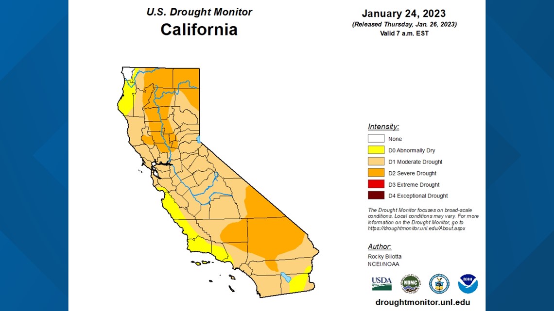
SACRAMENTO, Calif. — Although the last 10 days have been dry, the drought monitor continues to show improvement in California.
A weak, quick-hitting system will drop down from Canada on Sunday. The system is very much moisture-parched and won't bring much rain or snow to Northern California. Cold air will filter in on Sunday, as well, with temperatures not expected to escape the 40s for much of the valley.
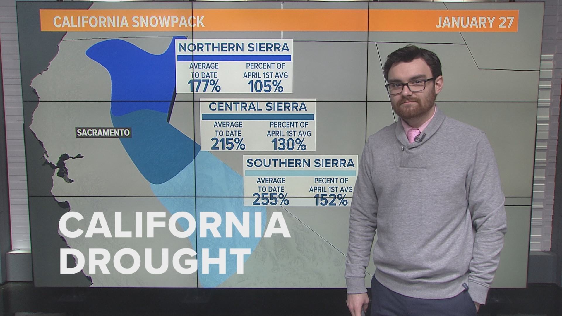
The Sunday storm likely won't affect the drought monitor, with less than a tenth of an inch of rain expected in the valley with 4-6 inches of snow likely in the mountains. The latest update dropped much of the Central Valley out of severe drought and into moderate drought along with placing much of the coast in the "abnormally dry" category. The Drought Score Index is 212, the lowest it has been since November 2020

California has one of the most volatile hydrologic systems in the world, shifting from drought to flood in a matter of weeks. However, new tools are helping officials and water managers better control California's waters.
One of these tools relates to NASA's SWOT (surface water and ocean topography) mission.
"We built a new piece of extreme engineering to observe the world's water. So we'll see all of the about 90% of the water that is covering the earth. So we're talking about surface water, oceans, rivers, lakes, reservoirs,” said Dr. Cedric David, research scientist at NASA's Jet Propulsion Laboratory in Pasadena.
The mission is a collaboration between the United States, France, the United Kingdom and Canada. The satellite was launched on Dec. 16 from Vandenburg Space Force Base and is currently orbiting Earth.
The satellite is fixed with a revolutionary instrument, know as KaRIn (Ka-band radar interferometer).
"KaRIn is really special, because it allows us to take radar pictures of where the water is and how high it is. We're using radar technology that is specifically designed so that it bounces on water and doesn't bounce on anything else," said Dr. David. "When we're flying a spacecraft, we send the signal, it bounces on top of the water surface and comes back, so we know where the water is we know how high it is by measuring the time that it takes to do the round trip between the the satellite and Earth."
The SWOT measurements will be 10 times the resolution of current satellite imagery, allowing for precise mapping of water levels around the world. This includes the oceans as well, which will allow for better modeling of sea level rise and improved global climate and weather models.
Water agencies in California, such as the Department of Water Resources and Bureau of Reclamation, will be able to use the data provided from SWOT to better manage water across the state.
"It's gonna be incredible to just see those first measurements when they come. We'll be looking at the breathing of the Earth's arteries and lakes and reservoirs, like we've never seen them before, including California. It is going to be really fun," said David.
WATCH ALSO:


