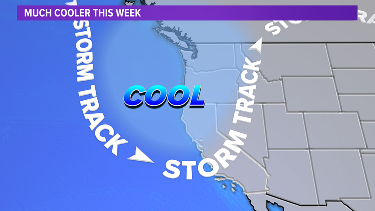
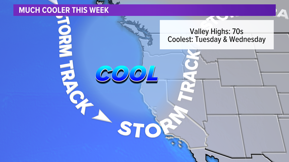
SACRAMENTO, Calif. — A big change in our weather pattern is expected this week as we move from record highs to unseasonably cool temperatures.
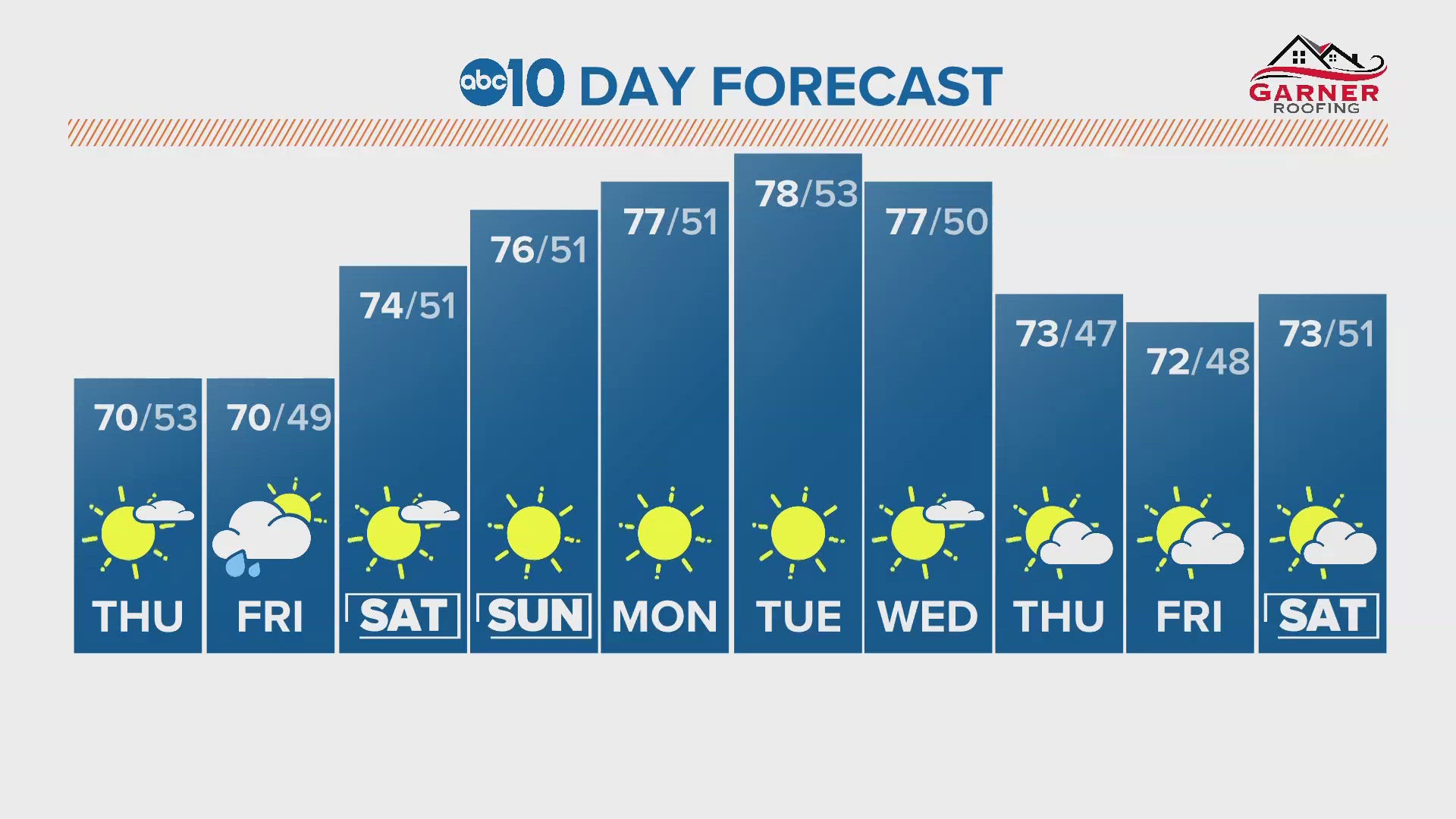
After a week-long stretch of well-above average temperatures, a cool weather system moves into California with highs expected to drop to 5 to 15 degrees below average. This will be a complete flip flop of conditions from last week when highs ran 5 to 15 degrees above average as the area recorded some highs.
A low will drop south along the coast, bringing a cooler air mass. The coolest days will be Tuesday and Wednesday, where highs will only be in the 70s. Overnight lows will drop to the upper 40s.

Occasional breezy conditions are expected, with gusts from 20 mph to 30 mph through the middle of the week. Those winds are elevating fire danger in the Sierra through Monday and a Red Flag Warning is in effect for breezy winds and drying fuel. Rapid fire spread is possible if there is a spark.
Highs will warm back to near normal temperatures by the end of the week, but another weather system will bring a slight chance of showers late Friday through Saturday.
READ MORE FROM ABC10:
WATCH ALSO: