SACRAMENTO, Calif. — A dangerous warming pattern is developing across California.
A high pressure ridge is building, which will bring well above average highs stretching through the Sacramento and San Joaquin Valley, surrounding Foothills and even parts of the San Francisco Bay Area.
An Excessive Heat Warning begins Friday and will last through Monday. Afternoon highs will warm to 100° to 115° between 4 p.m. to 6 p.m. each day. The hottest days are expected Saturday and Sunday with highs near 110° to 115°. Those temperatures will come close to breaking records.

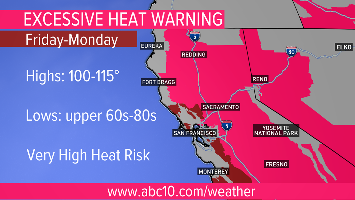
Lows will only fall to the upper 60s to low 80s, which won't allow much relief from the daytime heat. High to very high heat risk is possible and brings increased chances for heat-related illness, especially for those working outdoors.
To avoid heat-related issues:
- Drink extra water
- Avoid outdoor strenuous activities from 10 a.m. to 6 p.m.
- Help elderly, kids and pets stay cool
- Plan to be in air-conditioned buildings
Fire danger also increases with the higher temperatures and occasional gusty winds. A Red Flag Warning has been issued for Thursday afternoon and evening for parts of the Sierra.
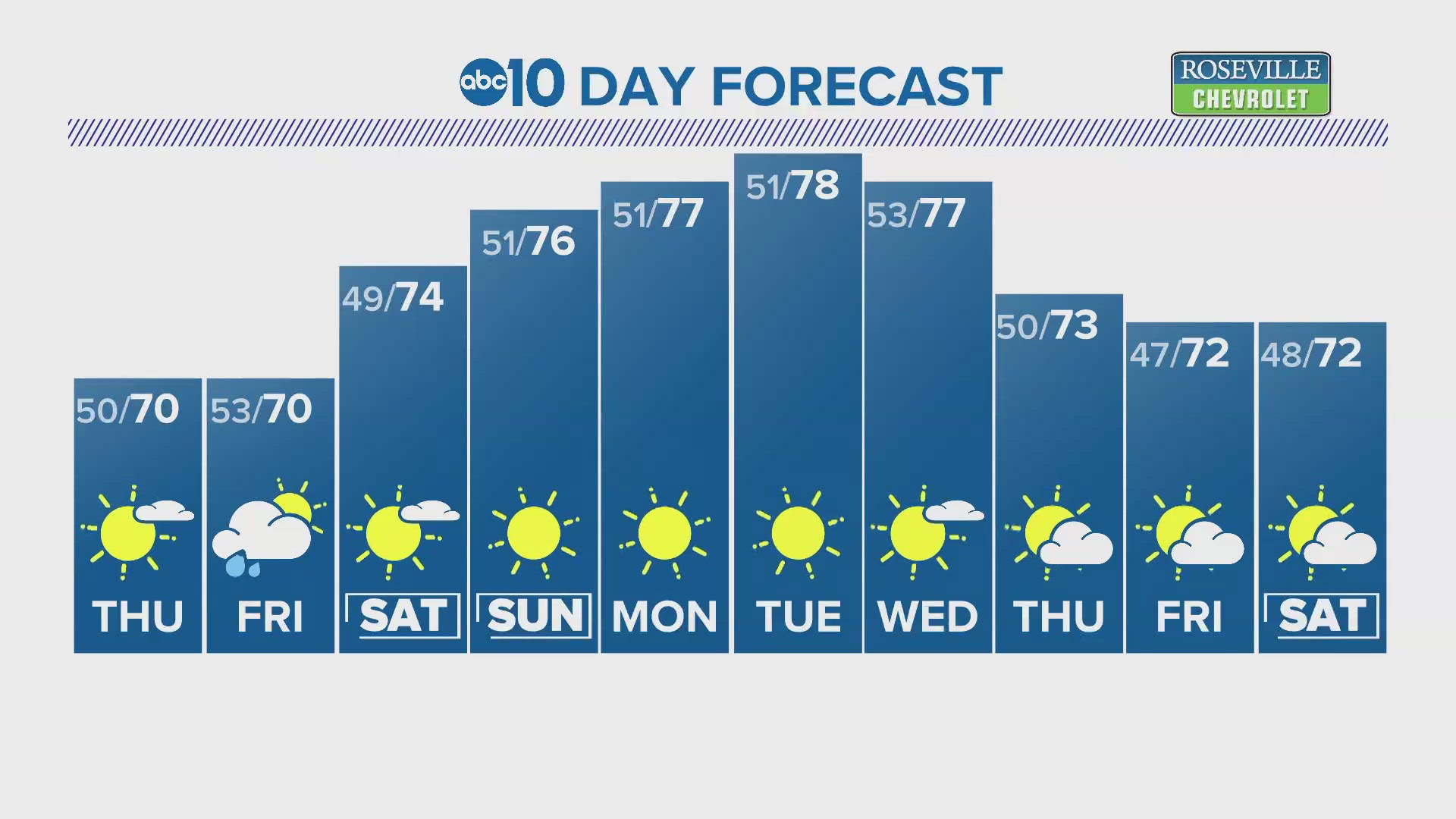
Cooler weather is expected by the middle of next week with highs dropping back to near average.