
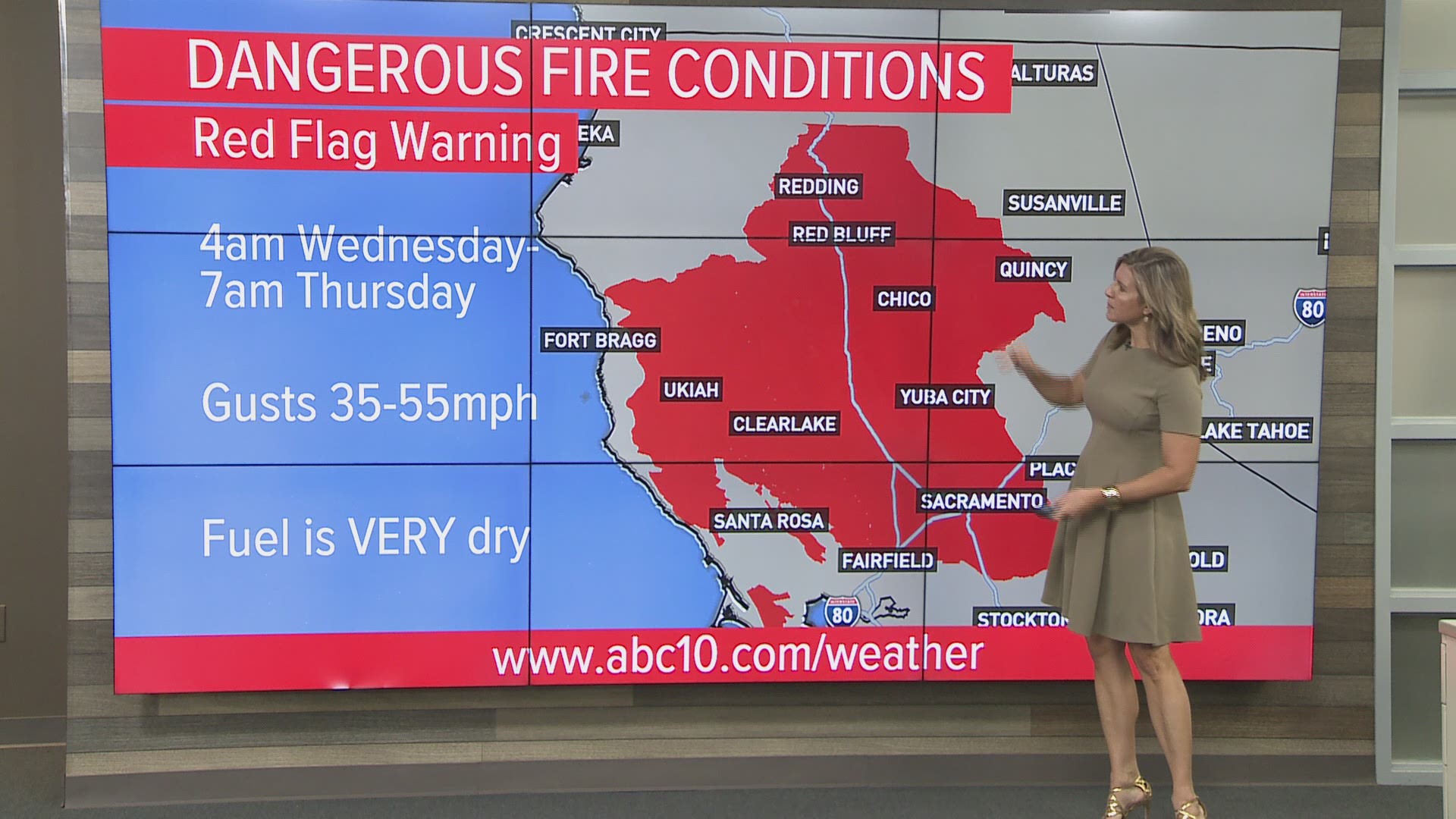
SACRAMENTO, Calif. — Gusty winds will bring an elevated fire danger late Tuesday through early Thursday for the Sacramento Valley and surrounding foothills as well as the Coastal Mountain and valley locations.
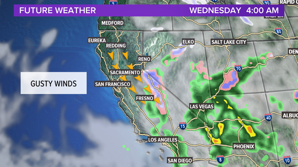
An approaching storm system will slide along the east side of the state and then head into southern California.
The Sacramento and San Joaquin Valleys will stay dry with this storm. The Sierra foothills and mountains though could see some showers late Tuesday through Wednesday. The snow level will be near 7,000 feet. A Winter Weather Advisory is in effect above 7,500 feet.
Once this system moves south, gusty winds develop prompting a Fire Weather Watch late Tuesday through early Thursday. North to northeast winds will be 15-35 m.ph. with gusts 35-50 m.p.h. in some exposed ridges.

Dry, north winds will lower humidity to the teens and 20s with very little overnight recovery.
During the Red Flag Warning time frame, gusty winds have the potential to spread fires quickly. Fuel is extremely dry right now, bringing additional concern fires will spread rapidly. A spark could very easily burn out of control before firefighters have the chance to intervene.
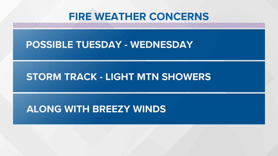
FIRE WEATHER CONCERNS
- Possible Tuesday through Wednesday
- Storm Track: Light mountain showers
- Breezy winds

Continue the conversation with Monica on Facebook.
FREE ABC10 APP:


►Stay In the Know! Sign up now for ABC10's Daily Blend Newsletter