SACRAMENTO, Calif. — Summer-like temperatures are back in the forecast with a strong ridge of high pressure dominating the West Coast.
Many records fell in San Francisco on Monday.
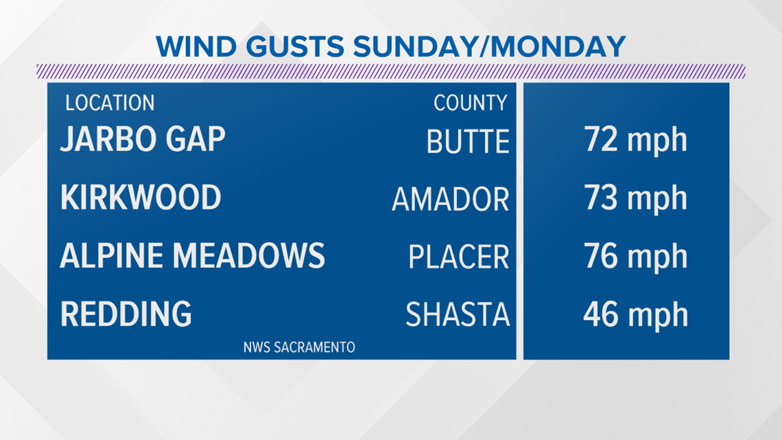
This all comes on the heels of a dangerous wind event that brought critical fire weather. Wind gusts were over 70 mph. in wind prone canyons and drainages.
These winds were the result of a departing low-pressure system and the high setting up over the interior West. Those dangerous winds lowered the humidity and allowed rapid warming.
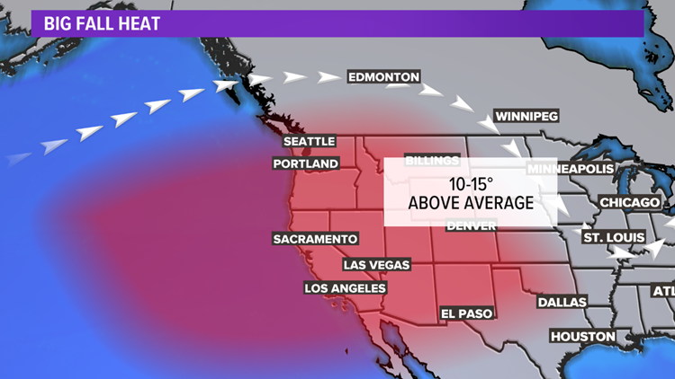
Now the West braces for days of temperatures 10-15 degree above average.

Records this time of year in the Southern Sacramento and Northern San Joaquin Valleys are close to 100. Average highs are closer to the mid-80s.
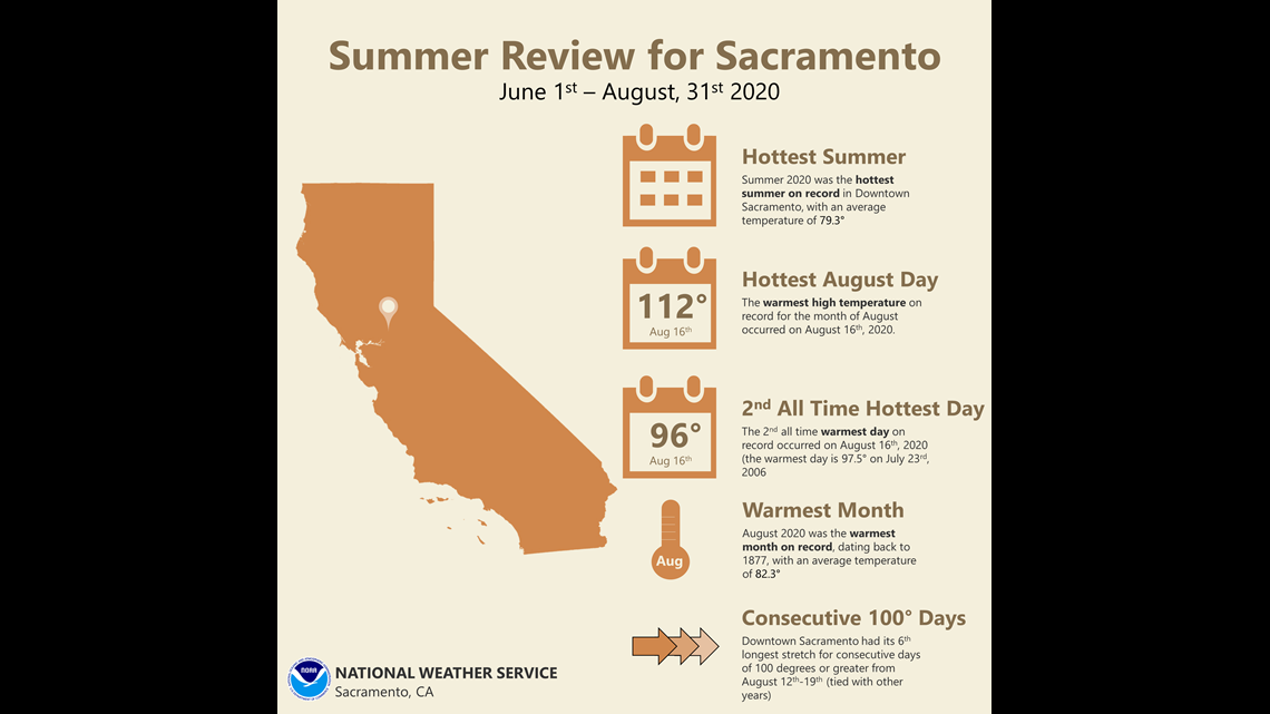
Heat has been a big story throughout the summer. Downtown Sacramento recorded its warmest summer with an average temperature of 79.3 degrees. August was also a record-setter. The temperature reached 112 degrees, making it the warmest high in the month of August.
Additionally, it was the warmest month on record, dating back to 1877 with an average temperature of 82.3 degrees.

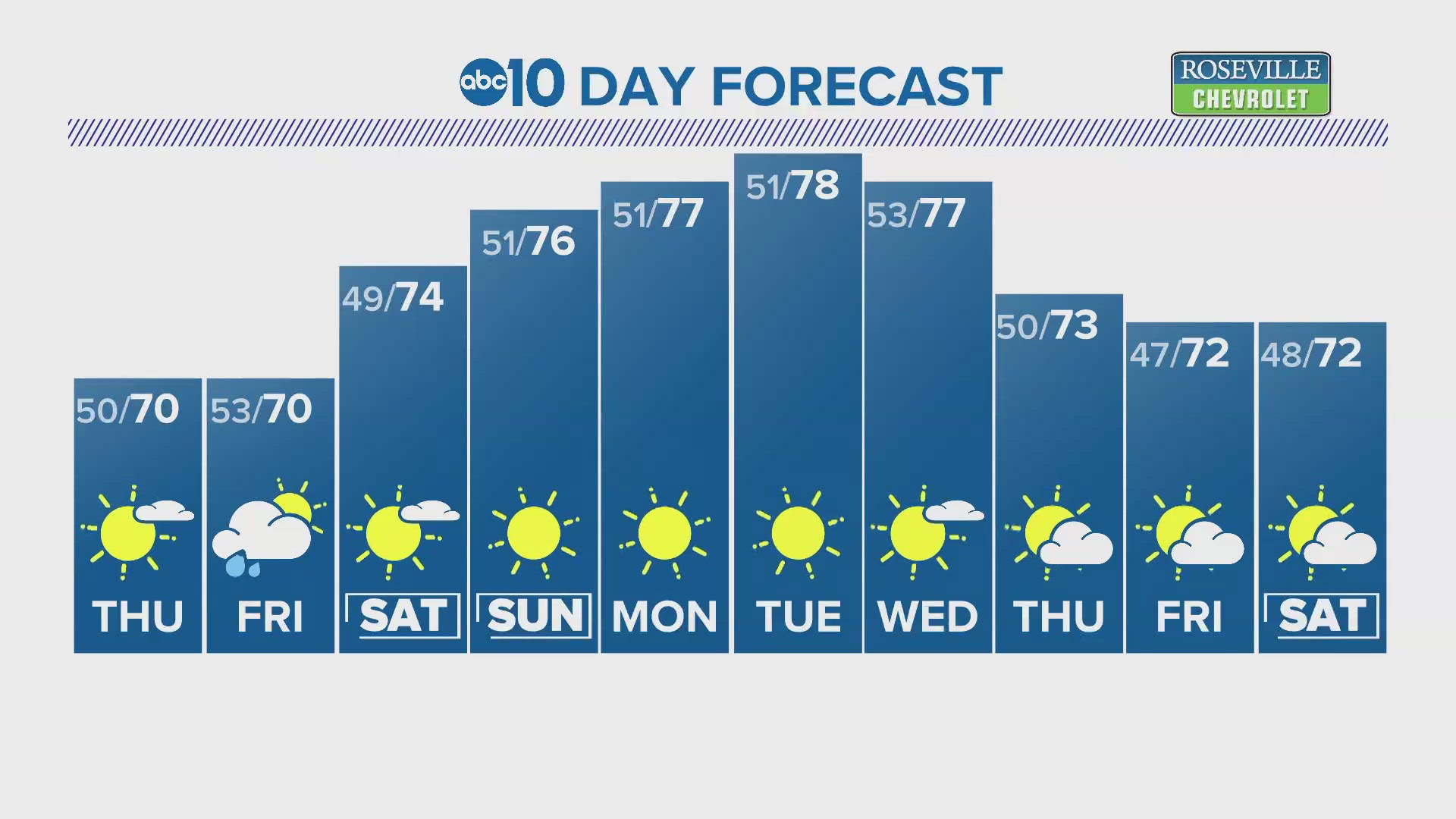
The big question then is, when will all this heat end and fall/winter begin? Cooler weather is forecasted by the end of the weekend with highs dropping back to near average by next week.
Continue the conversation with Monica on Facebook.