
SACRAMENTO, Calif — A Red Flag Warning has been issued for the High Sierra by the National Weather Service for Monday afternoon until about 9:00 pm.
Although the warning is for a three to five hour period, windy conditions will still be a concern for everyone on Monday, as well as Sunday.
Valley winds will only be about 5 to 10 mph on Sunday, but they will increase off the Delta to as high as 25 mph flowing into the San Joaquin Valley and parts of Sacramento by the early evening hours.
Areas of concern are primarily the Plumas and Lassen Forests along with the Tahoe Basin. The Red Flag Warning carries into much of Nevada, along with the Sierra.
Dry weather and strong winds will make it possible for any spark to spread and grow rapidly into a major fire.

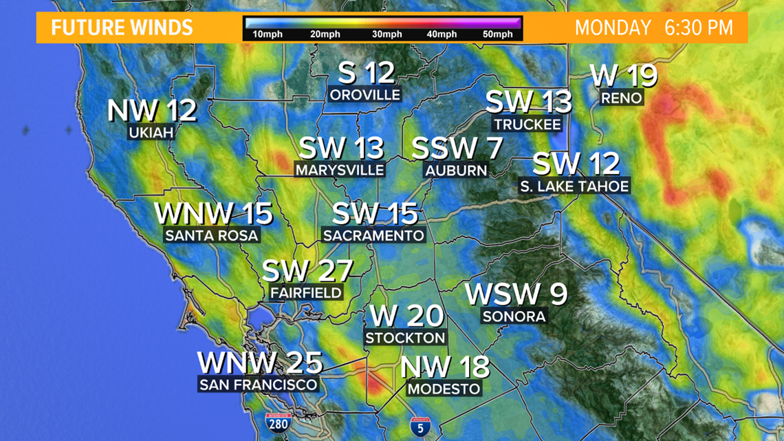
Temperatures on Monday will cool as much as five to eight degrees from Sunday due to an upper level low pressure system dipping into the Pacific Northwest. But due to this dip, a pressure gradient will amplify wind gusts to reach 30 to 35 mph and allow humidity to fall as low as 12% to 20%
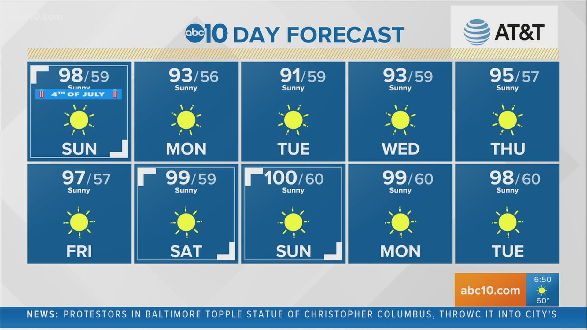
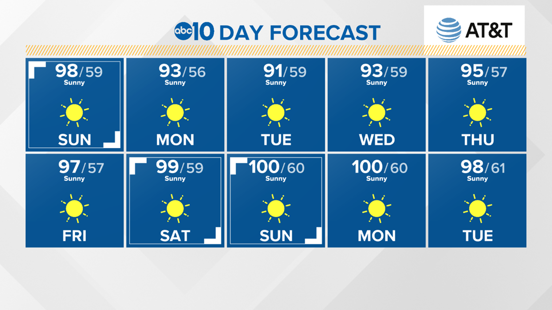
However, there is good news for the midweek. Temperatures are expected to remain in the low 90s before a weekend heat up approaches 100 degree temperatures.

READ ALSO:
- Chance of tropical development for an area near the Gulf Coast
- Sacramento Local Forecast
- Why smoke sometimes lingers in the air during fireworks displays
- Gusty, dry winds and high fire danger prompt Red Flag Warning in Northern California
- Brief cool down in sight for Northern California after spate of above-average heat
RAIN OR SHINE? GET THE LATEST FORECAST IN YOUR NEIGHBORHOOD BY DOWNLOADING OUR APP:


►Get the forecast in your email! Sign up now for the Daily Blend Newsletter
WATCH ALSO: