

SACRAMENTO, California — The first rain of the season brought significant totals through Northern California.
While some areas saw continuous rain,sometimes for as long as an hour long, some spots saw only moments of rainfall.
The change in weather is due to a long cold front moving in through the Pacific Northwest. The tail end of the cold front made its way into Northern California, bringing rainfall and thunderstorm through the Valley, Foothills, and Sierra. The shift in weather also caused a sudden drop in temperatures. Northern California saw as much as a 10-15 degree drop from Sunday into Monday.

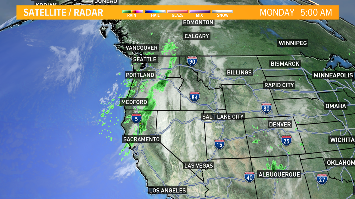
As of 11 a.m., much of the northern Sacramento Valley area saw the sun return and rainfall totals varying from a tenth of an inch to as much as an inch of rain.
The National Oceanic and Atmospheric Administration [NOAA] observed precipitation meaurements include:
- Yuba City: .25”
- Davis: .06”
- Sacramento: .10”
- Elk Grove: .20”
- Roseville: .23”
- Lincoln: .30”
- Auburn: .64”
- Placerville: .45”
- Grass Valley: .78”
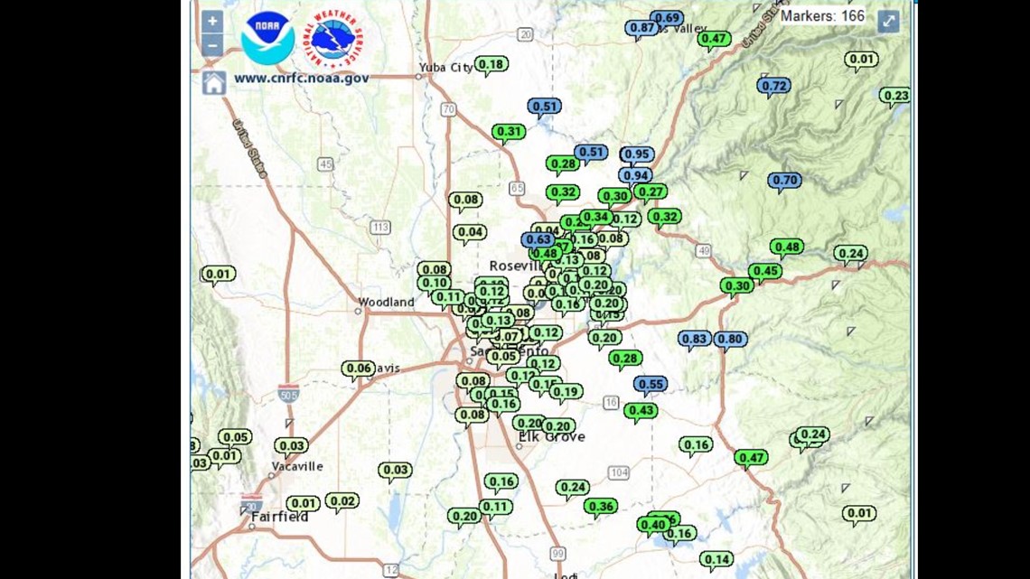
The Davis University Airport measured .06” of rain, while Sacramento averaged about a .10” of rain. Cities like Roseville and Lincoln observed precipitation measurements closer to a third of an inch. Further east in the Foothills, measurements between a half inch to an inch of rain were recorded in Grass Valley and Auburn.