SACRAMENTO, Calif. — It's the calm before the storm.
This holiday week, we are bracing for a series of storm systems that will hit Northern California, the first major rain of the season.
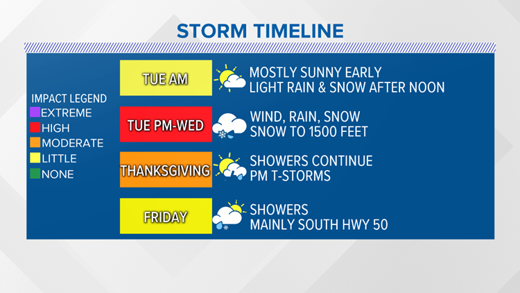
Rain showers are expected to begin Tuesday evening/night in the Valley. Snow showers will begin around 3,000 feet during this same time frame. Snow levels could fall as low as 1,500 feet Wednesday night into Thursday morning.
Rain and snow showers will be heavy at times and will also carry the opportunity for isolated thunderstorms on Wednesday and Thursday. There will be improving conditions on Thanksgiving, with a few leftover showers remaining.
A low pressure pulling in cold arctic air will drop temperatures as much as 15-20 degrees in the coming days. The high on Thanksgiving is expected to reach 48 degrees.
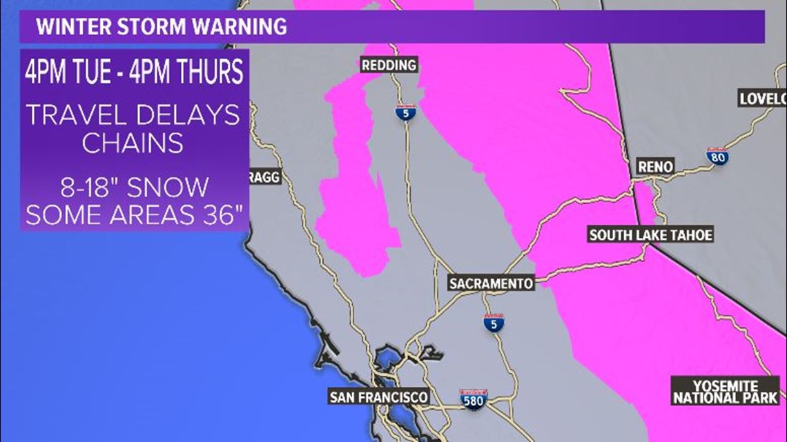
The National Weather Service has issued a winter storm warning for the Tahoe area from 4 p.m. Tuesday to 4 p.m. Thursday. A winter weather advisory runs from 4 p.m. Tuesday to 4 p.m. Wednesday for Reno, Sparks and Carson City where up to 5 inches (13 centimeters) of snow is forecast.
Most of northeast Nevada is under a winter storm watch late Tuesday through Wednesday night with up to 20 inches (50 centimeters) of snow possible in upper elevations.
“Travel could be very difficult to impossible,” service forecasters in Reno said Monday. They said it could take holiday travelers two to three times longer than normal to reach their destination.
“If you are traveling for the Thanksgiving holiday and want to avoid major winter travel headaches, finish your travels by midday Tuesday,” the service said.
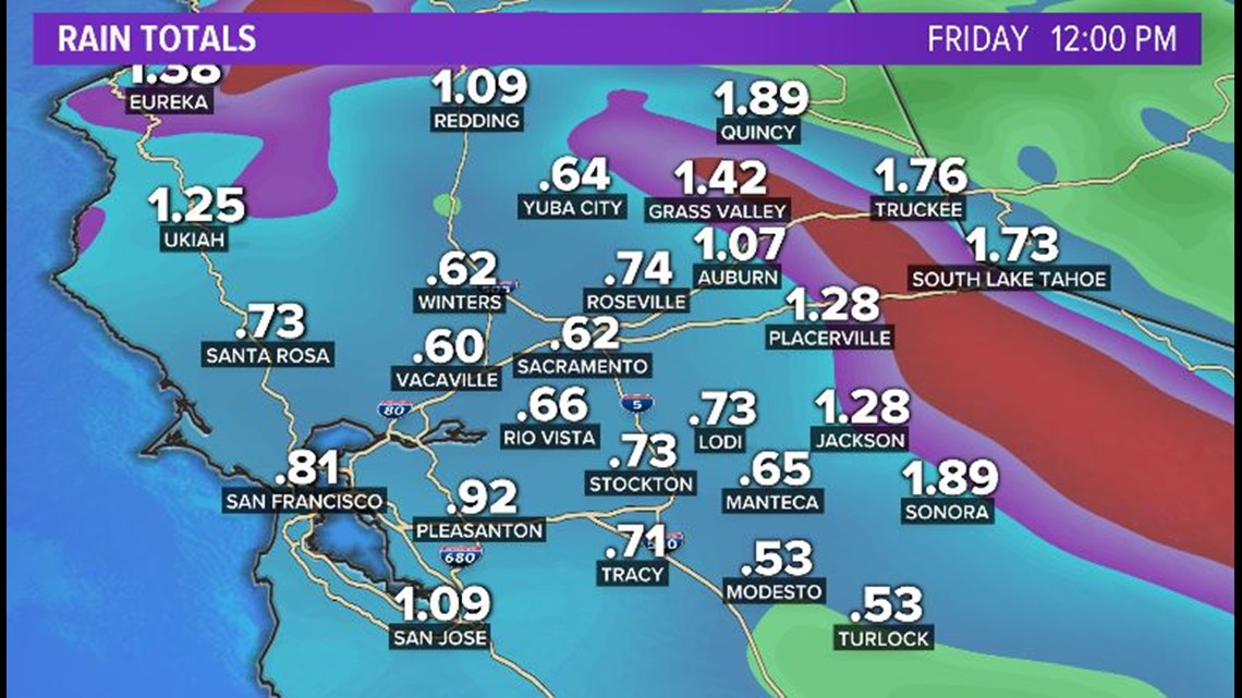
Rainfall Totals:
Many valley locations could see more than .50" of rainfall by Friday.

Snow Totals:
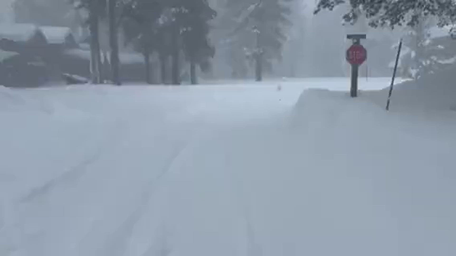
The worst conditions are expected around Lake Tahoe late Tuesday through midday Wednesday. Snow totals could reach 3 feet (91 centimeters) by Thanksgiving Day in some localized areas along the Sierra Crest as the unusually cold and potent storm for late November makes its way through the region, the weather service said.
For the Sierra, 8" to 18" of snow is expected for all areas currently under a Winter Storm Warning by the National Weather Service. Areas above 7,000' could see up to 36" of snowfall.

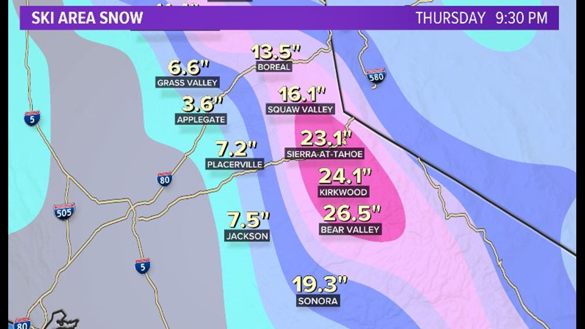
Here's a look at some snow totals in the upper foothills and Sierra through Thursday night.

Thanksgiving can expect to see snow and showers in the Valley and Sierra. Then, Friday will kick off the weekend with mostly sunny skies, a quick break in the weather before the next storm arrives Saturday.
FREE ABC10 APP:


►Stay In the Know! Sign up now for ABC10's Daily Blend Newsletter
WATCH ALSO: