SACRAMENTO, Calif. — Sunday's latest updates are HERE.
__________________
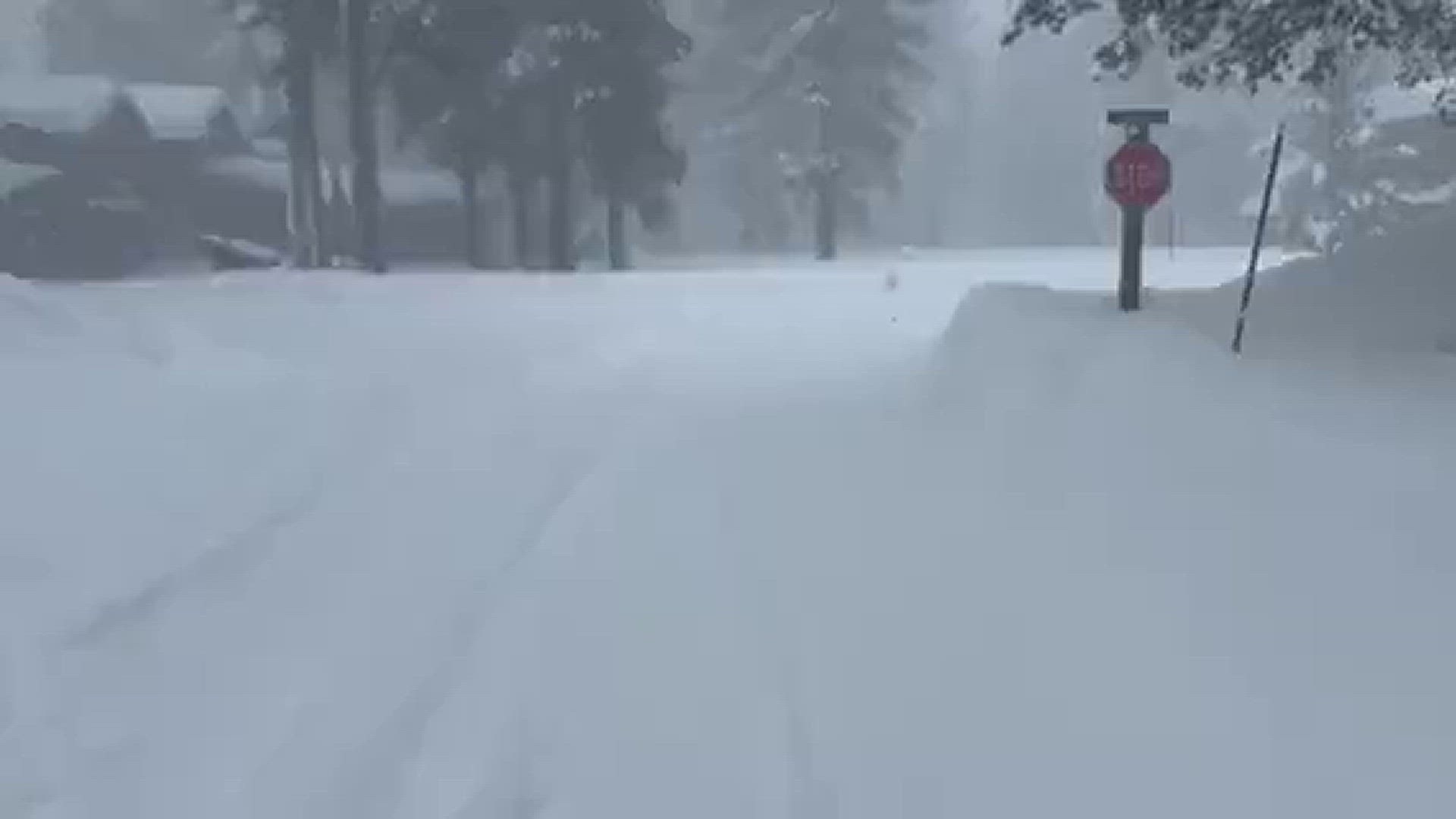
Northern California is being hit by another winter storm Saturday, with this system bringing the most rain the region has seen so far.
The National Weather Service issued a Flood Warning Saturday afternoon for the southern Sacramento Valley & Sierra foothills.
The agency also issued a Flood Watch for northern San Joaquin Valley, citing that "excessive runoff may result in flooding of rivers, creeks, streams, and other low-lying and flood-prone locations."
Sacramento's National Weather Service says there have been "too many road closures to count" and urge people to "stay put!" Multiple city, county and state officials are stressing for people to avoid all travel if possible this weekend.
See below for the latest updates on chain controls, road closures and more from our storm coverage all day.
Here are the latest updates:
As of 2:25 p.m. Saturday: Some chain controls are needed on the main roads leading to Lake Tahoe:
- Interstate 80: Between Nyack and Nevada State Line
- Highway 50: Between Twin Bridges and Meyers
- Check other highways HERE.
11:30 p.m.: National Weather Service Sacramento issued a flash flood warning for Wilton until 11:15 p.m., Jan.1, 2023. Residents should move to higher ground immediately.
11:07 p.m.: Sacramento County officials announce a flash flood warning for Wilton. The affected areas are: South of Wilton Road, West of Cosumnes River and North of Gay Road.
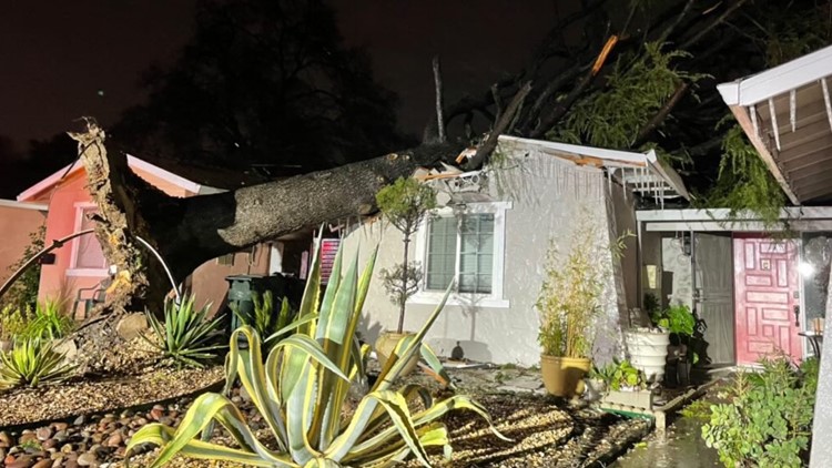
10:30 p.m.: Sacramento Metro Fire says they have responded to reports of trees falling on homes and cars as well as disabled vehicles from drivers attempting to get through flooded roadways.
10:12 p.m.: A special weather alert was issued for Stockton, Modesto and Tracy until midnight due to 50 mph winds. National Weather Service Sacramento advises people to find a sturdy shelter to stay in.
9:18 p.m.: A flash flood warning was issued by National Weather Service Sacramento near Wilton in Sacramento County until Jan. 1, 2023.
NWS Sacramento says "the levees near Wilton Rd. and bridge on the Cosumnes River Near Wilton are in a state of imminent failure causing flash flooding of immediately surrounding areas."
8:41 p.m.: Carson Pass is closed for avalanche control and has no estimated time of reopening tonight.
8:07 p.m.: SMUD and PG&E outages are affecting tens of thousands of customers in the greater Sacramento region as wind gusts hit nearly 60 mph.
6:30 p.m.: State Route 99 closed at Golden Gate Avenue in Stockton due to flooding. There is currently no estimated time of reopening.
6:19 p.m.: I-80 is closed westbound at the Nevada state line and eastbound at Colfax. Driving conditions are dangerous and treacherous, travel is not advised, according to CHP Truckee.
5:05 p.m.: Sacramento County proclaimed a winter storm state of emergency, Saturday evening.
3:48 p.m.: PG&E is urging customers to prepare for potential power outages as road and weather conditions impact their ability to restore power.
3:36 p.m.: Wilton residents are ordered to shelter in place by Sacramento County officials.
3:15 p.m.: Highway 50 is now open between Pollock Pines and Meyers due to flooding from the American River, according to Caltrans.
2:56 p.m.: Fairfield Police Department advises residents to avoid eastbound Air base Pkwy and Clay Bank Road due to fallen trees.
2:14 p.m.: Folsom Police Department advises residents to avoid these locations due to road closures.
1:33 p.m. Sacramento Office of Emergency Services is warning residents living in Wilton to leave the area now. Rising water may spill over onto the nearest roadways and cut off access to leave the area.
1:31 p.m.: El Dorado County Sheriff's Office has issued an evacuation order for Cameron Park in the area between Cameron Park Lake and Piper Court and Salida Way and Bonanza Drive.
1:00 p.m.: Solano County issues Flood Warning in effect until 10 p.m. Roadways may contain debris.
12:14 p.m.: Westbound Interstate 80 has been released at the Nevada State Line. Chain controls are in effect.
11:50 a.m. El Dorado County Sheriff's Office has issued evacuation orders for White Hall and South of Sandridge Road and Highway 49 to the Amador County border due to flooding.
10:41 a.m.: Highway 50 is now closed at Sly Park and Meyers due to flooding.
10:23 a.m.: All traffic is being held on westbound Interstate 80 at the Nevada State Line due to multiple spinouts over Donner Summit, Caltrans says
10:18 a.m.: Two people have been rescued by Cosumnes Fire Department Rescue Boat 74 (IRB) from an island in the middle of Laguna Creek in Elk Grove near Bond and Waterman. All crews are out of the water and preparing for their next incident.
10:07 a.m.: Highway 50 is closed from Ice House Road to Meyers due to flooding. Highway 49 is closed from Sand Bridge Road to Amador County and Highway 89 is closed around Emerald Bay.
9:55 a.m.: Highway 50 closed from Pollock Pines to Meyers due to flooding.
9:21 a.m.: In Butte County, Middle Honcut Road closed from Palermo Honcut Highway to Highway 70 and River Road closed from West Sacramento Avenue to Chico River Road due to flooding.
9:00 a.m.: The National Weather Service says heavy snow is falling across the Sierra passes with hazardous travel conditions.
8:45 a.m.: Stockton Police says to avoid Hammer Lane underpass at the railroad tracks just east of Lorraine Ave due to flooding.
5:44 a.m.: Four teenagers were rescued after their car got stuck in water from Deer Creek near Scott Road in Racho Murieta early Saturday morning. The teenagers were in tree limbs when crews arrived, the Sacramento Metro Fire District said in a tweet
Sandbags:
Counties across the Sacramento region are offering sandbags to residents. Locations are listed HERE.
As rain and wind beat down on Northern California, one homeless encampment, Camp Resolution, is asking the public for winter supplies to protect themselves.
On Friday, the Bureau of Reclamation released 10,000 cubic feet of water from Folsom and Nimbus dams into the lower American River to make room for snow runoff.
STORM RESOURCES:
► FORECAST DETAILS | Check out our hourly forecast and radar pages.
► GET WEATHER ALERTS TO YOUR PHONE | Download the ABC10 mobile app
► WEATHER IN YOUR EMAIL | Sign up for the ABC10 Today newsletter
MAPS:
Radar map from ABC10.com. Adjust the layers with a filter on the bottom right corner to show rain, snow, wind and current temperatures:
National Weather Service's Sacramento radar:
TRAFFIC
Live map showing traffic conditions along Interstate 80, Highway 50, Highway 89 around Lake Tahoe and the Sierra Mountains.
Snow Park locations are identified with purple markers.
Power Outages
PG&E outages can be found HERE.
SMUD outages can be found HERE.
Click HERE for more ABC10 weather maps.
GO DEEPER: When you think of California's climate, drought probably comes to mind first, but California has a long history of floods. Some floods were so punishing and relentless they crippled the state. New research indicates these "megafloods" are twice as likely in the future with a changing climate. It's a future we can't avoid, but we can learn from the past and prepare. ABC10's team of meteorologists investigated the topic, answering questions like: What exactly is a megaflood? Can our infrastructure withstand it?