SACRAMENTO, Calif. — So far in December the weather has been dry except for some damp mornings.
The wet pattern we need in California has a chance of returning starting late Monday night.
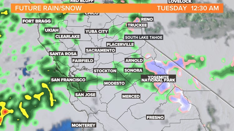
Clouds will move in through much of the day then very late Monday and early Tuesday a weak storm moves in. The snow levels will remain high and rain is the main forecast for the Sierra. Snow levels should drop to about 7,000 feet by Tuesday morning and some light snow is possible at the pass level.
Light, scattered showers will pop in overnight Monday to Tuesday likely making for a wet Tuesday commute.
The impact of this storm is small but it does usher in a new pattern allowing more storms to move into California.
Thursday morning a wetter and colder storm will move in bringing more valley rain through the day and evening — and snow in the Sierra.
Snow levels will be below the passes so chain controls might be an issue for commuters on Thursday and Friday. Snow totals are often hard to pin down but six inches of snow or more is possible for the resorts between Thursday and Friday.
Snow could fall as low as 3,000 feet by Friday morning. Many locations will start to see frost in the morning by Friday and Saturday. The Tahoe Basin will see temperatures dip into the single digits by the end of the week.
The upcoming weekend will see some clearing but signs point to a wetter pattern in Mid-December.