SACRAMENTO, Calif. —
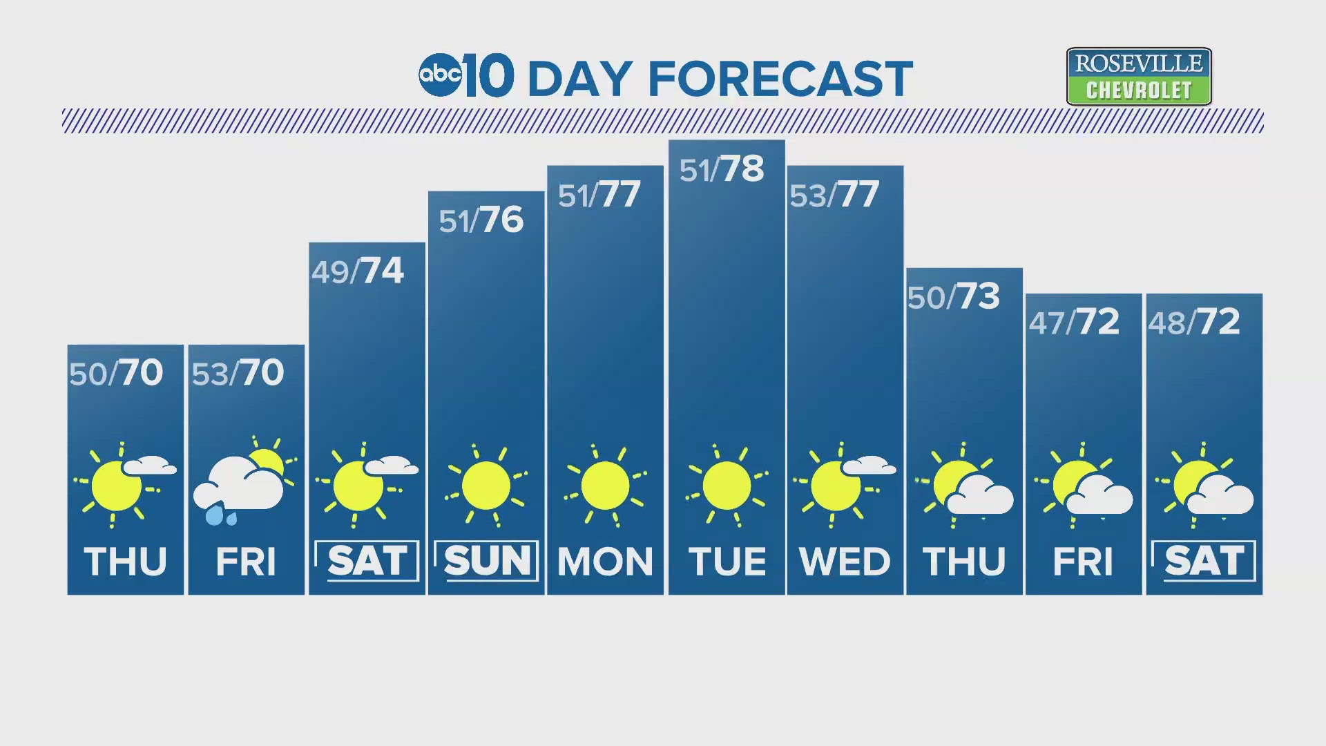
Apart from the first weekend of June, this month has started off mild temperature and will continue through this weekend into next week.
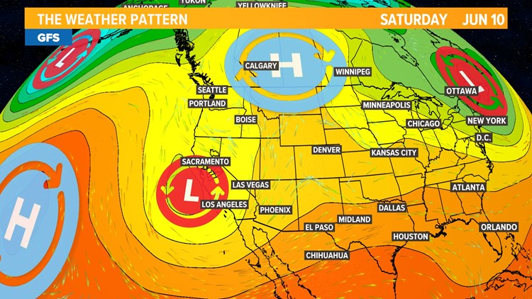
The presence of persistent low-pressure systems following last weekend's heat has dropped temperatures below climatological normal and even introduced some scattered showers to the Valley. In the Sierra, daily afternoon thunderstorms have dropped up to an inch of rain in areas where the storms have set up.
By Sunday, the system will be over the Central California coast which is when rain chances will be highest across the state.
This weekend may be cool for June standards (highs in the upper 80s are typical this time of year) but the weather will still be excellent. The medium range weather models are hinting at near normal to slightly above average temperatures next weekend so enjoy the beautiful weather while it's still here.
If you’re headed out this weekend, whether it be to chill on the beach at Lake Tahoe or explore San Francisco, this forecast has you covered.
Central Valley
Temperatures will remain slightly below average for this time of year this weekend. Friday, Saturday and Sunday will feature high temperatures around 83 or 84 in Sacramento.
Similar to earlier in the week, a few showers may make it down to the Valley on Saturday or Sunday afternoon, mainly in the central and northern Sacramento Valley and portions of the San Joaquin Valley. There is about a 20% chance of rain in Sacramento Sunday.


The low pressure systems and an influx of moist air will result in partly to mostly cloudy skies this weekend.
The delta breeze will also be present this weekend in the Sacramento area, cooling things down quickly in the evening hours. Low temperatures will fall into the mid 50s in the Sacramento area, staying a bit warmer north and south of the region where the delta breeze has less influence.
Bay Area
"June gloom" is in full effect up and down the California coast. The marine layer has been very persistent lately and will continue to be this weekend.
Temperatures in the low to mid 60s are forecast for San Francisco this weekend. Similar temperatures are expected in areas like Santa Cruz, Point Reyes and Monterey due to the deep marine layer allowing spotty sunshine in the afternoon hours before the fog builds back in.
Areas able to escape the fog will warm up into the 70s. An outside chance of rain exists in the Monterey and Santa Cruz areas on Sunday as the low pressure moves in also causing wind speeds to pick up on Saturday and Sunday.
Lake Tahoe/Sierra
Temperatures in the Sierra will remain below average as well, with highs in the 60s and 70s.
The main story in the Sierra will be thunderstorms, as it has been for the last few weeks. The presence of unstable air and high moisture levels point to the potential for heavy downpours and flash flooding in areas where storms pop up, especially due to ongoing snowmelt concerns.
Other threats will be present thanks to the thunderstorms will be periods of gusty winds, small hail and lightning. When thunder roars, head indoors! The American Hiking Society recommends finishing hikes before noon to limit risk of getting caught in a thunderstorm.