
MARKLEEVILLE, Calif — This morning, the incident management team from mainly Colorado, Wyoming and South Dakota assumed control of managing the response to the Tamarack Fire, which started July 4 and is burning near Markleeville, California.
The Rocky Mountain Area Type 1 Incident Management Team said in a Facebook post that firefighters battled the fire activity overnight which maintained in size, 39,045 acres, and containment percentage 0% as reported yesterday.
In addition to crews fighting the fire and working to maintain containment lines of the fire, crews are working to protect structures specifically in Woodfords Community, Markleeville, and Grover Hot Springs, according to the Rocky Mountain Area Incident Management Team.
California State Parks said on Twitter that Grover Hot Springs State Park has been evacuated and will be closed until further notice due to the fire.
ABC10 reporter Van Tieu was able to cross into the fire zone and into the town of Woodfords. There was high fire activity overnight but the structures within the town were saved.
Some landmarks -- including the Woodfords Inn and Mad Dog Cafe -- are still standing, shielded from the fire threat. Both businesses evacuated and closed earlier this week.
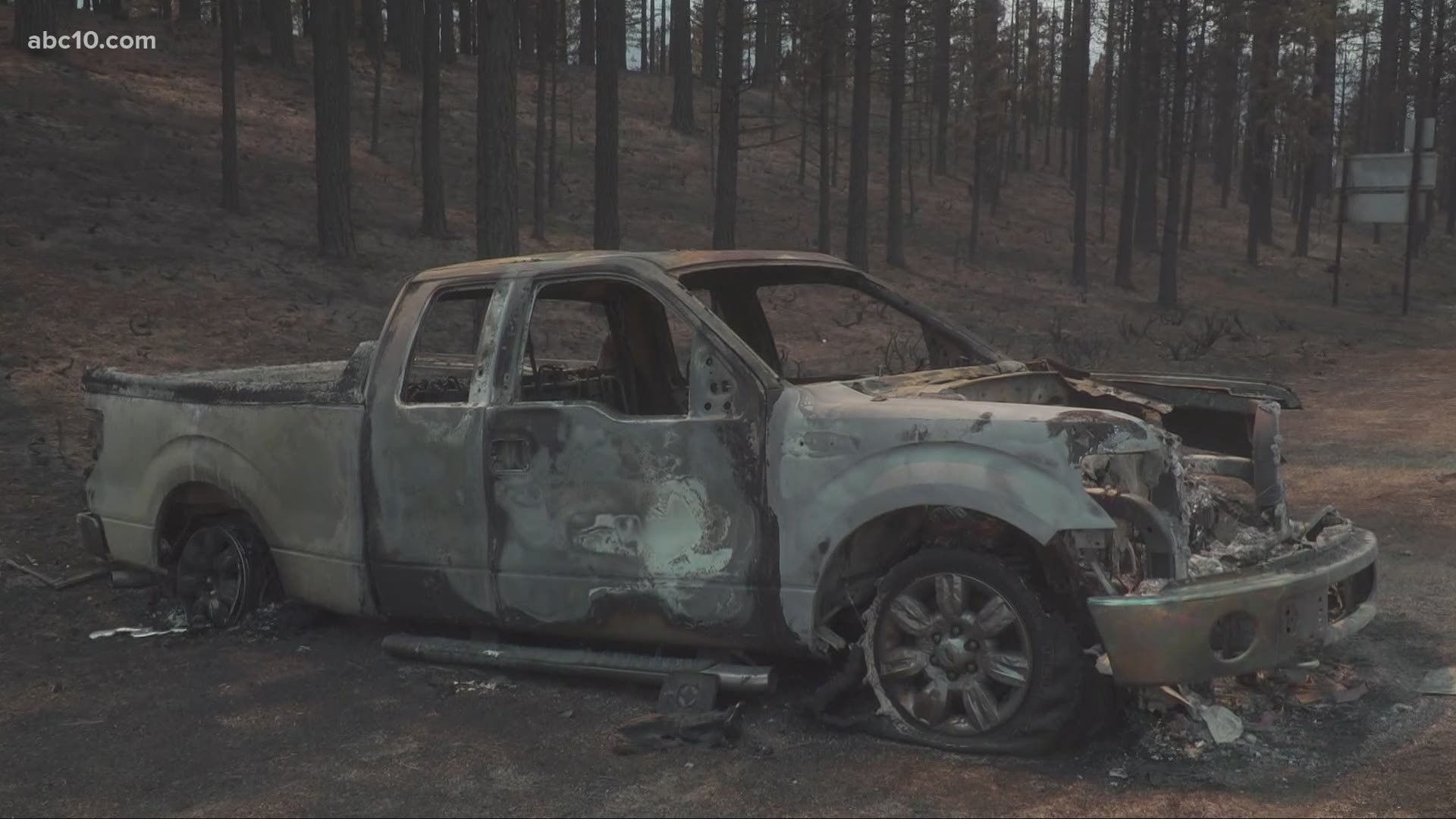
However, the fire did burn along both sides of the freeway closer to Markleeville, taking down power lines and engulfing at least one truck. This is one of the priority zones for the 1,100 personnel assigned to fight the Tamarack Fire. The goal is to keep the fire south of Highway 88. Currently, Highway 88 is closed even for evacuation escorts.
Several aircraft have been making passes to stop the progression. Fire officials anticipate the Tamarack Fire will progress northeast, with unfavorable conditions expected to last for days. While there are no evacuation orders in Douglas County, communities east of Highway 395 are being kept on high alert.
"There's a lot of homes in here where there's a high value we want to protect so we really want a solid plan moving along this 395 corridor. Once again, this will be monitored. Keeping this progression and keep the fire west of Byron Creek is the goal," said fire operations section chief Pat Seekins.
Alpine and El Dorado County Sheriff's Offices began helping residents return to their homes to collect pets, papers and emergency items. Residents can meet with deputies at Mad Dog Café located at 290 Old Pony Express Way, Markleeville, between 10 a.m. and 1 p.m. as well as between 2 p.m. and 5 p.m. on Tuesday, July 20. First responders will be escorting people to their homes as long as the fire condition allows them to travel safely to a person's home.
The Tamarack Fire was ignited by a lighting strike on July 4. Since then it has exploded in size, destroying homes in the process.
For Monday's updates, click HERE.
Accounts to follow:
Mandatory evacuations
The following locations and their surrounding areas are under a mandatory evacuation, according to Alpine County:
- Markleeville
- Mesa Vista area
- Grover Hot Springs
- Shay Creek
- Marklee Village
- Carson River Resort
- Alpine Village
- Hung-a-lel-ti
- Blue Lakes Road
- Wolf Creek Campground
- Silver Creek Campground
- Sierra Pines
- Upper Manzanita
- Lower Manzanita
- Crystal Springs
- Diamond Valley Road
Evacuation Center
- Douglas County Community Senior Center in Gardnerville, Nevada
Road Closures
- Highway 89 is closed at the intersection of Highway 4 and 89
- Pacific Crest Trail is closed between Carson Pass (Highway 88) and Ebbetts Pass (Highway 4).
- SR-88 at the Nevada/California state line to SR-89 at Pickett’s Junction
Wildfire Map
WILDFIRE PREPS
According to Cal Fire, 2020 was one of the most severe fire seasons on record as 9,917 wildfires burned 4.2 million acres. Over 9,000 structures were destroyed, and 31 people (civilians and firefighters) were killed.
California also experienced its first "Gigafire" because of the August Complex Fire, burning over 1 million acres by itself. Four of California's top five largest wildfires in state history happened in 2020.
If you live in a wildfire-prone zone, Cal Fire suggests creating a defensible space around your home. Defensible space is an area around a building in which vegetation and other debris are completely cleared. At least 100 feet is recommended.
The Department of Homeland Security suggests assembling an emergency kit that has important documents, N95 respirator masks, supplies to grab with you if you’re forced to leave at a moment’s notice. The agency also suggests signing up for local warning system notifications and know your community’s evacuation plans best to prepare yourself and your family in cases of wildfires.
Some counties use Nixle alerts to update residents on severe weather, wildfires, and other news. To sign up, visit www.nixle.com or text your zip code to 888777 to start receiving alerts.
PG&E customers can also subscribe to alerts via text, email, or phone call. If you're a PG&E customer, visit the Profile & Alerts section of your account to register.
WATCH MORE FROM ABC10: Family loses home in Tamarack Fire


