
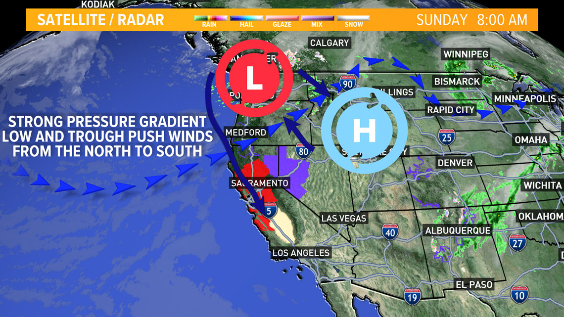
SACRAMENTO, Calif. — Very strong northerly winds will begin late Sunday as a low-pressure system in the Pacific Northwest moves along a trough into northern California.
A high-pressure system to the east of the low is causing both systems to press firmly against each other. This will increase wind speeds Monday into Tuesday.

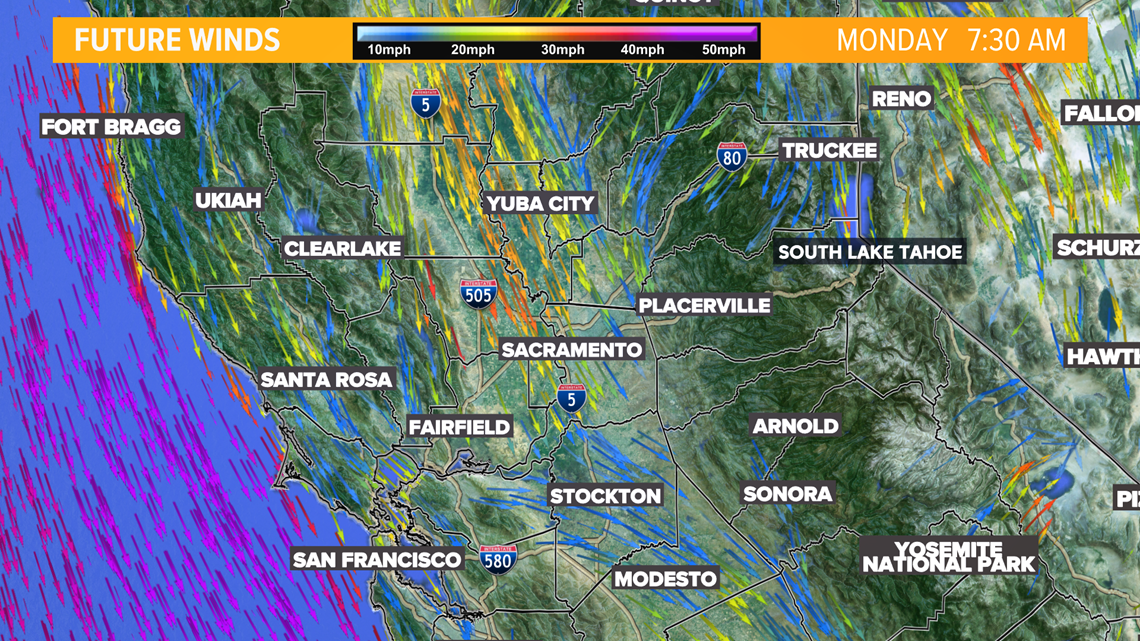
Drivers can expect to see 20 mph winds for the early Monday commute.

By lunchtime into the evening hours, some of the strongest winds are expected to reach 20-30 mph with gusts as high as 40-50 mph.

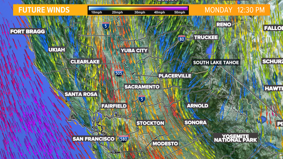
The western side of the valley and the coastal range are expecting to experience the most powerful winds. The commute along I-80 to and from Sacramento may be rough on drivers as winds pound the area.

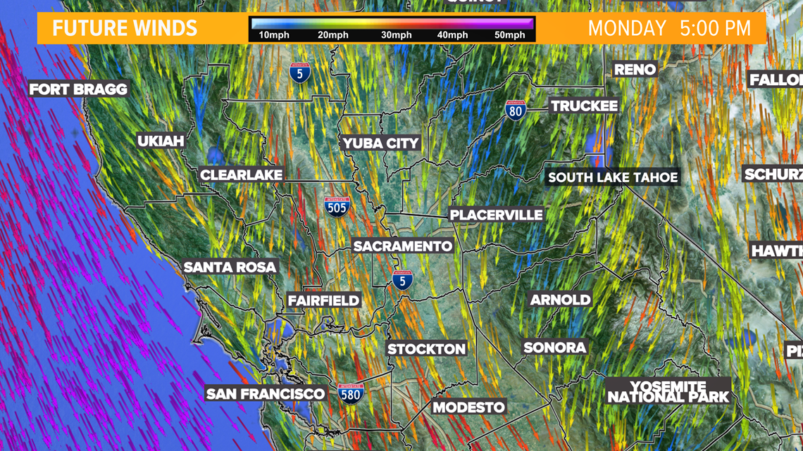
A fire weather warning will be in effect until at least 7:00 p.m. Tuesday. Any spark, whether from a power line, chain dragging, or cigarette, could cause a fire to start and move quickly.
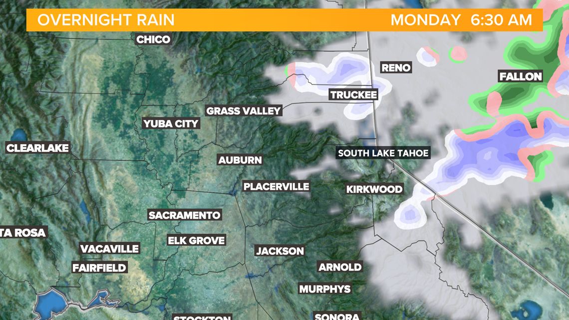
Along with high winds, a low-pressure system will bring precipitation into the foothills and high Sierra. Areas around Truckee and Tahoe could see a dusting of snow early Monday as the system passes through Yosemite in the afternoon.

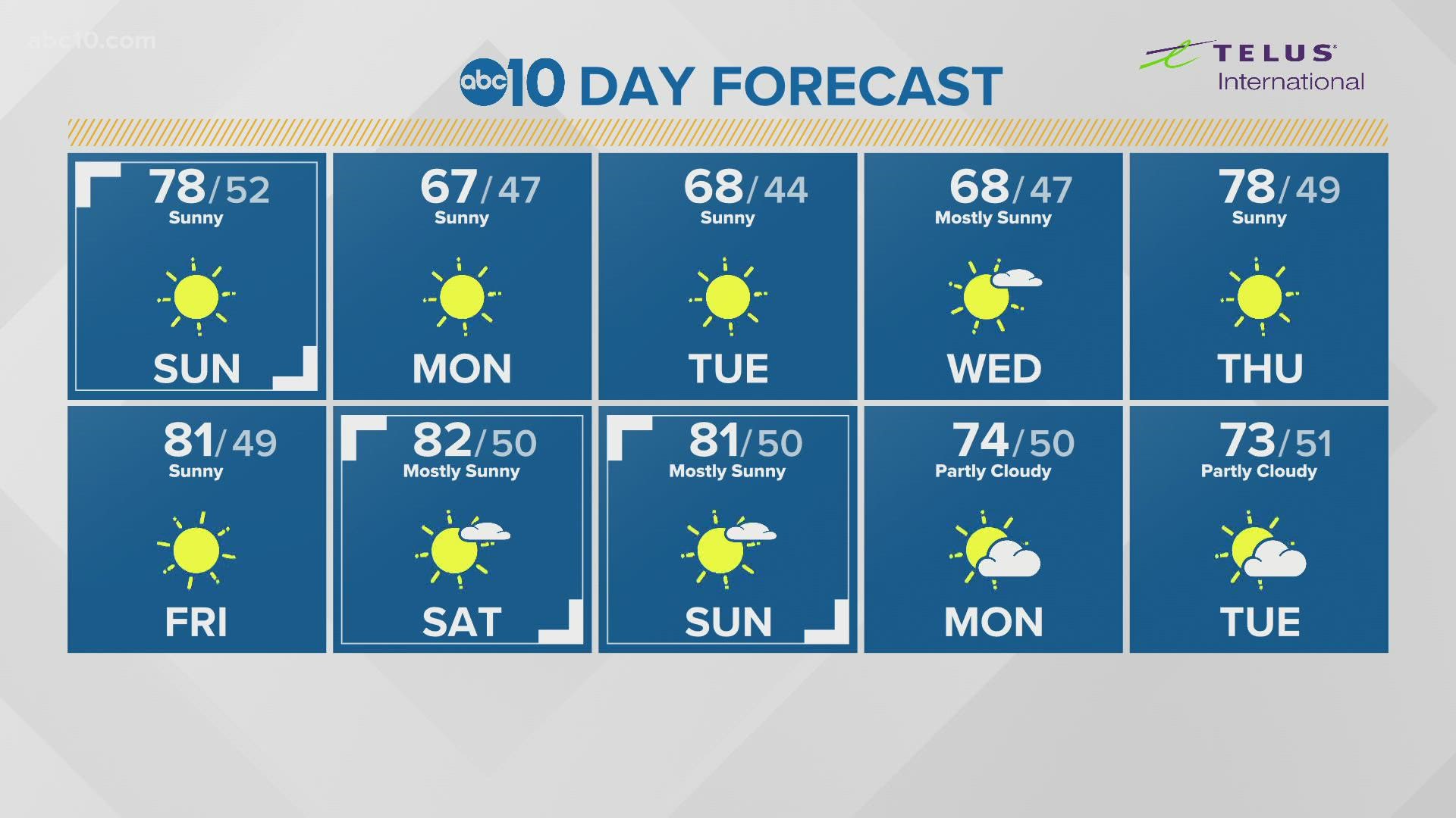
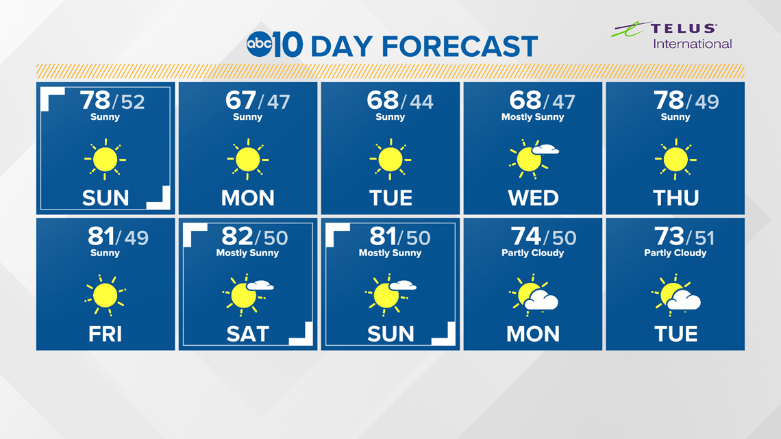
Temperatures will cool into the mid to upper 60s in the valley Monday through Wednesday, and return to the upper 70s and low 80s by the weekend.

ABC10: Watch, Download, Read


WATCH MORE: