
NEVADA CITY, Calif. — Click HERE for the latest information from Tuesday.
Monday's story:
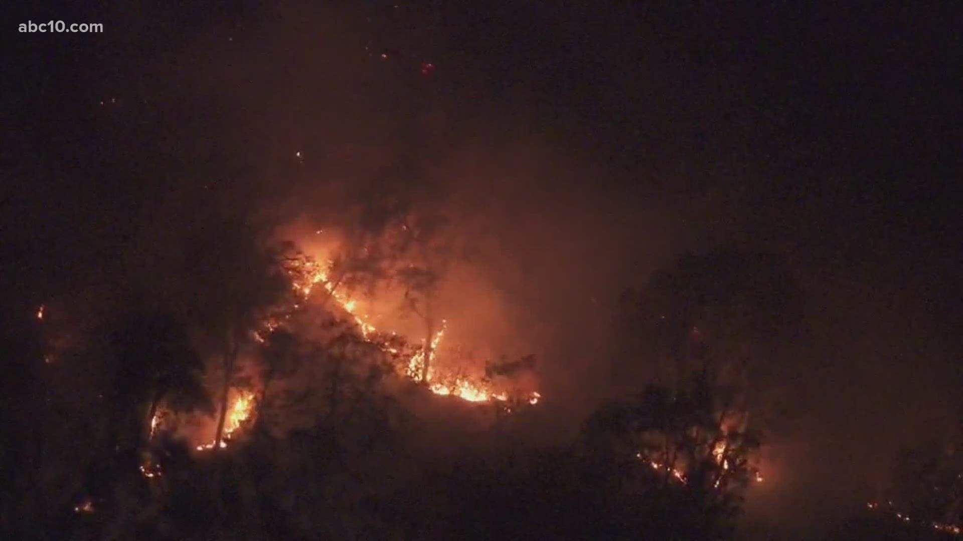
The Nevada County Sheriff's Office ordered mandatory evacuations on Monday morning for the Jones Fire, burning in the South Yuba River Canyon area, west of Nevada City.
The fire has burned about 340 acres and is headed toward the southeast. Cal Fire said it started as one of 14 lightning based fires that happened early Monday morning due to overnight storms.
3,891 people have been ordered to evacuate due to the blaze and more than 11,000 are under evacuation warnings.
The Grass Valley School District said all their school sites and programs will be closed on August 18 due to the uncertainties with the fire.
In a Cal Fire update, officials said there was an increase in fire activity that burned through retardant lines. Cal Fire said they're concerned about the fire heading east toward Highway 49 and Nevada City.
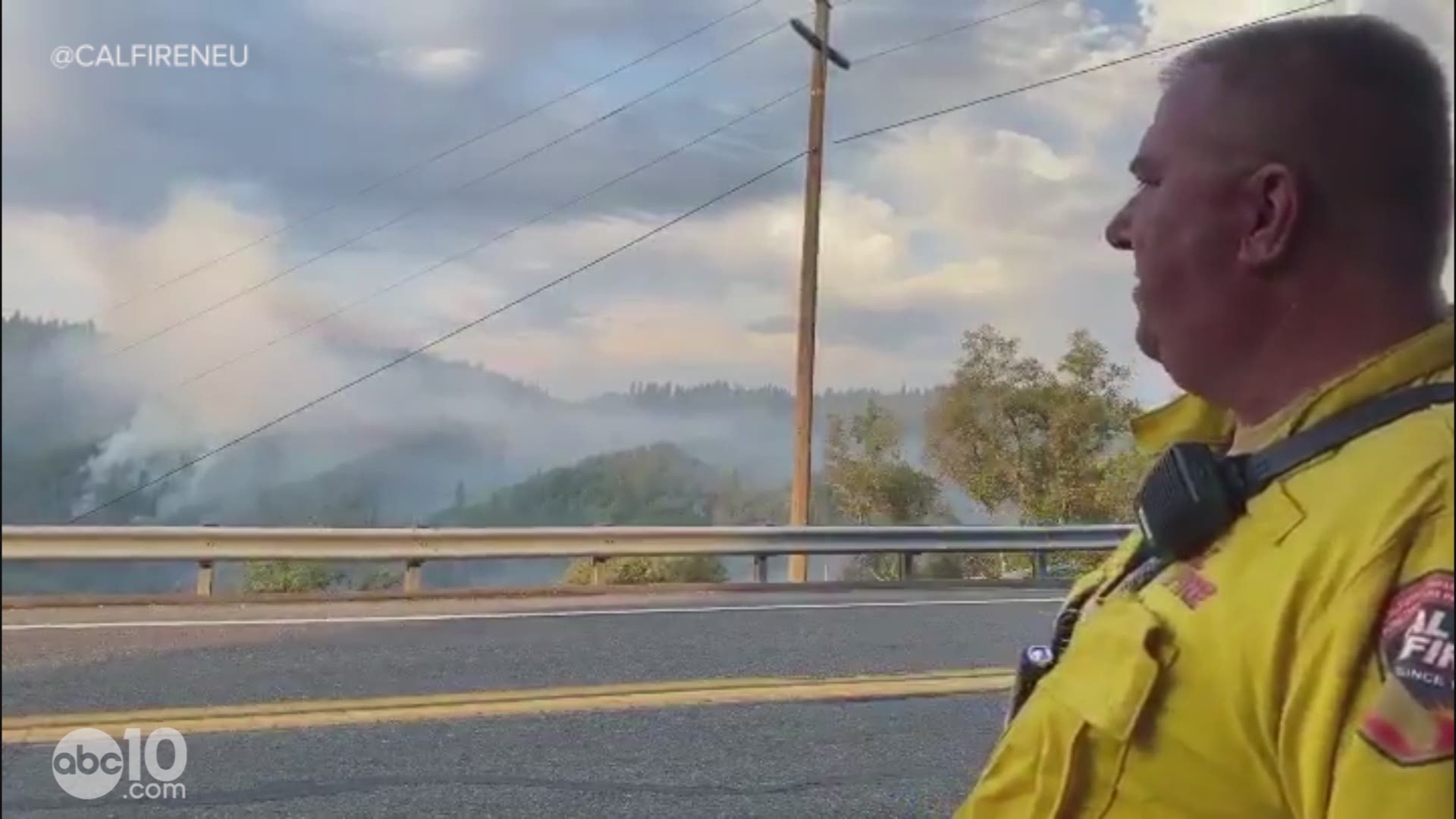
Cal Fire Division Chief Jim Mathias, incident commander for the Jones Fire, said firefighters are hoping to hold the fire south of the Yuba River and north of Newtown.
"We want to try to keep the fire over to west of Highway 49 and then we want to keep it the east of Jones Bar, the actual Jones Bar Road that comes down into the Yuba River," Mathias said.
Officials said fire crews are having a hard time with the Jones Fire due to the number of fires across the state and the availability of resources.
In a Facebook post, the Nevada County Sheriff's Office said mandatory evacuations are underway for the area of Jones Bar Road north of Woolman.
Roads within the evacuated areas include:
- Jones Bar Rd
- Nishinam Gulch Rd
- Yuba Crest Dr
- McKitrick Ranch Rd
- Pau Hana Wy
- Little Bear Lane
- Hoot Owl Rd
- Arctic Owl Rd
- Willo Wisp Court
- Fenton Wy
- Woolman Lane
- Toller Ridge Court
- Rush Creek Wy
- Lost Ranch Way
- Owl Creek Road
- Yuba Ridge Drive
- Red Tail Hawk Drive
- Kodama road
- Baron Owl Lane
- Denmark Court
- Holland Drive
- Carli
- Crooked Arrow
- John Barleycorn
- Shoshoni Trail
- Cavanaugh
- Lowden Lane
- Apache Trail
- Prince Rainer
Evacuations orders are also in place for the North Side of Newton Road to include:
- Lois Lane
- Monte Vista
- Jones Bar
- Empress Cross
- Personeni
- Elizabeth
The North Side of Ridge Road down to Rough and Ready Highway to Bitney Springs Road is also under evacuation orders. The Morgan Ranch subdivision is not currently included in the evacuation order.
According to the Nevada County Office of Emergency Services, a temporary evacuation point has been setup at Magnolia School located at 22431 Kingston Lane in Grass Valley. The school will function as a place to triage residents while working to find overnight sheltering with assistance from the American Red Cross, officials said.
A temporary evacuation center has been set up at Ready Springs School in Penn Valley. People with animals can take them to the Nevada County Fairgrounds. Other evacuation points include Cottage Hill Elementary School in Grass Valley and Alder Creek Middle School in Truckee.
Nevada County is tracking the fire here.
Cal Fire PIO Mary Eldridge says lightning sparked about half a dozen fires in the area. Most of the fires are a half-acre or less.
For a map of evacuation zones, use the Ready Nevada County Dashboard below and select "evacuations map" tab at the bottom.
According to Cal Fire, in 2019, California wildfires burned just under 260,000 acres from 7,860 incidents. Over 700 structures were damaged or destroyed and three people were killed. This follower two years of some of the “deadliest and most destructive wildfires” in California history.
If you live in a wildfire-prone zone, Cal Fire suggests creating a defensible space around your home. Defensible space is an area around a building in which vegetation and other debris are completely cleared. At least 100 feet is recommended.
The Department of Homeland Security suggests assembling an emergency kit that has important documents, N95 respirator masks, supplies to grab with you if you’re forced to leave at a moment’s notice. The agency also suggests signing up for local warning system notifications and know your community’s evacuation plans to best prepare yourself and your family in cases of wildfires.
► FOR THE LATEST WILDFIRE NEWS,
DOWNLOAD OUR APP.


►Stay in the know! Sign up now for the Daily Blend Newsletter