
PLACER COUNTY, Calif. — Updates for Saturday, Sept.10 are at /article/news/local/wildfire/mosquito-fire-foresthill-georgetown-volcanoville-saturday/103-ac5d81c2-b4b9-4ba5-9e74-406168a73945
----------
Friday's developments:
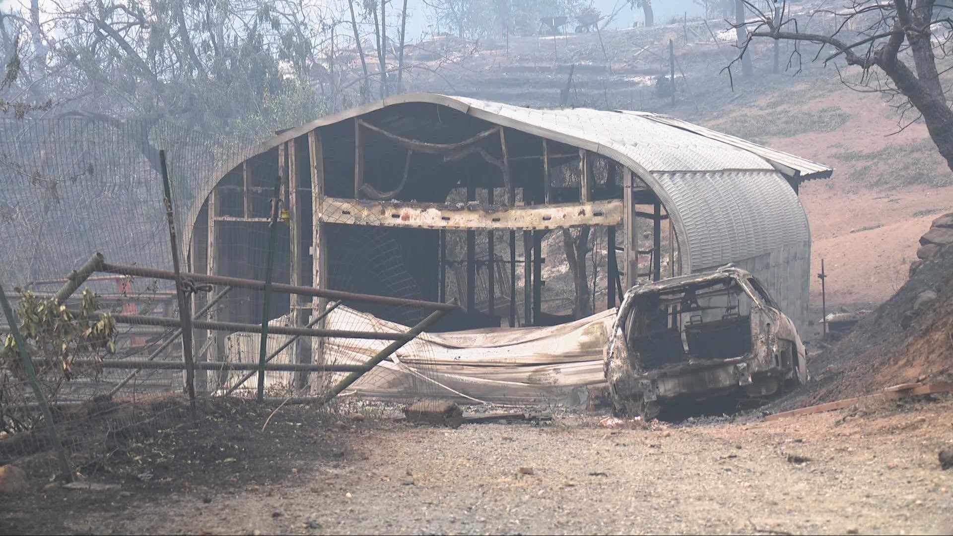
There is extreme fire growth in the Mosquito Fire as it moves to the southeast in Placer and El Dorado County.
Flames jumped the American River Thursday, extending mandatory evacuations in both counties. According to Cal Fire, it's difficult to accurately map because of the smoke, but the fire has burned at least 29,585 acres and is uncontained. About 3,666 structures are threatened.
El Dorado County Sheriff John D'Agostini issued a local emergency due to the fire and a public health emergency has been issued for the area due to the smoke.
The weather helped firefighters Friday with a higher humidity level, lower temperatures and slower wind speeds, according to Rob Scott, El Dorado County's fire behavior analyst.
On Thursday, PG&E submitted documents to the California Public Utilities Commission in relation to the Mosquito Fire.
"PG&E’s information reflects that an electrical fault occurred close to the reported time of the fire, which began September 6, 2022, near Oxbow Reservoir in Placer County. Thus far, PG&E has observed no damage or abnormal conditions to the pole or its facilities near the reservoir and has not observed any downed conductor in the area or any vegetation or tree on the line," PG&E wrote in a statement.
RELATED: Smoke impacting foothill regions and valley overnight into tomorrow as Mosquito Fire expands
The cause of the fire is under investigation.
Stay Informed
Evacuation Maps
Here is a map of evacuations from the Placer County Sheriff's Office.
A map of evacuations in El Dorado County is below.
Evacuation Centers
Placer County
- Evacuation center:
- Bell Road Baptist Church at 707 Bell Road in Auburn
- Temporary Location: Auburn Regional Park Gym at 3770 Richardson Dr in Auburn for parking (for RV/Car), bathrooms and shower access ONLY (no hookups/sleeping spaces/etc.)
- For large and small animals: Nevada County Fairgrounds on 11228 McCourtney Road, in Grass Valley. Check-in at Gate 8
- No birds/chickens due to avian flu.
El Dorado County
- Evacuation centers:
- Cameron Park Community Services District, 2502 Country Club Drive, Cameron Park
- Green Valley Community Church, 3500 Missouri Flat Rd, Placerville
- El Dorado County Animal Shelter 6435 Capitol Avenue, Diamond Springs
- Rancho Murieta Equestrian Center, 7200 Lone Pine Dr, Rancho Murieta
- Must call first: (916) 985-7334
- Large animals only: Flying M Ranch, 82 Carefree Way, Oroville
Map
This map from the National Interagency Fire Center shows fire activity (this may take a few seconds to load):
Road Closures
For a map with current road closures, click here.
Wildfire Preps
According to Cal Fire, the 2021 fire season started earlier than previous years, but also ended earlier, as well. January 2021 saw just under 1,200 acres burned from nearly 300 wildfires. Fires picked up in the summer when the Dixie Fire burned in five Northern California counties — Butte, Plumas, Shasta, Lassen and Tehama. The Dixie Fire started on July 13 and wasn't contained until Oct. 25, burning nearly 1 million acres. It has since become the second-largest wildfire in state history and the largest non-complex fire.
Overall, 2.5 million acres were burned in 2021 from 8,835 wildfires. Over 3,600 structures were destroyed and 3 people were killed.
If you live in a wildfire-prone zone, Cal Fire suggests creating a defensible space around your home. Defensible space is an area around a building in which vegetation and other debris are completely cleared. At least 100 feet is recommended.
The Department of Homeland Security suggests assembling an emergency kit that has important documents, N95 respirator masks, and supplies to grab with you if you’re forced to leave at a moment’s notice. The agency also suggests signing up for local warning system notifications and knowing your community’s evacuation plans best to prepare yourself and your family in cases of wildfires.
Some counties use Nixle alerts to update residents on severe weather, wildfires, and other news. To sign up, visit www.nixle.com or text your zip code to 888777 to start receiving alerts.
PG&E customers can also subscribe to alerts via text, email, or phone call. If you're a PG&E customer, visit the Profile & Alerts section of your account to register.
What questions do you have about the latest wildfires? If you're impacted by the wildfires, what would you like to know? Text the ABC10 team at (916) 321-3310.
Watch more on ABC10


