
SACRAMENTO, Calif. — UPDATE: Sunday 6 p.m.
ABC10 Chief Meteorologist Monica Winds says winds will become lighter after sunset. Rain will start around 8 p.m. in the valley and move east into the Sierra through the evening.
Rain turns to snow in the mountains before midnight, and the snow level overnight will drop down to near 5,000 to 5,500 feet.
Along Highway 50 near Twin Bridges, the corridor is one of concern due to the Caldor Fire burn scars. One area of concern is weakened trees.
Gusty winds and snow could topple trees and break off branches. Over the past few weeks, PG&E crews have been hard at work clearing those hazards.
PG&E officials say nearly 1,000 workers have been staged at Sierra at Tahoe and have cleared about 25,000 fire damaged trees with 80,000 more to go.
Roads could be congested by morning. Caltrans officials are urging drivers to check the Caltrans Quickmap before hitting the road. They're also asking people to carry chains or have four-wheel drive and winter tires.
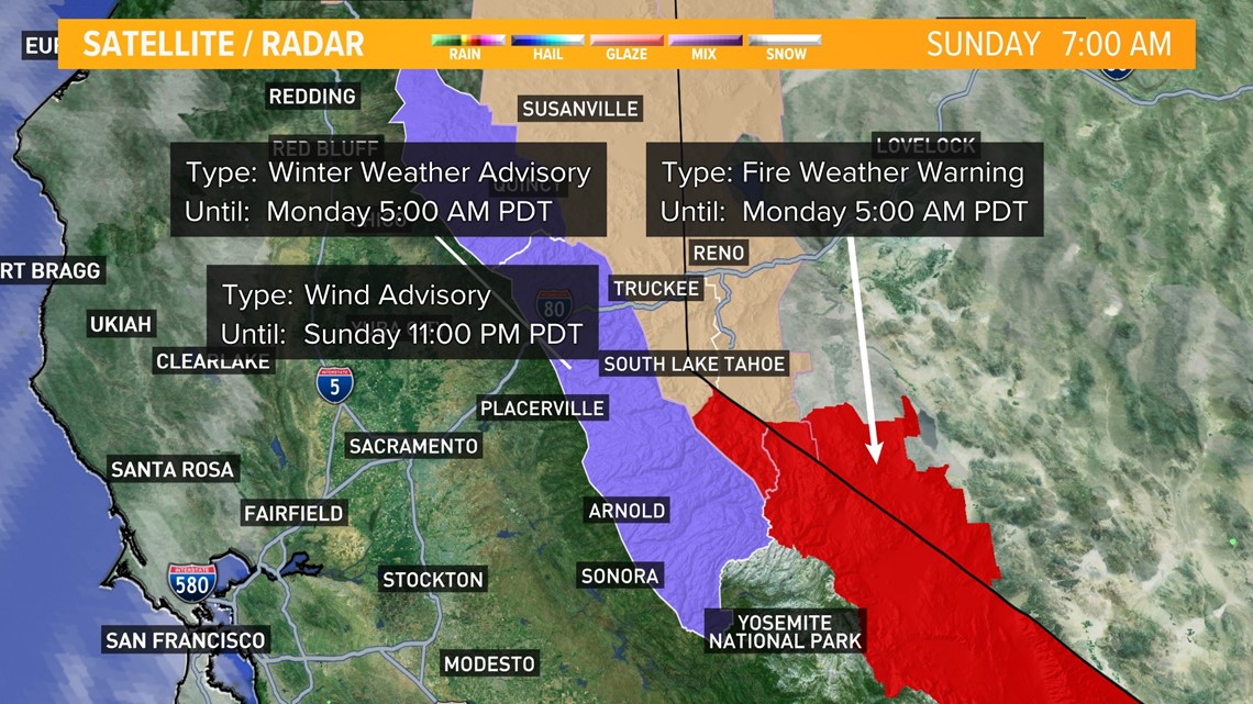
ORIGINAL: Sunday 10:30 a.m.
Temperatures will drop into the low 70s Sunday with an impending weather system arriving through the afternoon.
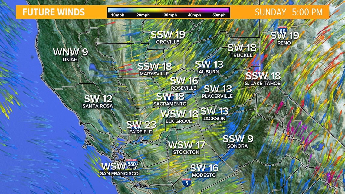
Winds will increase hour by hour across northern California with 10-20 mph winds in the Valley. Gusts could reach 20-30 mph inland with a Wind Advisory taking effect for the high Sierra. Those gusts are forecasted to reach 40-45 mph.

A Red Flag Warning for the Mono and Mineral counties region of the Sierra goes into effect from 2:00 p.m. Sunday to 5:00 a.m. Monday. Strong winds, low humidity and dry vegetation are a concern.
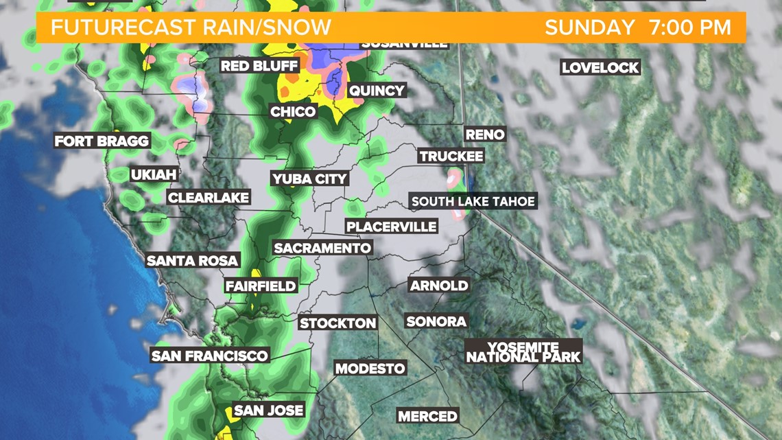
A line of showers will move over northern California by the early afternoon. Showers are expected in the Sacramento valley from 4-8 p.m. Heavier rain is forecast to fall in the foothills with local downpours possible near Caldor Fire burn scars. There are chances for flooding and mudslides in burn scar areas.

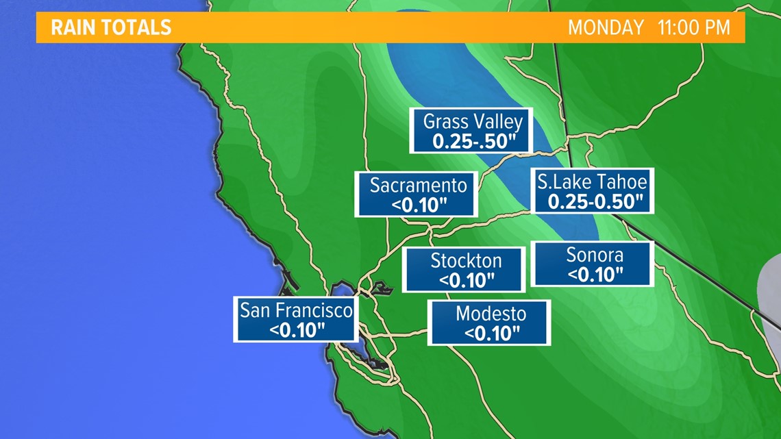
Total rain accumulation is expected to be less than 0.10 inches for the valley with 0.25-0.50 inches possible in the foothills and Sierra.

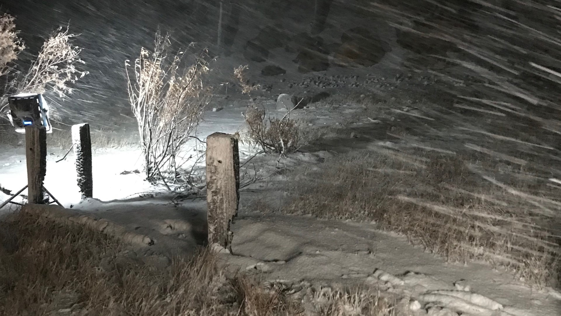
A Winter Weather Advisory is in effect until 5:00 a.m. Monday as icy roads will make travel difficult beginning around 5:00 p.m. on Sunday. Snowfall will begin Sunday night with ice and slush and then freezing to roadways overnight.

A dusting of snowfall will bring 2-8 inches of snow through the Sierra with as much as 12 inches near Lassen.


Travel delays are expected as strong winds and blowing snow will limit visibility. Accumulating snow will begin around 5,000 feet. Lower levels may see a dusting, but not much snow accumulation.
The remainder of the week will see unsettled weather with varying chances of showers. Temperatures will be in the mid to upper 60s.
ABC10: Watch, Download, Read


WATCH MORE: