
SACRAMENTO, Calif — An increasingly wet and cool late season storm is on the way to Northern California by Saturday.
Winds are much calmer Thursday than they were Wednesday but still expect breezy conditions as the low pressure system that brought the north winds moves east.
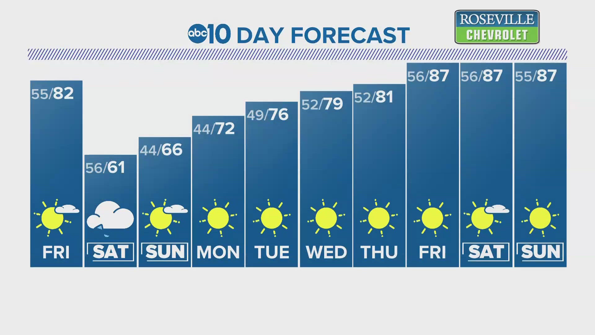
Temperatures will rise into the low to mid 80s Thursday and Friday in the valley thanks to high pressure in place overhead. Temperatures will be drastically cooler Saturday as a low pressure system originating from the Gulf of Alaska drops into the region. Afternoon temperatures Saturday compared to Friday will be about 20 degrees lower.

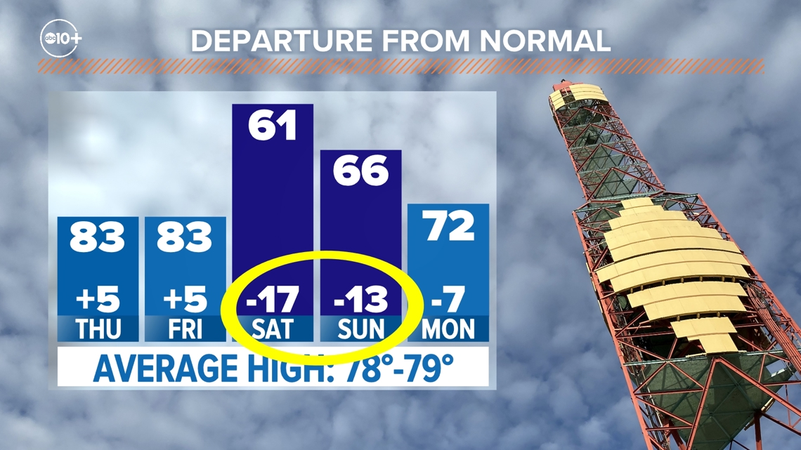
Temperatures Saturday will be in record low daily maximum range. The coldest high temperature recorded May 4 in Sacramento was set last year and the high was 61 degrees. The forecast high temperature Saturday is currently 61 degrees.
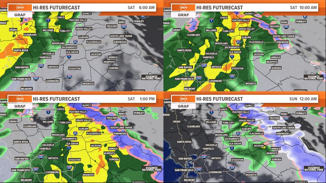
Rain will begin in the valley Saturday morning, continuing through the day but slowing down by the evening. Isolated showers are possible through Sunday morning.

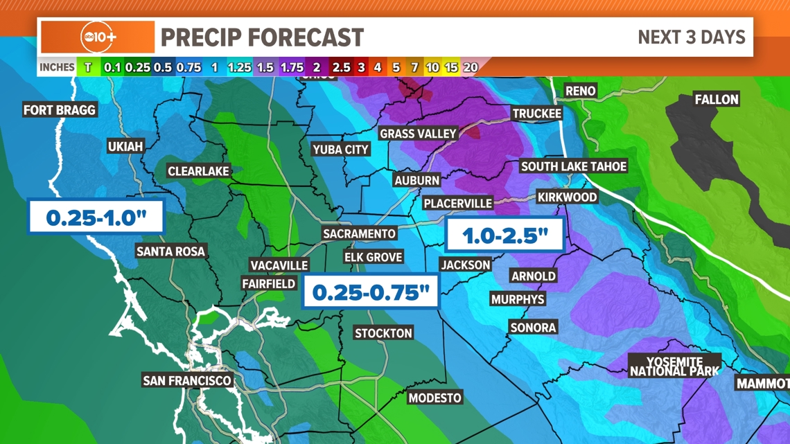
Rain totals will be impressive for May. May represents the tail end of the rainy season in Northern California and Sacramento only averages 0.86” during the month. This storm is expected to produce 0.25-0.75” in most valley locations and totals will increase from west to east due to western valley locations being partially rain shadowed by the coastal range.
Precipitation amounts will be greatest over the Sierra and foothills. Between 1.0-2.5" are expected in the foothills and Sierra and much of that above 5,000 feet will fall as snow.

Surprisingly large snow accumulations are expected with this system. Snow levels will start around 7,000-8,000 feet before lowering to 3,500-4,000 feet by Sunday morning. A few showers will linger in the Sierra through the first half of Sunday but will eventually taper off as the system moves east. Around 3-12" is expected for most mountain areas with 18" possible at the peaks.
Sunday will be on the cooler side compared to the early May average but should still be a pleasant day for outdoor activities. A high of 66 is forecast for Sunday in Sacramento.
Temperatures will gradually rise next week and will be back around average by Wednesday. The Climate Prediction Center favors a return to warmer than normal conditions beginning later next week along with being drier than normal.


