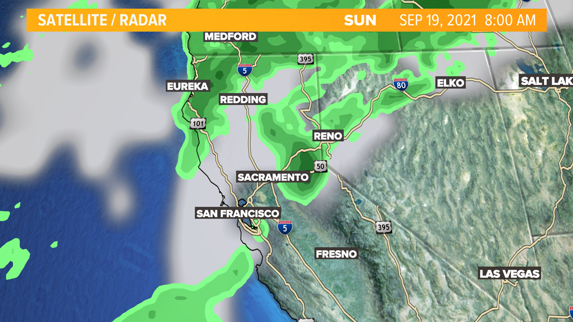
SACRAMENTO, Calif. — The rain returns to northern California after a low pressure system approached the Pacific Northwest Saturday morning. Winds will be a factor in your daily activities for the next few days as the front moves slowly across the region.

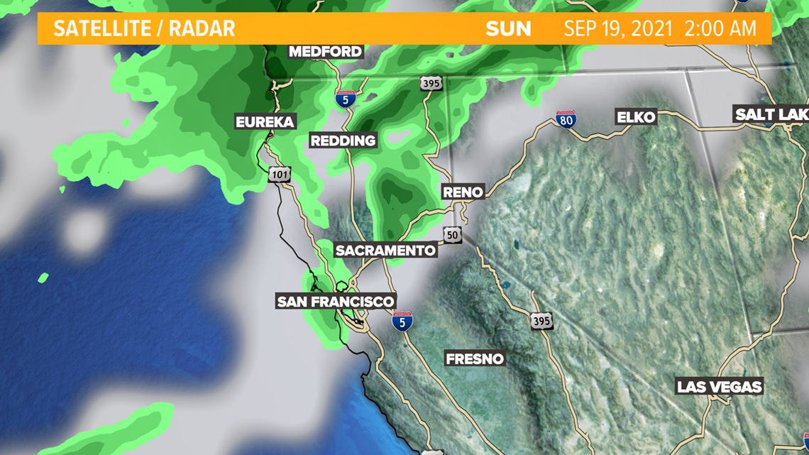
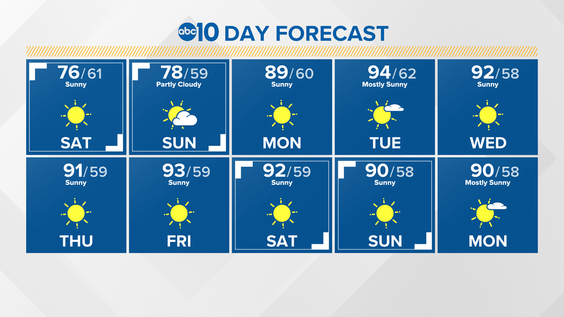
The best chance for rain will be Saturday overnight into Sunday early morning for the Sacramento Valley and foothills. There could be as much as .10 to .25 inch of rain possible.

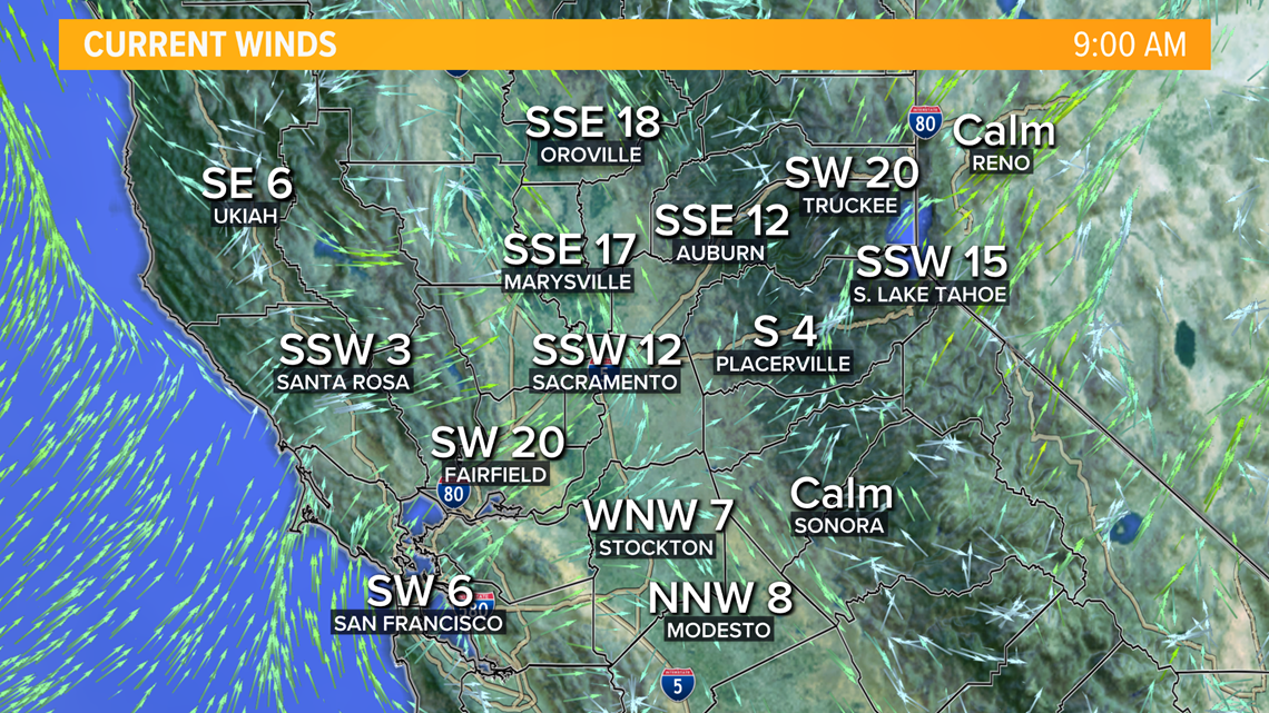
Winds will be anywhere from 10-20 mph in the valley with gusts as high as 30 mph mostly around the coastal range.

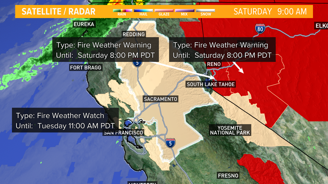
Once the cold front passes, a new concern moves in. The cooler temperatures leave, but the jet stream moves right through northern California. Winds will continue to be a concern throughout most of northern California. The National Weather Service has issued a Fire Weather Watch and Red Flag Warning over the area from Sunday 11 pm through Tuesday 11 am.

Humidity levels are expected to be extremely low as temperatures rise into the mid-90s and winds become strong. It’s likely, overnight recoveries in humidity will be limited in the teens to twenty percent range.
Temperatures into next week will remain near average in the low 90s.