SACRAMENTO, California —
Another relatively weak weather system is poised to push through Northern California Wednesday.
The previous weak system that dropped light rain and snow across the region this past weekend was replaced by a high pressure system that raised temperatures early this week and promoted fog formation for parts of the valley.
A pattern change is on tap for Wednesday with low pressure replacing the high pressure system as the dominant feature for Northern California. This means unsettled weather and cooler temperatures across the region for the rest of the work week.
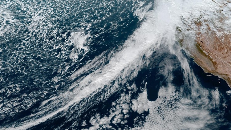
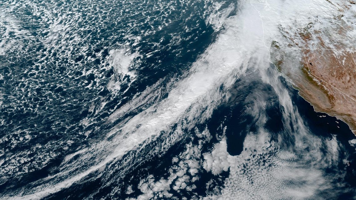
The rain and snow will spread across Northern California along a cold front Wednesday. The cold front is part of the tail end of a low pressure system centered near the Gulf of Alaska delivering a major atmospheric river event to the Pacific Northwest.

Impacts in the valley will begin in the afternoon with rain expected from the early afternoon through the early evening. Rain totals are expected to be on the lighter side once again and will increase towards the Oregon border. The Sacramento area is expected to receive anywhere from 0.10-0.25" and areas from Marysville north could see up to 0.50". Foothill locations like Placerville and Auburn could pick up close to half an inch as well.
Snow levels will start at around 6,000-7,000 feet but will drop as the frontal boundary passes. By Thursday morning, snow levels will be much lower, hovering near 4,000 feet.
As for totals, up to 8" can be expected along the west slope of the Sierra with the heaviest totals along and north of Interstate 80 along with winds as high as 35 mph. A Winter Weather Advisory is in effect from 10 a.m. Wednesday through 10 p.m. Thursday.
Another weak wave of moisture could bring a few rain and snow showers Thursday but the bulk of the rain in the valley and snow in the Sierra is expected Wednesday.
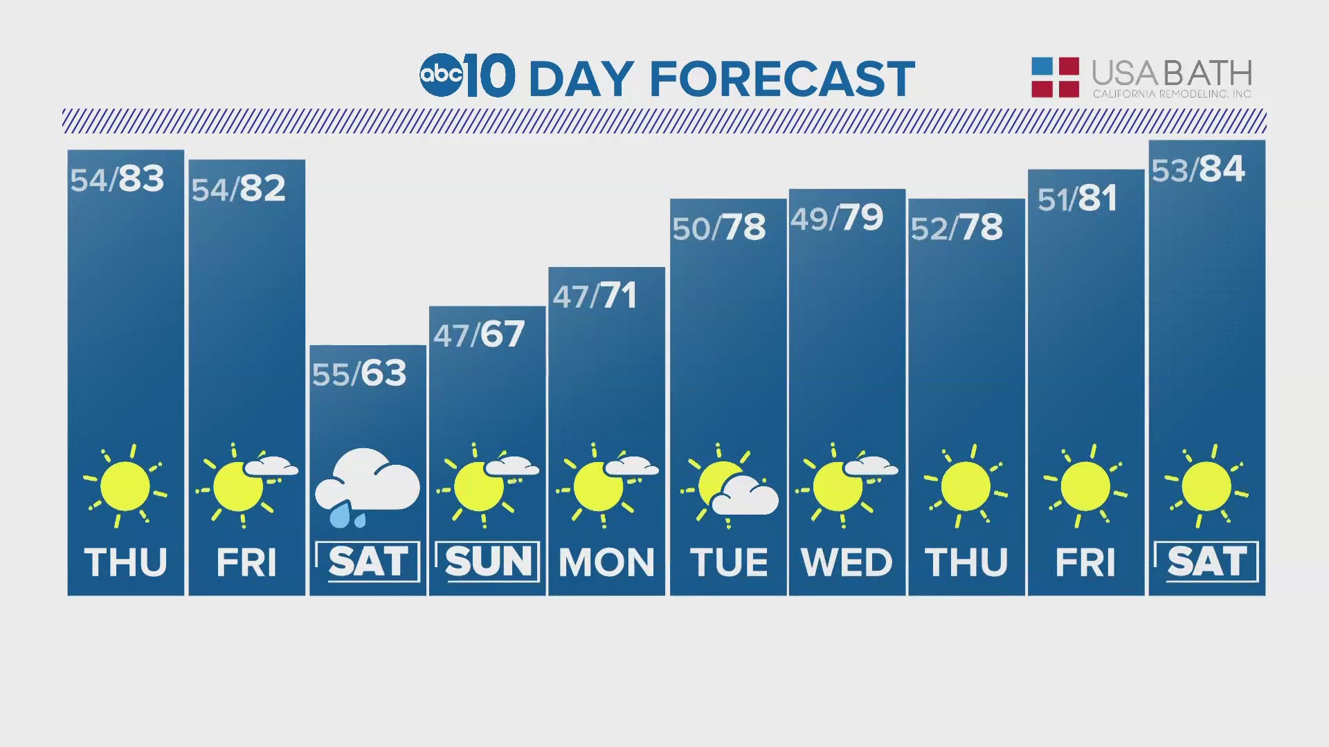
Valley high temperatures will cool throughout the week. Temperatures Wednesday will be right around 60 while Thursday and Friday will only be in the mid to upper 50s behind the cold front. Sierra highs will be in the 30s and 40s the rest of the week and mainly 50s in the foothills.
Heading into the weekend, ridging is set to move back over California and dry conditions will resume. There is still no evidence of any major atmospheric rivers impacting California in the next two weeks as the slow start to winter continues.