SACRAMENTO, Calif —
A chilly and damp weekend will be replaced by a short stretch of sunny skies and warm weather before more cold weather returns by the end of the work week.
Sunday will be warmer than Saturday, but temperatures will still be below average as the low pressure system exits the region. The valley will be mainly dry, apart from a few isolated showers that could develop Sunday afternoon. More light snow will fall in the Sierra throughout Sunday, too.
Rain totals ranged from a 0.1” to around 1 inch in the valley. Sacramento received 0.48”, Folsom received 0.97”, Stockton received 0.30”, Modesto received 0.73” and Marysville received 0.40”.
About 1-2 feet of snow fell in the Sierra since Friday, and a few more inches are anticipated Sunday. The Central Sierra Snow Lab received 18” and the lab is now at 107% of average this season.
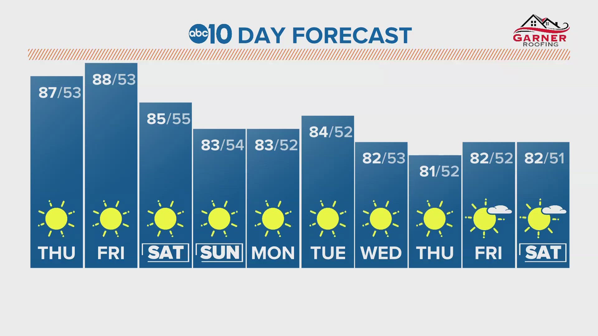
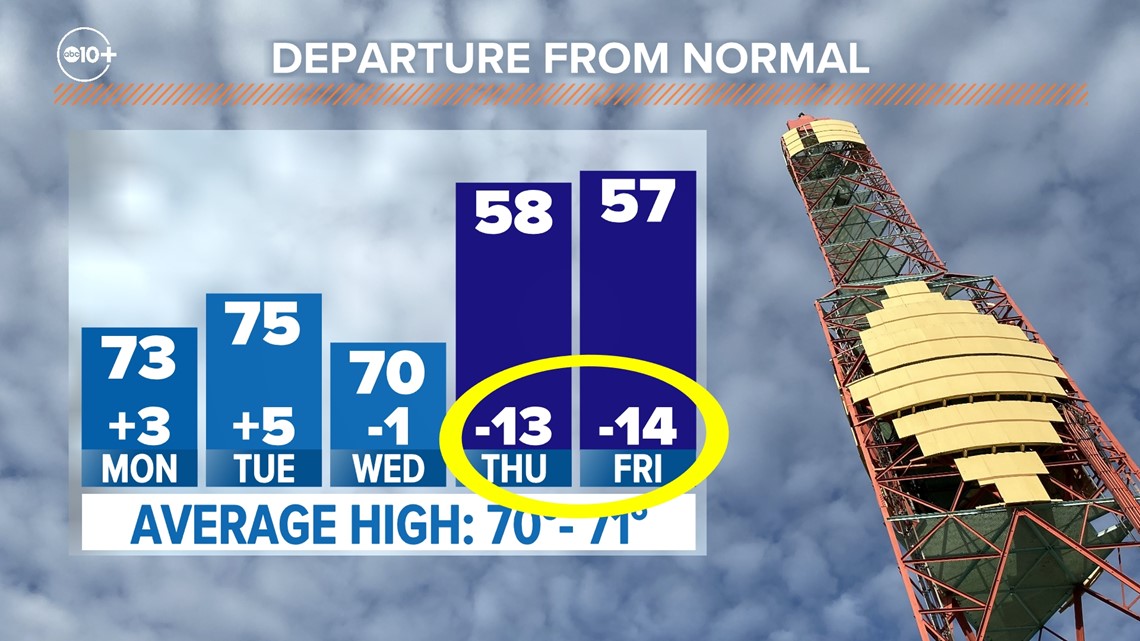
Highs will be in the low 70s on Monday as high pressure moves over the region. Gusty winds from the north are expected Monday as the ridge of high pressure builds into the region.
Tuesday will be the warmest day of the week with highs in the mid-70s. Wednesday will be around 70 as the ridge of high pressure begins to break down as the cold weekend system nears. Sierra high temperatures will be around the 40s and 50s through Wednesday.
An unusually cold system of low pressure will drop into the region from the north and temperatures will be 10-15 degrees below average across Northern California by Thursday. Valley high temperatures will be in the upper-50s on Thursday and Friday, and the Sierra will see temperatures rise only into the 20s and 30s.

Although rain and snow are expected with this system's arrival, it will be moisture-starved compared to recent storm systems. Rain is likely to begin on Thursday with snow beginning in the Sierra around the same time. The exact timing and precipitation totals will become clearer throughout the week.
The Climate Prediction Center’s 6-10 day outlook highlights how unusually cool that period will be, along with leaning toward wetter than average. Temperatures will return to warmer than average levels by next week.


WATCH ALSO: