SACRAMENTO, California —
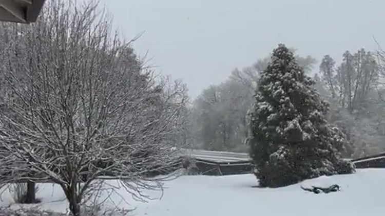
The most impactful snow storm so far this winter added up to 15” of snow in the Sierra and fresh powder will continue to pile up Thursday.
The UC Berkeley Central Sierra Snow Lab, located near Soda Springs, received 11" of snow Wednesday, putting the season total at 25". Even with the boost to the snowpack, the statewide percent of average for this time of year is only 39%.
The valley picked up more rain than expected Wednesday as the initial cold front passed the region.
Sacramento Executive Airport received 0.48” Wednesday and other valley locations generally picked up 0.2-0.4” in the Sacramento area. As expected, totals dropped off to the south and both Stockton and Modesto received only a few hundredths of an inch.
Another wave of precipitation is expected Thursday afternoon. While it will be weaker than Wednesday's storm, it will still drop an additional 0.01-.10" in the valley and 2-6" of snow in the Sierra. Treacherous driving conditions will be present in the Sierra throughout Thursday.
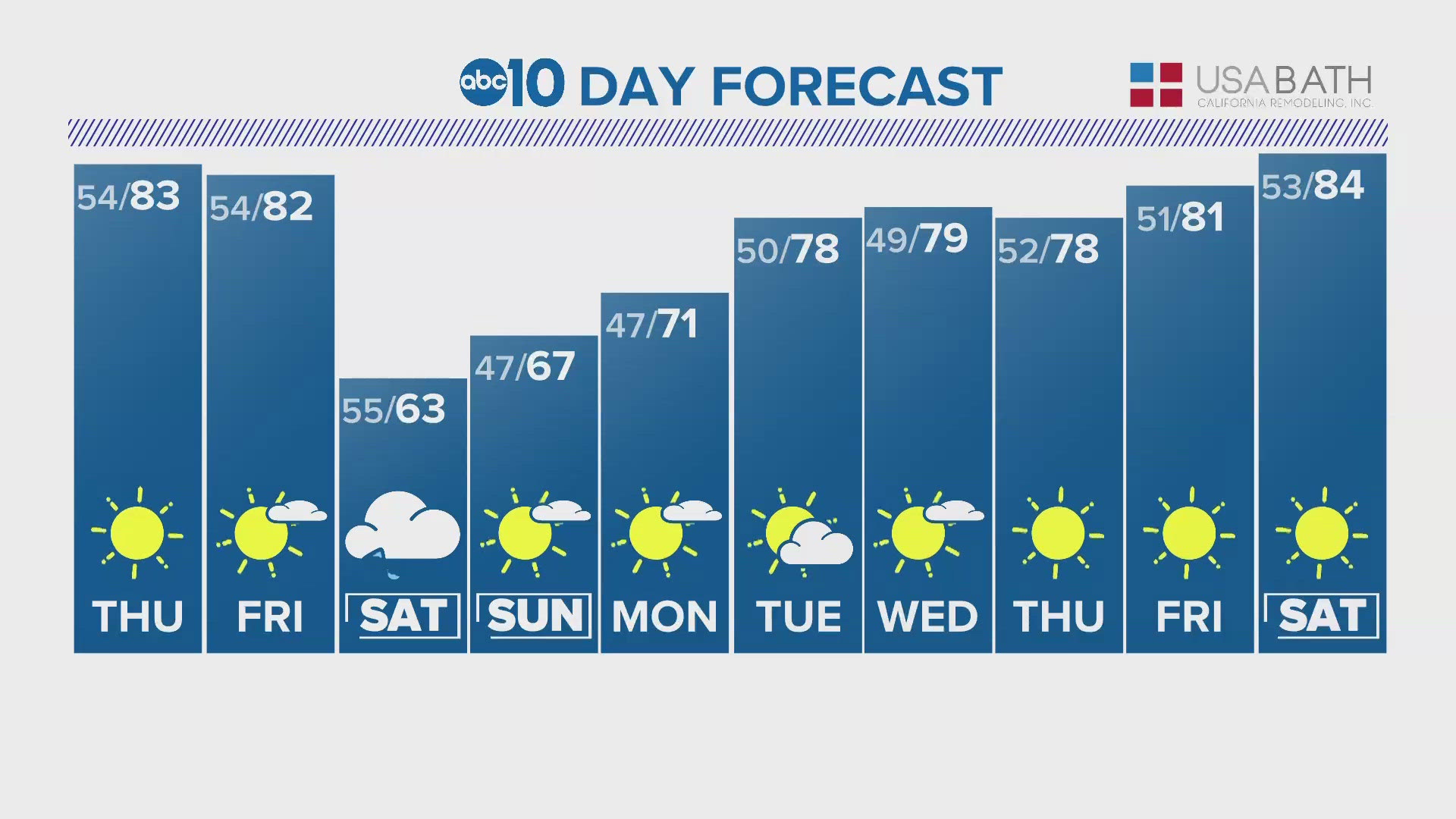
High temperatures the rest of the week and into the weekend will be in the mid to upper 50s across the valley, 40s and 50s in the foothills, and 30s for the Sierra. The average high in Sacramento on Dec. 7 is 58 degrees.
After Thursday, Northern California will find itself stuck in a persistent dry pattern as ridging sets up over the state, deflecting the jet stream too far north to impact California. Instead, mild weather will be the story for at least the next 10 days here in California as the slow start to winter drags on.
One indicator of the upcoming weather pattern is the Pacific North American Oscillation (PNA).
The PNA has a positive and a negative phase. The positive phase consists of ridging over the west coast while the negative phase has low pressure over the West Coast. The negative phase allows Pacific weather systems to push onshore rather than being blocked by high pressure.

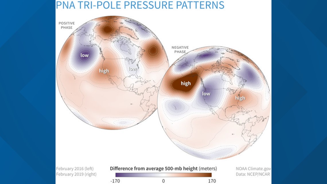
The PNA will be heading into the positive phase over the next few days and will stay positive through mid December, hence the upcoming dry stretch. Temperatures will also be on the warmer side thanks to the high pressure, but that only means valley highs in the low 60s this time of year.
Even though no rain or snow is expected through the extended forecast, there will be still be impactful weather across the region.
Friday morning, dense fog is expected to form in parts of the valley thanks to the recent rainfall, depending on if winds can die down in the overnight hours.
Heading into the weekend, temperatures are forecast to reach the near the freezing mark in the valley. Due to the fact the valley has already been subject to freezing temperatures this fall, NWS Sacramento will not be issuing a freeze watch or warning for this event. Freeze watches and warnings are reserved for the first such events of the cold season.
WATCH ALSO: Snowfall in the Sierra sparks chain controls on I-80 in Northern California | To The Point