SACRAMENTO, Calif —
A powerful cold front on Saturday morning delivered a steady rain to Northern California beginning in the morning and lasting throughout most of the day.
The cold front passed through the region around 6 a.m. Before the front passed, temperatures were in the mid to upper 50s and temperatures took a nosedive after. At 6 a.m., the temperature in Sacramento was 57 degrees, and by 7 a.m., it was 48 degrees. By 8:30 a.m., it was 44 degrees.
Temperatures remained cold and most areas were in the mid 40s all day, which is very cold even for December or January standards. Sacramento peaked at 46 degrees in the afternoon, which would have shattered the daily record high if it weren't for the warmer temperatures before the front.
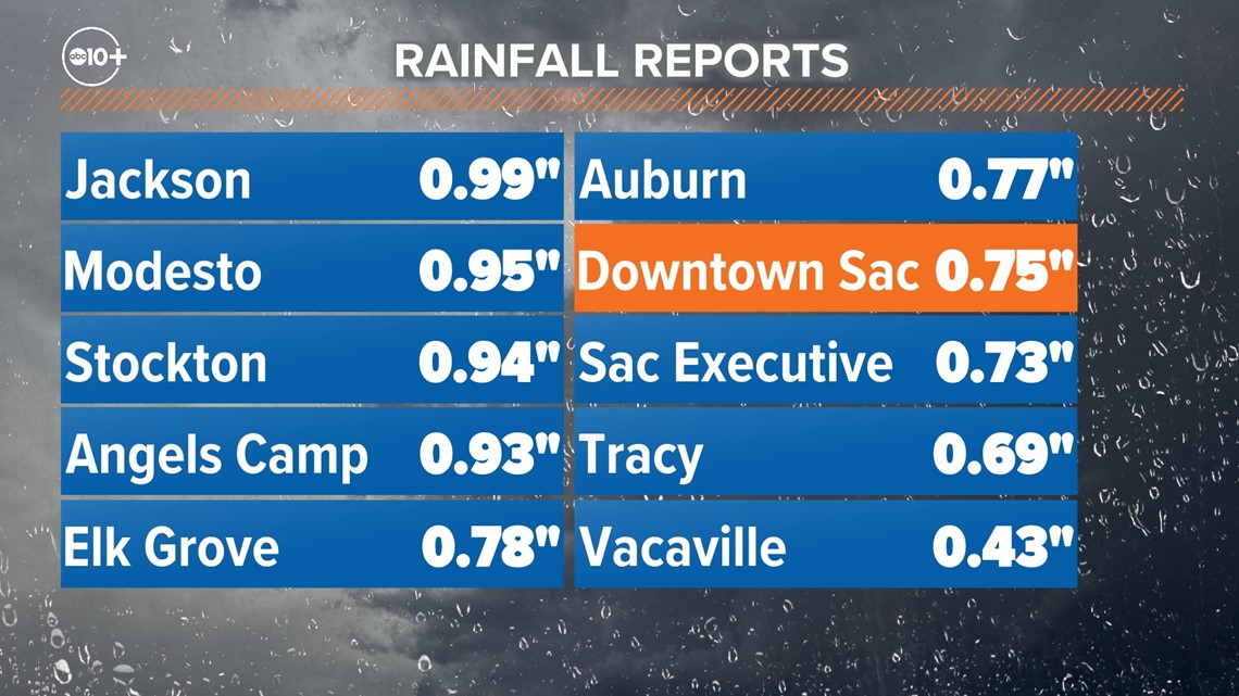
Valley rainfall totals generally ranged from 0.5-1". Sacramento Executive Airport received 0.73" and has received 17.34" this water year, which began on October 1. Sacramento is now .05" above average, most of which came after the New Year.

The spiraling bands of precipitation hardly touched the Sierra and snow totals were very light with this system. The Central Sierra Snow Lab only received 0.6" of snow and other Sierra locations ranged from a dusting to 3". The statewide snowpack remains above average and is 112% of average to date.
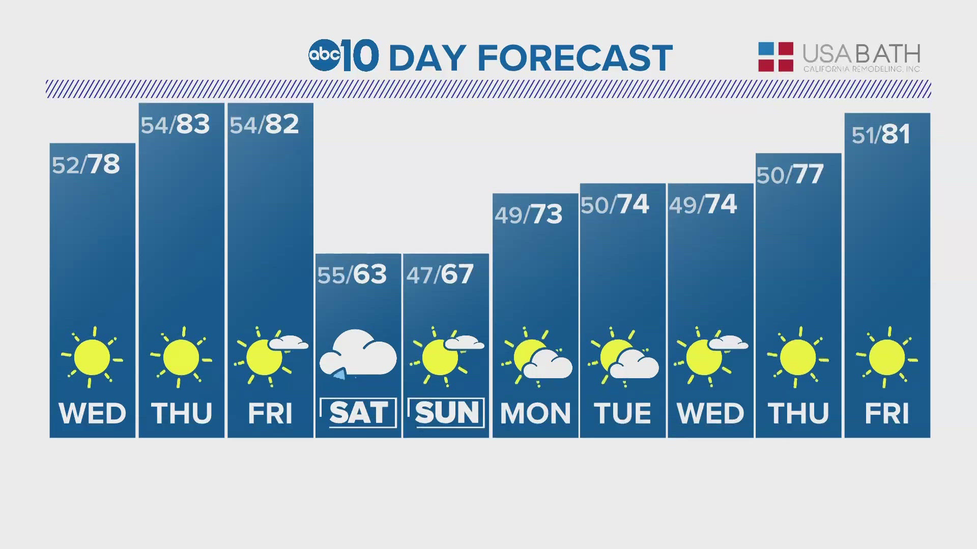
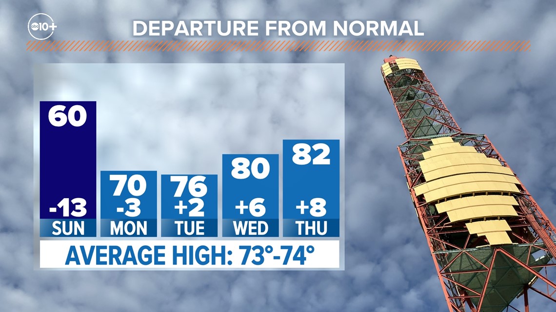
A few lingering showers are expected on Sunday, but most areas will stay dry. A ridge of high pressure building into the region will raise temperatures this week to around 80 by the middle of the week.

With no rain expected through the extended forecast and the California wet season drawing to a close, this very well could have been the last big storm of the season.
WATCH ALSO: