
SACRAMENTO, Calif. — The week after Christmas has been ramping up with more active weather and the next 10 days will see a series of storms.
California has 7% of the state still in top level drought, and any rain and snow is very beneficial to the still-low lakes and reservoirs. Shasta is 55% of normal, but Folsom Lake is 82% of normal for this time of year.
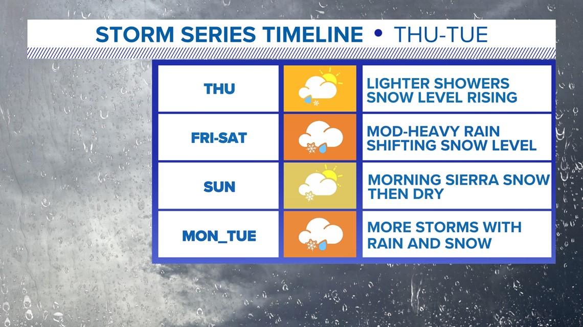
Thursday morning a system will produce widespread rain and snow, soaking the areas below 4,000 ft. Spots in the Sierra above that elevation will have light to moderate snow with a lull in the middle of the day.
Thursday night to Friday, a new system will move in and bring heavier rain and warmer temperatures. This will make the snow level rise overnight and could take it above most mountain passes by Friday.

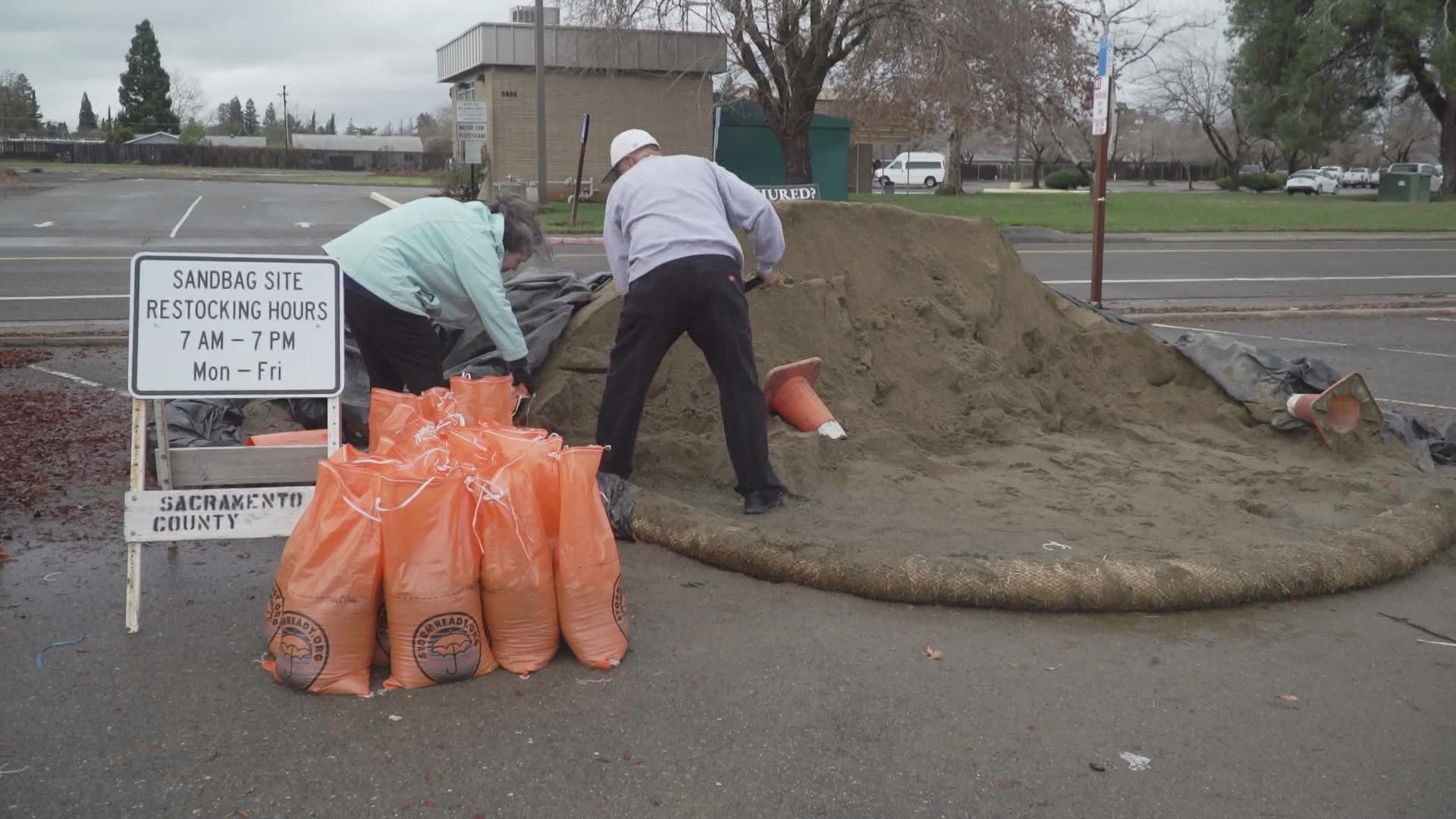
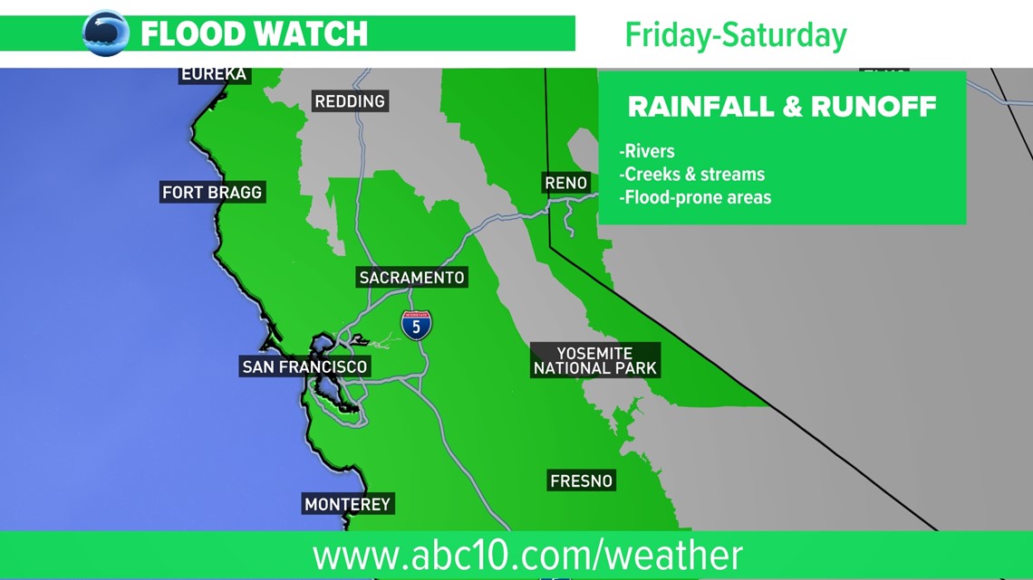
The Friday storm will produce 2-4" of rain for the Valley through Sunday morning and 3-7"+ for the foothills. The warmer storm will also melt some lower lying snow and add additional water to local creeks and streams, which are expected to rise rapidly on Friday and Saturday along with more rain for the region.
Some larger rivers like the Cosumnes and Mokelumne will approach low flood stage by Saturday into Sunday.

The storm moving in Saturday has some colder air and will start to lower snow levels back to the passes and winter driving conditions will affect some New Year's Eve travel.
New Year's Day will see widespread clearing for all elevations and a break in the wet weather.
Monday and for most of next week, the unsettled pattern continues with a series of storms bringing rain chances each day.


