SACRAMENTO, California — Last winter, California was slammed with atmospheric river after atmospheric river, and the phrase dominated headlines as the Sierra racked up a record snowpack.
As for what these atmospheric rivers are, they are defined by NOAA as "long, concentrated regions in the atmosphere that transport moist air from the tropics to higher latitudes. The moist air, combined with high wind speeds, produce heavy rain and snow upon landfall, especially over mountainous terrain."
While these storms can be dangerous and produce widespread flooding, California as we know it would not exist without them. Although atmospheric river events can occur across the globe, they are particularly important for the West Coast and California in particular.
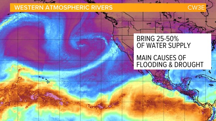
Data from the Center for Western Water and Weather Extremes (CW3E) shows that they produce 25-50% of the state’s water supply and are the main causes of flooding and drought, depending on how prevalent they are in a particular winter.


Atmospheric rivers can generally be seen well with satellite imagery. The moisture associated with an atmospheric river is drawn into the counterclockwise circulation of a low pressure system that forms over the Pacific. As the low approaches the coast, the spiraling bands of clouds supply the state with its water needs in the form of rain and snow as it interacts with the diverse geography of California.
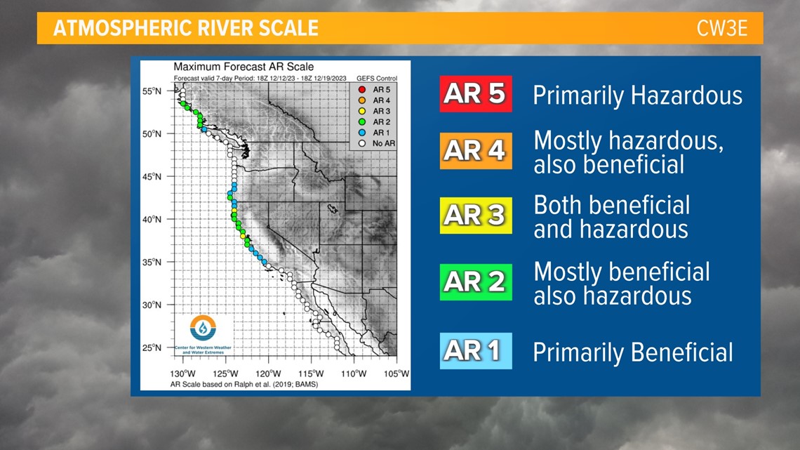
CW3E uses a scale to describe the intensity of atmospheric rivers, ranging from weak (AR1) to exceptional (AR5).

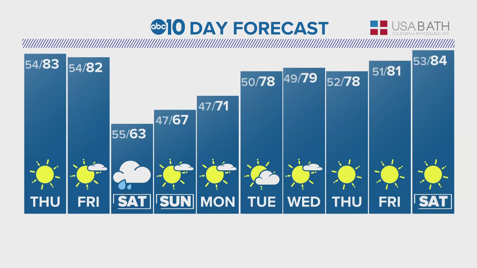
From the last week of December through March, California was hammered with a train of atmospheric rivers ranging in intensity. This winter has gotten off to a slow start for California and no significant atmospheric rivers have struck the state.
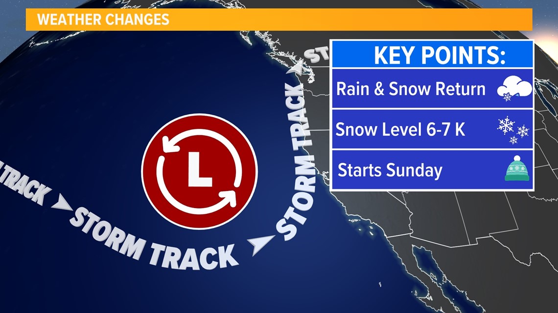
However, a pattern change this weekend is set to finally bring atmospheric river impacts to California as a cutoff low pressure system taps into tropical moisture.
CW3E is currently forecasting this as an AR2 event along the coast, weakening to an AR1 in the foothills. NWS Sacramento is currently forecasting 1.25-2.5" of rain in the Central Valley and 2.5-7" of liquid precipitation equivalent in the foothills and Sierra with snow expected above 6,000 feet.

WATCH ALSO: