
SACRAMENTO, Calif. — California has made great strides regarding it's recovery from dire drought conditions, but new maps indicate the road to full recovery has a long way to go.
The U.S. Drought Monitor released its new maps and data for California which shows almost 1% of far Northern California in the most serious Exceptional level. At the driest point of this drought, almost 50% of the state was at that level.
The biggest change this week was the drop in the area covered by Extreme drought from 33% to 17%. Most of the Sacramento Valley remains at this level and part of the San Joaquin level. However, Southern California has moved out of the Extreme level thanks in part to recent wet weather.
Certain highlights compliment this change on the map, including Folsom Lake at more that 100% of normal capacity for this time of year. Lake Oroville is at 75% of capacity for this time of year. However, two large lakes, Trinity and Shasta, still remain low, at only about 50% of average, for this time of year.
Snowpack for most of the state is well above average and will add to lake levels in the warmer spring months.
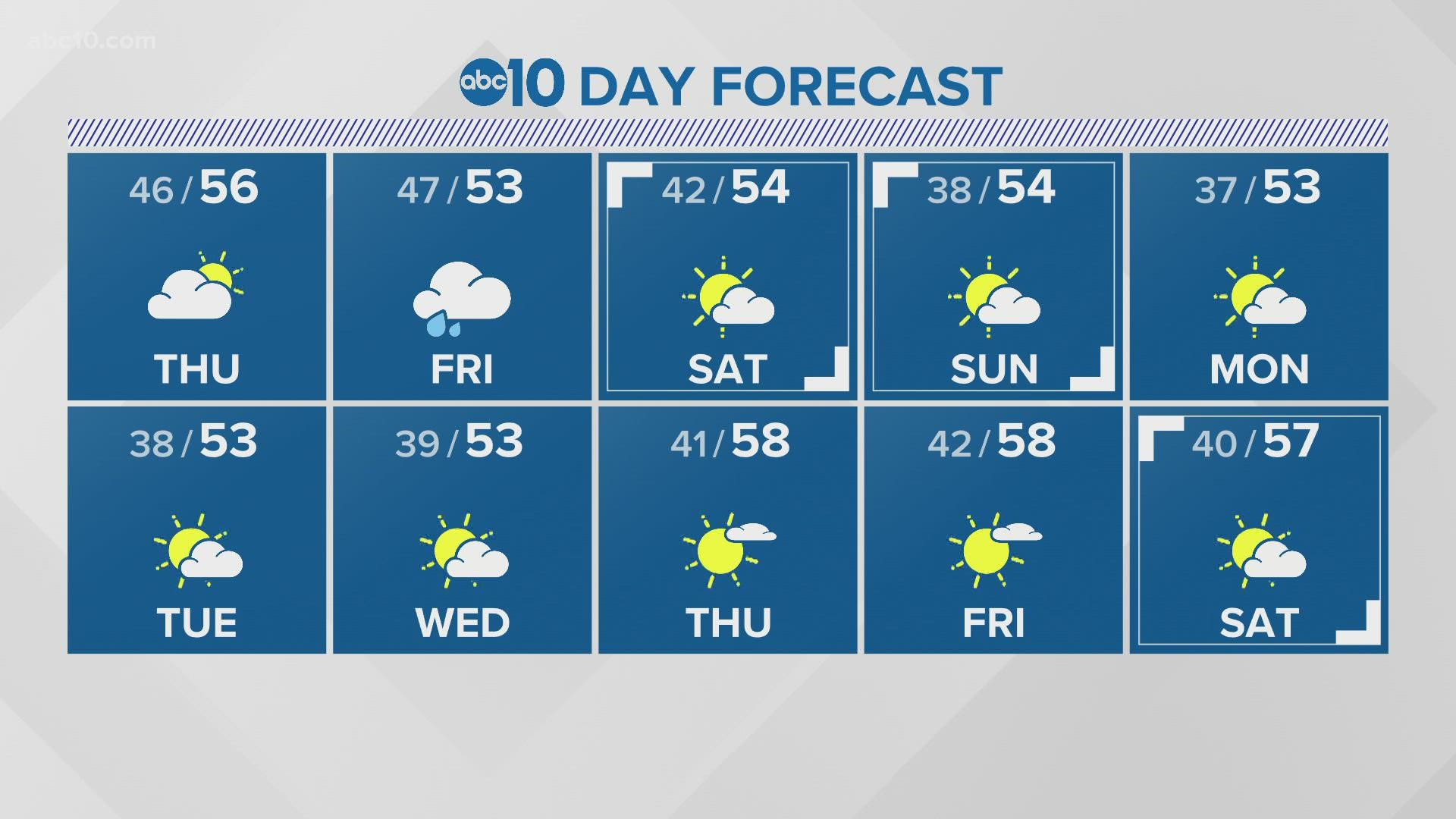
A new storm moves in Friday with rain and snow, but a mid-January dry period looks to take over this weekend and all of next week. Dry periods in mid-winter are not uncommon for a week or more.
The rainy season typically lasts until April or May.
READ MORE FROM ABC10:
ABC10: Watch, Download, Read


Watch more from ABC10
California Drought: Aircraft tech hopes to help conserve even more water in California