
SACRAMENTO, Calif. — Californians will get to enjoy one dry day before the next storm system spins into the state.
Monday, the first day of Spring, will still be below average in terms of temperature but will be mainly sunny before cloud cover builds in overnight. A high of 60 is expected in Sacramento.
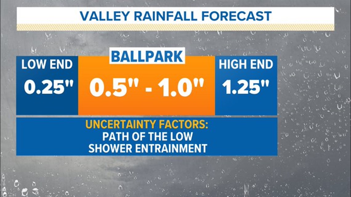
More rain and snow fell over the weekend. Rain totals in the valley generally ranged from 0.25-0.75” and the Sierra picked up another 6-12" of snow.
A pair of low pressure centers are currently spinning off the coast of Oregon and Washington and is expected to rapidly intensify as it nears the California coast. Uncertainty remains where exactly the initial low pressure system will set up as it approaches, with some models favoring a path more towards the central coast and others thinking it will land near the Bay Area.
Strong winds are expected south of the low pressure center, so its path will dictate which areas sees the strongest winds. The strongest winds are expected to be along the coast, and the valley will likely be spared of widespread damaging winds with gusts of only 20-30 mph expected.
No wind advisories have been issued in the valley but they have been issued by the NWS Bay Area office for areas mainly south of San Francisco.
Rain will spread into the valley by Tuesday morning in a south to north direction thanks to the counterclockwise movement of wind around the low pressure to the southwest. Snow will pickup in the Sierra in the morning hours also, continuing through Wednesday.
A Winter Weather Advisory is in effect for the Sierra from 5 a.m. Tuesday until 5 p.m. Wednesday.
This storm setup favors the bulk of precipitation falling in Central and Southern California with Northern California receiving modest amounts of both rain and snow in comparison.
This system will be cold with snow levels expected to be from 3,500-5,000 feet. The high in Sacramento is expected to be a chilly 53 degrees, well below the average of 67 for March 21. The rest of the valley will also be in the low to mid 50s and the Sierra will max out in the 30s.
Rain and snow totals will diminish as you head north. The Sacramento area is expected to get 0.5-1" of rain by Wednesday and totals will increase to the south.
The main event of the storm will wrap up in Northern California by Tuesday evening and will be followed by spotty showers through much of Wednesday.

The Northern Sierra is only expected to see a foot of snow, but the Southern Sierra could see upwards of three feet. This system will further the seasonal discrepancy between the Northern and Southern Sierra, which have seen 181% and 278% of average snow to date respectively.
WATCH ALSO:
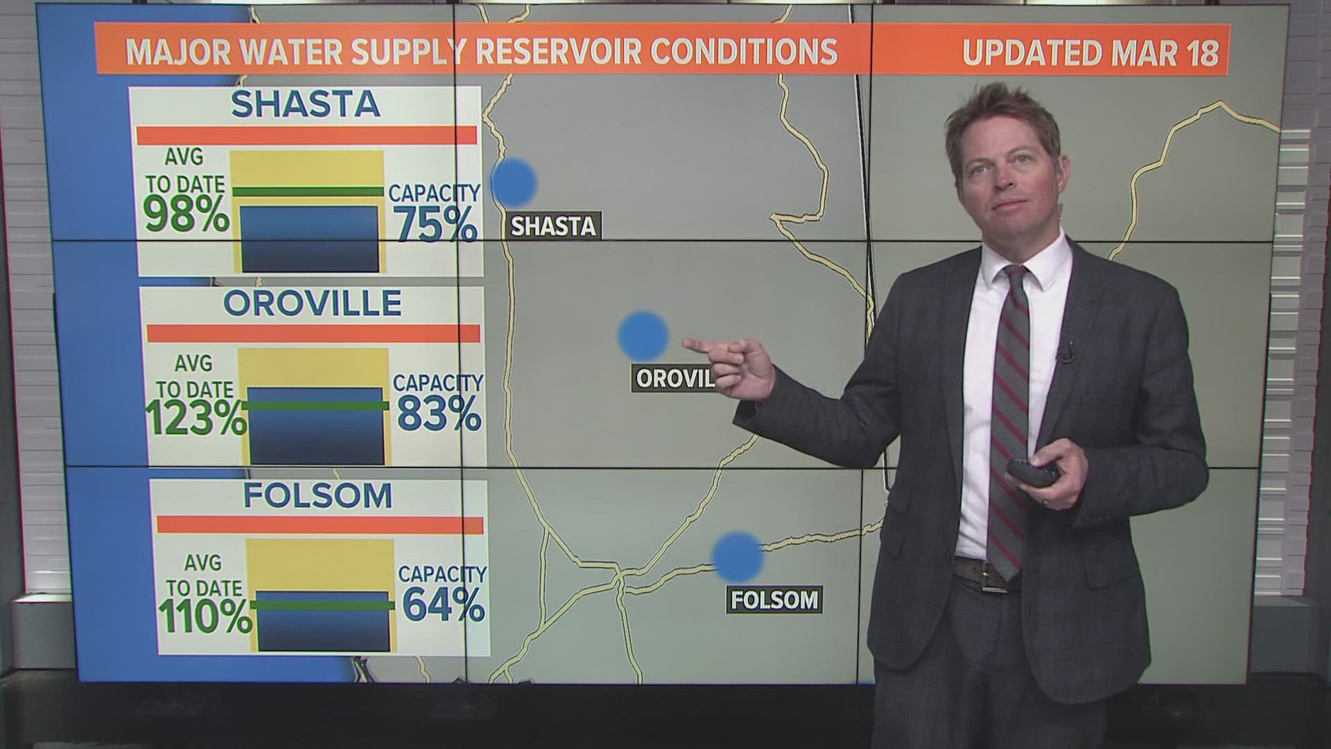
California Drought: Reservoir levels rising & La Niña is dead; Time for "proactive" water management


