

SACRAMENTO, Calif. — Gusty winds are being tracked on the heels of the early work week rain and snow.
The weather system that brought showers Tuesday will move into the Great Basin for the rest of the week. This will happen as a ridge of high pressure begins building in off the West Coast. This pattern will support gusty, offshore winds.

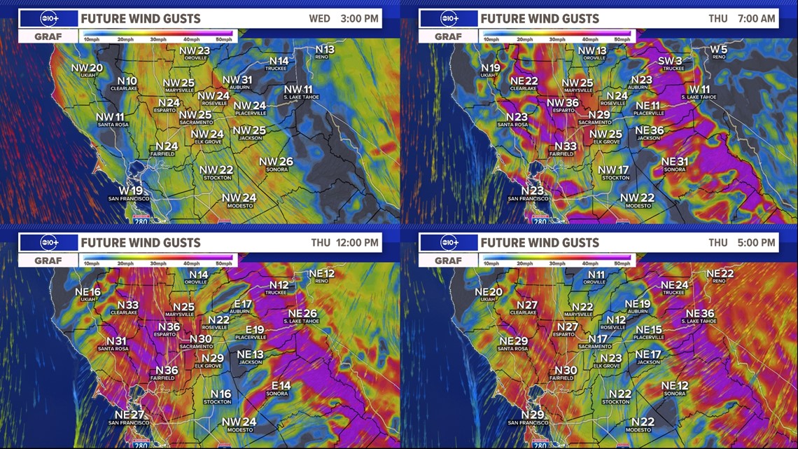
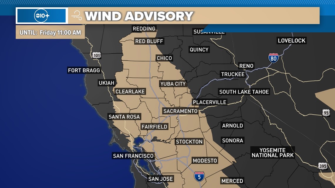
A Wind Advisory goes into effect for the lower elevations late Wednesday through early Friday. Gusts will peak on Thursday around 35-45 mph.
Sustained winds will be out of the north to northeast at 20-30 mph. Winds at this strength could cause downed tree limbs and bring down weakened trees. Localized power outages are also possible. Expect some driving difficulty on overpasses, bridges and the Yolo Causeway.

A High Wind Watch will be in effect for the mountains through early Friday.
Dangerous gusts could reach 55-70 mph which could bring down trees and cause power outages. The Sierra winds could also impact small, temporary structures and make driving difficult for high profile vehicles.


One more item to keep in mind is recreation. There's a high likelihood ski resorts will have to close some lifts Thursday due to the dangerous, gusty winds.
In regards to temperatures, these winds are dry and warm. Highs will warm to above average temperatures through the end of the week.
Despite the warm and dry winds we will see this week, the overall fire risk remains low thanks to live and dead fuels being very moist.
Nonetheless, it's always good to practice fire safety and prevention.
WATCH ALSO:


